
Riding Arizona


I had been to Arizona in fall 2005 on a Titan motorcycle press launch for their 2006 models. That trip consisted of a couple of short rides in the city of Phoenix, followed by a day’s ride of 500 kilometres to Las Vegas (leaving Phoenix on Highway 60 west to Wickenburg, then all the way to the Hoover Dam on Highway 93 with a short stint on Interstate 40 through Kingman). Riding through the switchbacks down into the Hoover Dam provided more twists and turns in a couple of kilometres than the rest of the 500-kilometre ride had to offer. I commented in my Titan article, “Arizona is chopper heaven, with miles and miles of long straight flat roads that vanish into the horizon.”
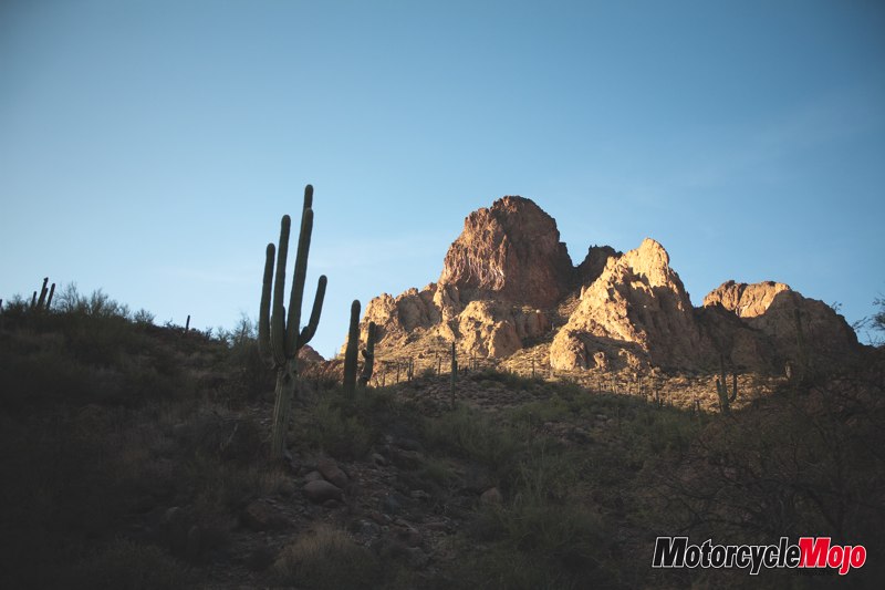
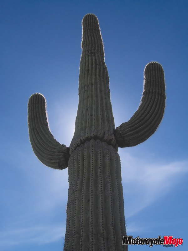
I’ll admit I was naive, but with clear blue sky and the hot sun beating down on us as we passed by many types of cactus, I just assumed that Arizona was pretty much desert all the way through and that straight roads were the norm. In fact, nothing could be further from the truth. A recent trip to Arizona proved to me that one should never assume.
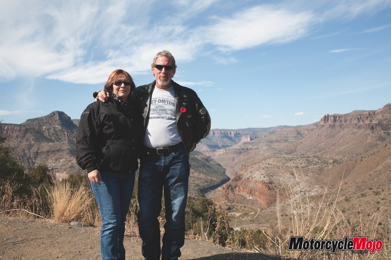
Gwen and I flew into Phoenix at the beginning of November to get together with some friends she had met on a High Seas Rally cruise. While I hadn’t met any of them yet, Gwen assured me that I would get along fine with all of them and considering that the morning we left there was frost on the rooftops, it didn’t matter. I was looking forward to a few days of riding in temperatures that would hopefully reach into the 30-degree range. The thought of those temperatures was even more appealing since the summer of 2009 in the northeast quadrant of North America consisted of more rainy days than sunny ones.
Our hosts, B and Karen, met us at the airport and gave us the rundown of the next few days’ itinerary. First order of business the next morning would be to pick up my rental bike at EagleRider Phoenix, then to pick up a keg and other party supplies, because later that day we would begin celebrating B’s sixtieth birthday, our main reason for going to Phoenix at this time of year.
EagleRider Motorcycle Rental is located at the back of Hacienda Harley-Davidson in the Phoenix suburb of Scottsdale. Kameron Amstutz, the manager of EagleRider Phoenix, set me up with helmets, maps, and of course, the required paperwork. After pointing out on the map a number of places we should ride to, he showed me to my wheels for the next few days, a Firefighter Special FLH Ultra, and bid me farewell. EagleRider rents a variety of bikes and at very reasonable prices, US$140 per day or US$372 for three days.
Bite, Stab, Stick or Sting
The birthday party would be held outside, and we were warned that pretty much anything that grows in the desert will either bite, stab, stick or sting you. The number of cactus varieties is mind-boggling, but they aren’t the only danger: you also have to watch out for scorpions, spiders and rattlesnakes (13 of the 36 rattlesnake species can be found in Arizona). And with that came another good piece of advice. “Be sure to always shake out your boots as well as your clothes in the morning, in case a scorpion has crawled into them.” During the party, B mentioned to me that scorpions crawl under rocks at night and that they glow when the beam of a flashlight hits them. That was all the temptation I needed. Later when there were very few partygoers remaining, B and I went in search of scorpions while trying not to get stuck by cacti that might get in our way. I suppose it’s just as well we didn’t find any.
In the morning I looked in amazement at the view out the large picture window. A tall saguaro cactus stands proud just to the left of their ground level stone patio with various desert plants filling the flat sandy distance. Your eyes are drawn to the mountain that rises from the surrounding desert just a few kilometres away. A little black dog climbing on my left shoulder breaks my gaze of the spectacular vista and almost spills my coffee. I have always loved big dogs that you don’t have to bend over to pet, but this little guy stole my heart. Dash would jump on a chair and then onto the kitchen table, then climb on your shoulder so you could whisper in his ear. The silence is broken by the sound of motorcycles pulling in the driveway.
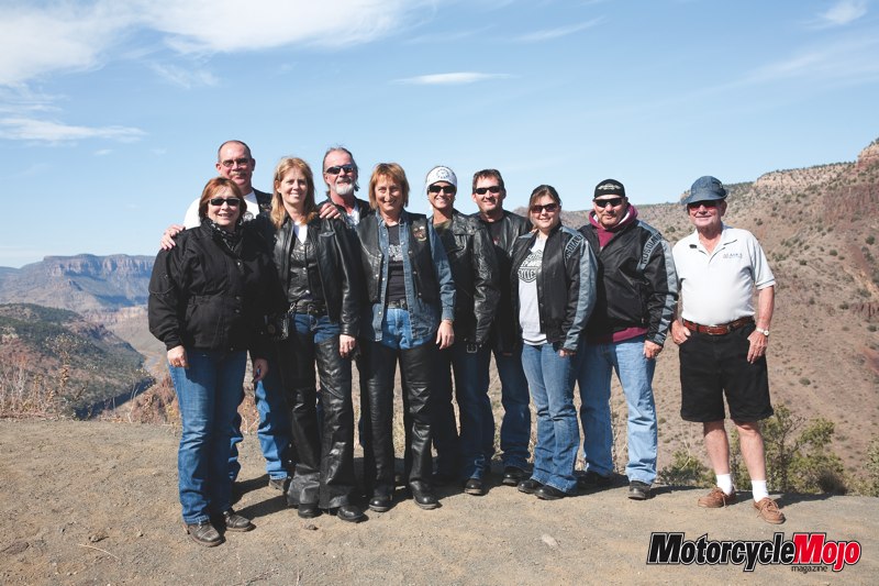
It’s Sunday morning and Shorty, Joyce, Mike, Heather, Jim, Theresa and Chuck are right on time. By 9 a.m., we were heading east and the thermometer was already reading 27 degrees C (80 degrees F) under a cloudless blue sky.
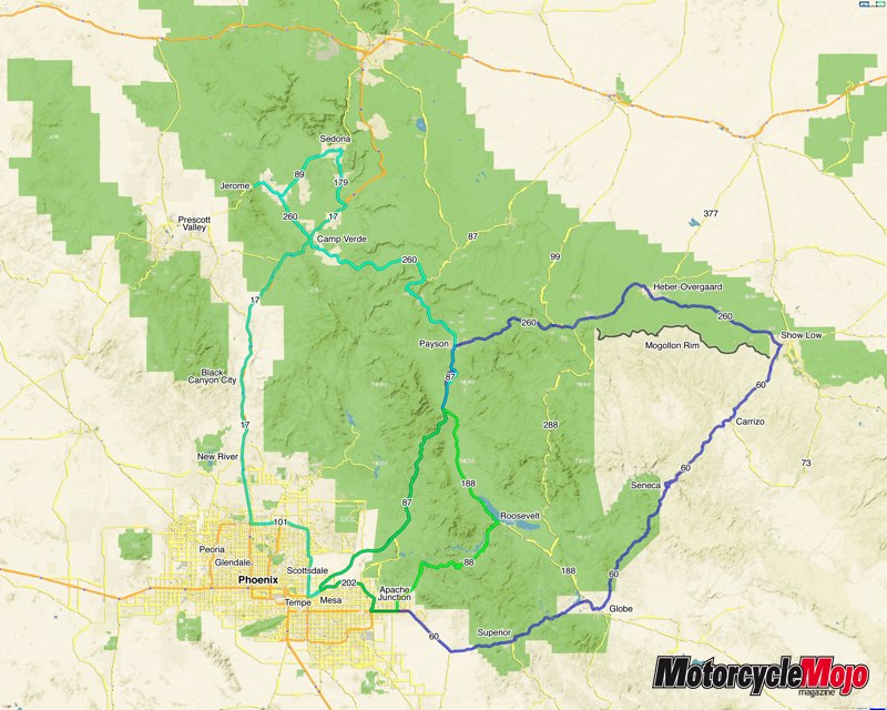
B and Karen live in sparsely populated Apache Junction on the far eastern edge of Phoenix. Within minutes of leaving their driveway, we were in the country, with various varieties of cacti dotting the landscape on both sides of the road. The landscape started out flat, both in terrain and colours, consisting of unique muted greens and browns. While the shades of green and brown were far removed from what I am used to, they were very warm and welcoming. Like chameleons, the buildings blended into the panorama as they took on similar colours to their surroundings. Heading east on Highway 60, our first stop was the Buckboard City Cafe for breakfast in the town of Superior. The parking lot of the small restaurant was already full of bikes, but we were lucky enough to get the last table. Like many towns in the area, mining is, or was, the town’s claim to fame. Superior is said to have one of the richest copper veins in the world running under the highway, yet to be mined.
Shortly after getting on the road, I realized how wrong I was to assume that Arizona is flat desert. Between Apache Junction and Superior, we passed signs stating that we were entering Tonto National Forest; that should have been my first clue. Just minutes outside of Superior we were ascending mountain roads, and immediately after riding through the half-kilometre Queen Creek Tunnel that cuts through solid rock, we stopped at our first canyon. The rock formations are unlike anything I have seen before. Gwen and I were awestruck by the rugged beauty of the surroundings, and we’d only been on the road just shy of 100 kilometres.
Shortly after, we arrived at our next outstanding land formation, the Salt River Canyon. Stopping at the top, we couldn’t see the bottom directly below us. The asphalt performs a series of hairpin turns and switchbacks as the road leads you to the bottom of the canyon, and then you cross the river and it’s the same thing going up the other side. If I wasn’t with others and didn’t have Gwen as my passenger, my bike wouldn’t have had any floorboards left.
Highway 60, which turned northeast after Globe, took us into the town of Show Low, at which point we turned onto Highway 260 heading west. Shorty led us into an area he called “the Rim.” The Mogollon Rim is an escarpment separating the Tonto and Sitgreaves National Forests. If someone were to randomly plunk me down and ask me where we were, in a million years Arizona would never be one of my answers. The Rim’s cliff edge offers a view of mountain after mountain covered in forest for as far as the eye can see. Stunning scenery considering that only a few short hours prior, we were riding by a dizzying amount of cacti in the desert.
B and Shorty were elk hunting in these mountains three weeks before our visit, and seeing photos of them in the mountains with snow on the ground was quite surprising: snow in Arizona in the middle of October. Who would have guessed it?
We were told that temperatures in the mountains are generally 20 degrees F cooler than on the flat land below. While it was 27 when we left in the morning, at 5 p.m. in the mountains it had dropped to a brisk 10 degrees C (50 degrees F). Everyone began bundling up with electric vests and scarves for the evening ride back to Apache Junction, and while Gwen and I are more accustomed to riding in cooler temperatures than the rest of our riding party, a long sleeve shirt was in order, and after half an hour or so of riding I started doing up my zippers in an attempt to stop wind from creeping into my coat.
During the summer months in Phoenix, with temperatures in the 40-degree (104 degrees F) range, it is actually too hot to ride in the desert, so locals leave early in the morning and ride northeast into the mountains where temperatures might be in the low 30s. In the winter months they’ll head south into warmer climes; they have the best of both worlds for year-round riding. It’s because of this great weather that every single person I met on this trip had moved to the area from somewhere else in the States. That explains why, in 2006, Arizona was the fastest-growing state.
We finished our evening’s ride on Highway 87 south, a twisty multi-lane highway that winds over three mountain passes before dumping us back in the Phoenix area. While the dark twisty road was busy and warranted all of my attention while riding, a bright ribbon of flames from a prescribed forest fire along the side of one of the mountains to our left did force a glance or two out of me.
Highway 87 – Take Two
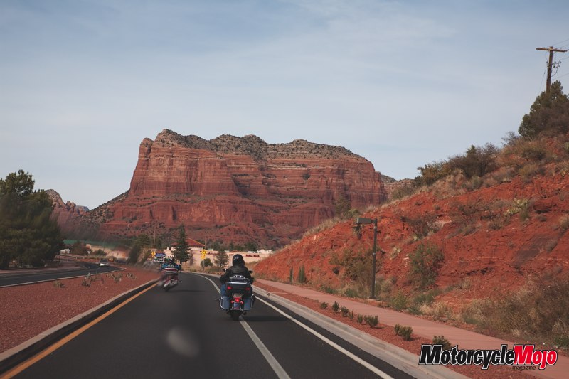
The next day’s ride started out much the same, although with fewer riders. This time Shorty would be riding solo, B and Karen on their Roadglide, and Gwen and I on our rented Ultra. We headed north on Highway 87 so we could see what we missed the night before. What we missed was a beautiful, perfectly smooth, twisty divided four-lane road that took us over 1,200 metres in elevation across three mountain passes with thousands of Saguaro cacti on both sides of the road. Our destinations for the day were Sedona and Jerome. We backtracked on 87 until the town of Payson, at which point we headed northwest on Highway 260 to Camp Verde. It was just north of here, on Highway 17, that I realized the colour ahead of us was changing from muted greens and browns to a reddish landscape. From 17 to Highway 179 into Sedona is where the colour really hits you. The red rock outcroppings of the Sedona area, with names like Chimney Rock, Cathedral Rock and Bell Rock, tower above the road as it winds its way into Sedona. The red rock is vibrant in the late afternoon when the sun is going down and reminded me of the Valley of Fire State Park in Nevada, which I visited in 2005. Sedona has about 10,000 residents and is a hot tourist destination, partly because the area is considered a spiritual mecca and home to many global power spots, also known as vortexes, sought after by alternative healers and those who wish to be healed. All told, the area attracts more than 4 million visitors per year.
Google Maps Links:
North route through Sedona
East route through Show Low
Central route via Highways 188 and 87


Thanks for Reading
If you don’t already subscribe to Motorcycle Mojo we ask that you seriously think about it. We are Canada’s last mainstream motorcycle magazine that continuously provides a print and digital issue on a regular basis.
We offer exclusive content created by riders, for riders.
Our editorial staff consists of experienced industry veterans that produce trusted and respected coverage for readers from every walk of life.
Motorcycle Mojo Magazine is an award winning publication that provides premium content guaranteed to be of interest to every motorcycle enthusiast. Whether you prefer cruisers or adventure-touring, vintage or the latest models; riding round the world or just to work, Motorcycle Mojo covers every aspect of the motorcycle experience. Each issue of Motorcycle Mojo contains tests of new models, feature travel stories, compelling human interest articles, technical exposés, product reviews, as well as unique perspectives by regular columnists on safety or just everyday situations that may be stressful at the time but turn into fabulous campfire stories.
Thanks for considering a subscription. The Mojo team truly appreciates it.
