
All Roads Lead to Maggie Valley

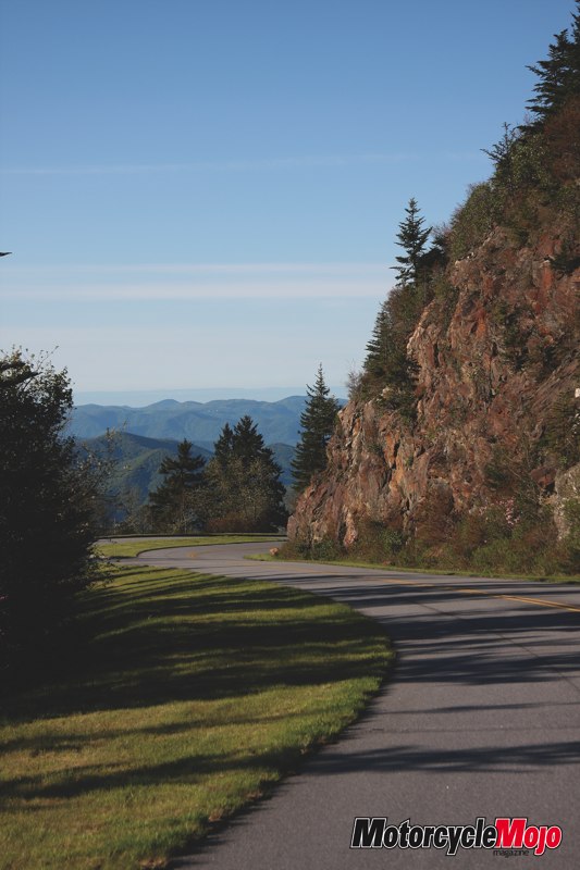
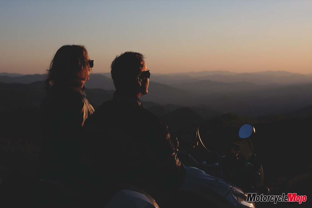
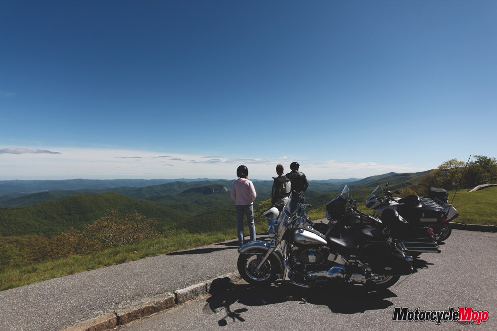
Sometime before sunset, and a while after the tourists have headed back to their hotels, it’s possible to be alone on the Blue Ridgeway Parkway. You can pull over at a scenic overlook, slip your bike on the stand, lean back, and get lost in the magical vista. As multiple layers of soft color melt away into the distance behind the fading mountains, the spirits of the ancient ones whisper through the still evening air.
Not wild or breathtaking, the way the Rocky Mountains or the Grand Tetons tear the horizon with their jagged peaks two miles above the earth, the Smoky Mountains appear more gentle, approachable and peaceful, as they melt into the pastel horizon. Time disappears as the transition to night transforms the landscape, and you find yourself lost in thought and wonder in their presence. Later, the cool of the approaching night and the sound of nature’s orchestra warming up for the evening symphony brings you back. It’s time to swing your bike off the stand, fire it to life, click into gear and head for home. A welcome reception, a hot shower, and dinner with friends await. Leaving the fading mountains to the transition from light to dark, and winding down the sinuous ribbon of tarmac ahead, it’s comforting to know that all roads lead to Maggie Valley.
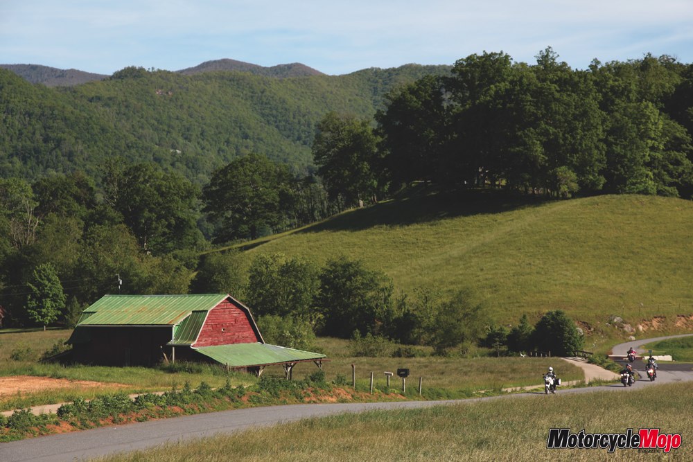
Located in the heart of the Smoky Mountains with a population of just a few hundred, the majority of Main Street, which runs the length of town, is given over to tourism. It’s a corner of the world that has managed to avoid the destruction of mainstream development. Small mom-and-pop restaurants, hotels, motels, and curiosity shops rule the roost, with little influence from fast-food America to spoil the ambience. With southern hospitality, great service and fantastic prices, it’s long been base camp to savvy motorcycle travellers, the kind in need of refreshing air, lightly trafficked roads and some of the most beautiful scenery the east coast has to offer.
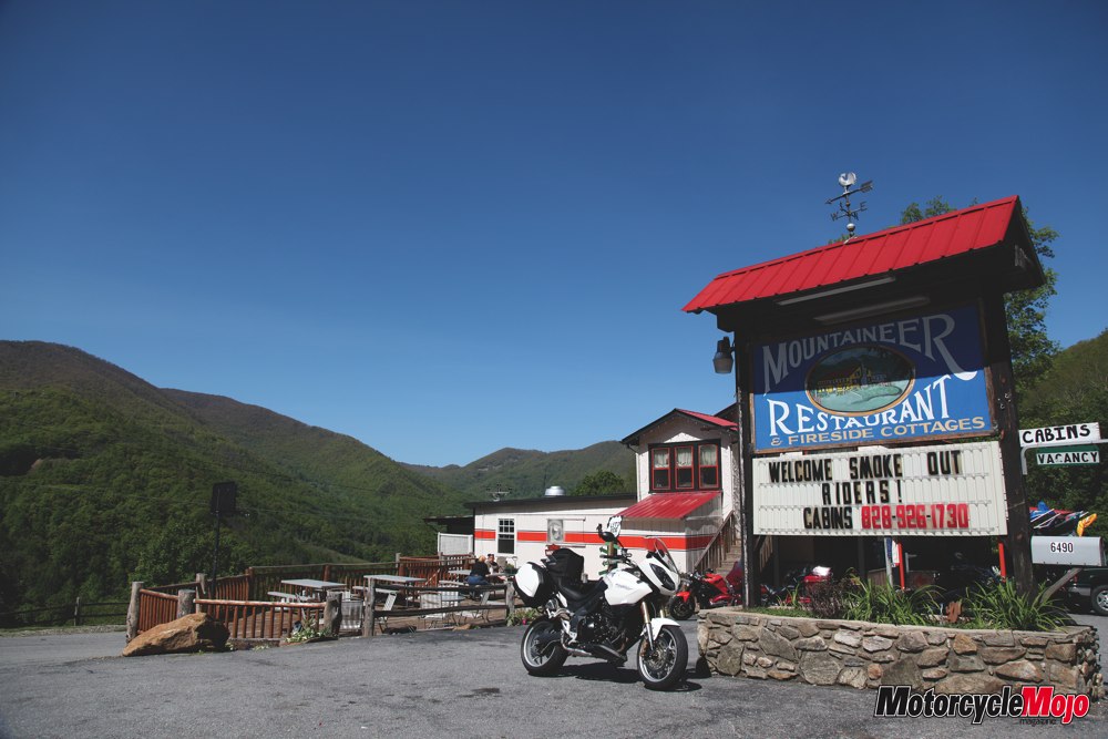
I’ve been in and out of Maggie Valley for years, and when Joanne Martin at the Mountaineer Restaurant invited my buddy Jim Miller and me for a few days’ riding recently, we couldn’t resist the call. Setting up in one of her cabins below the restaurant, we picked up the phone and put in the call that would ensure the best possible riding experience for the time we had available.
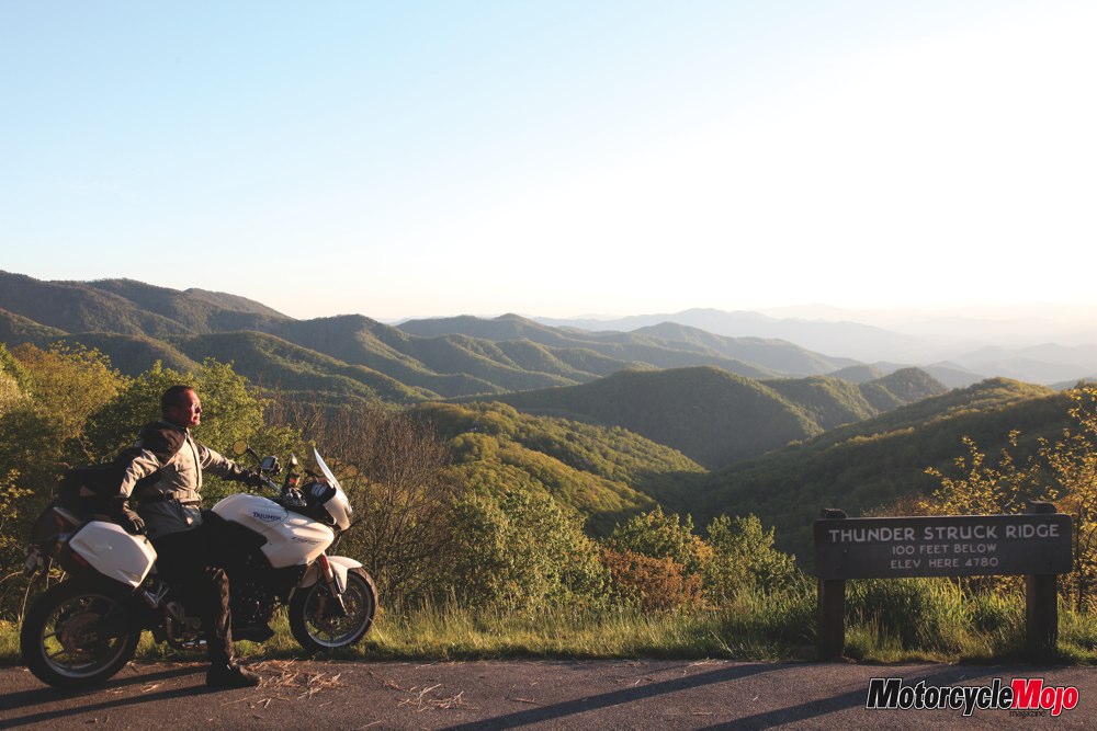
Meeting early for breakfast the following morning, we were greeted by a beaming grin bursting out of a plain white helmet. Sitting astride a fully loaded Triumph Tiger with no signs of any chicken strips on the well-scrubbed tires, Mr. Wayne Busch is obviously a very serious mountain rider. He is also the owner of America Rides Maps (www.americaridersmaps.com) and probably has ridden more miles in these mountains than anyone you are likely to meet. He has made a series of maps highlighting all the best rides available in this area, so just decide what you want to do, where you want to go for the day, grab a map and head out. Taking you on a circular route past all the best scenery and on the least travelled roads – it’s like putting on the cruise control or having your own private tour guide on top of the tank bag. Jim and I actually did, as Wayne kindly offered to lead a ride. Over mugs of steaming coffee, he showed us different routes as we told motorcycle stories and got acquainted.
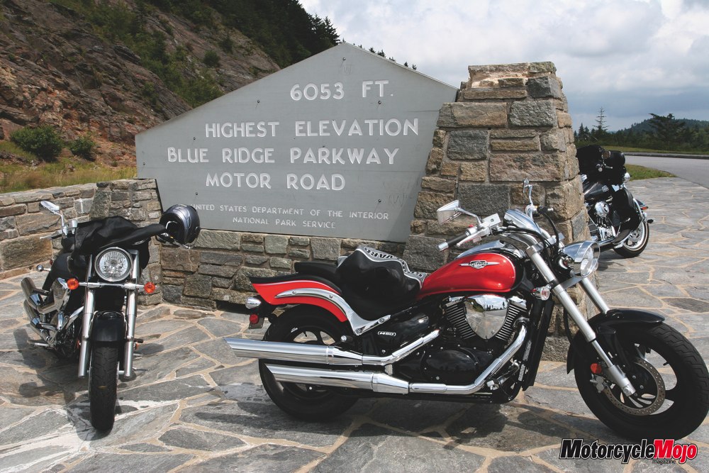
Heading out of the Mountaineer with Wayne at the helm, we had chosen the most popular tour that riders select in this area, a challenging ride that would take us to the Tail of the Dragon and the Cherohala Skyway out on the western edge of North Carolina. First we chose one of the three routes, which Wayne lists as Approaches 1, 2 and 3. One is the shortest and most direct, and three is the longest and most meandering. If you are in a hurry and want to focus on the Dragon for the day, Approach 1 will get you there in under two hours, while only racking up 81 miles (130 km) on your odometer. Number three is called “The Back Roads Approach,” and is listed as 145 miles (233 km) or four hours and two minutes. It was the unanimous choice for our group.
Dropping into Maggie Valley on a beautiful, clear morning, the air was alive with the sounds and smells of this small, industrious town getting busy. Lawnmowers cut neat lines in carefully tended yards, and delivery trucks unloaded supplies as we wound down and into the neighbouring town of Waynesville. With a tourist tagline of “slow down and enjoy the present” and a historic Main Street that gives views of the Blue Ridge Mountains and is packed with brightly coloured art galleries, coffee shops and curiosity shops, it would have been easy to get distracted from the ride. Luckily we were on a mission and kept rolling, making a mental note to return.
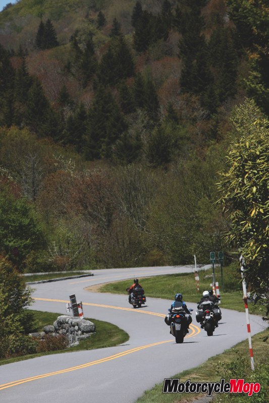
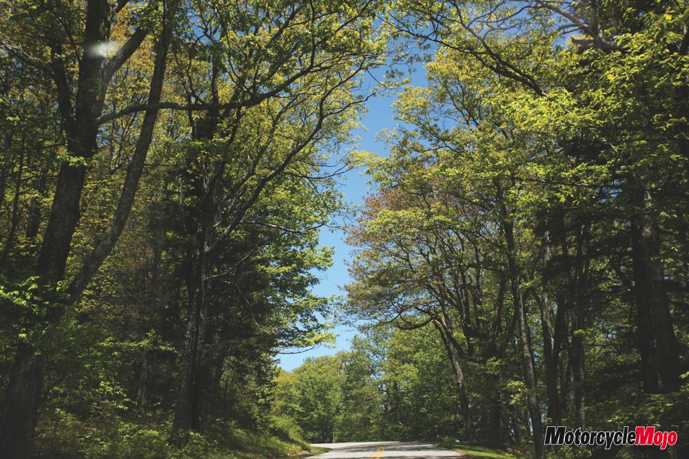
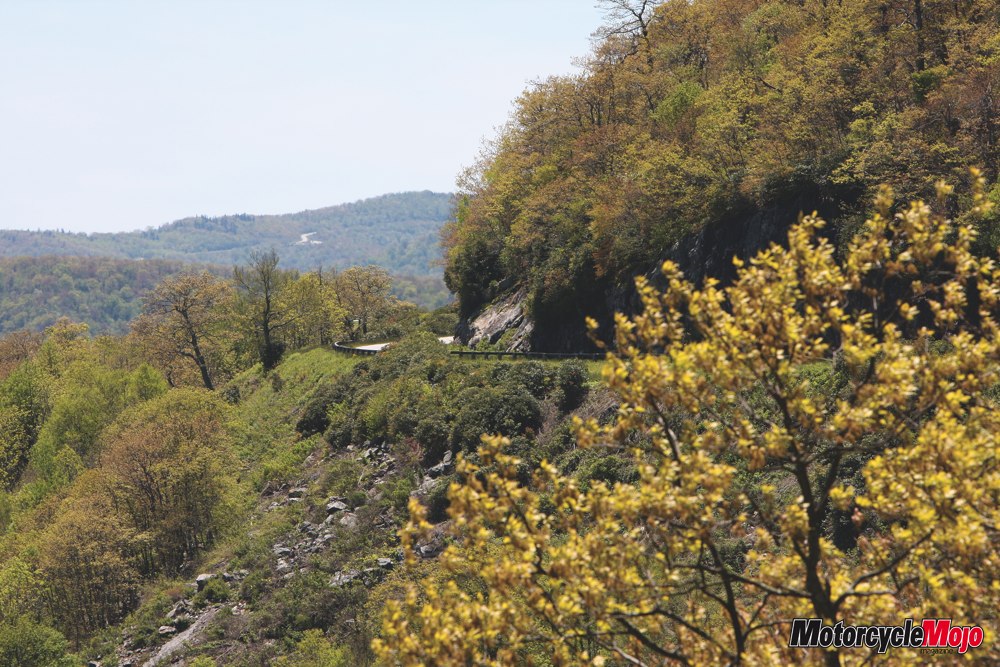
Pigeon Street leads out Brevard, before US276 twists and turns under the Blue Ridge Parkway about thirty minutes into the ride. Riding along these lightly trafficked, two-lane roads is motorcycle heaven, and as NC107 becomes Pine Creek Road, we wrap along picturesque Glenville Lake. Travelling in early May, the dogwoods are still in bloom, and splashes of intense colour punctuate the warm backdrop of pastel green and brown that lines the route. Weaving around for a fun few miles, we end up on Wayah Road for the next 28 miles (45 km). This gives another chance to stretch the throttle cables a little as we carve back and forth on what seems like an endless series of perfectly arced curves. Thick forest interspersed with open meadows accompanies us on the ride, and before long we are popping out onto US74.
Turning south, within a mile or so we pick up US129 and roll through the cool, shady countryside on tarmac so fine it’s like a manicured golf course of the motoring kind. This leads us through the funky little mountain town of Robbinsville, where we gas up and add a little fuel to our bellies. It’s wise to watch your speed through here, Wayne advises us, and within a few minutes we are out of town and back into the country. Crisscrossing the Cheoah River, we make our way past peaceful Lake Santeetlah and the Tapoco Lodge. Three miles further, we cross the Little Tennessee River and stop for a look at the Cheoah Dam, made famous in the movie “The Fugitive.”
Saddling up, we roll up the hill and out to the Deals Gap Resort. Located at the end of the world-famous Tail of the Dragon, named by local riders Ron and Nancy Johnson of www.tailofthedragon.com fame, the resort offers gas, cold drinks and food, as well as plenty of souvenirs and memorabilia. They also have accommodation available for those wanting to spend more time here, but our group votes on one ride up and back before heading to the more leisurely and scenic Cherohala Skyway.
With a clear mental snapshot of the “Tree of Shame,” located on the grounds of the resort (which for those unfamiliar with it is decorated like a Christmas tree with parts of crashed bikes dangling in place of shiny ornaments), we took off to tame the Dragon. Featuring 318 curves in 11 miles, it’s a highly challenging series of tight corners, with a few short straights thrown in to really confuse you. Without intimate local knowledge, it’s easy for the Dragon to bite you with its many decreasing-radius corners or lurking local policemen. These guys have had their sense of humour surgically removed, so be warned if you go over the limit, or cross over the centre line.


Thanks for Reading
If you don’t already subscribe to Motorcycle Mojo we ask that you seriously think about it. We are Canada’s last mainstream motorcycle magazine that continuously provides a print and digital issue on a regular basis.
We offer exclusive content created by riders, for riders.
Our editorial staff consists of experienced industry veterans that produce trusted and respected coverage for readers from every walk of life.
Motorcycle Mojo Magazine is an award winning publication that provides premium content guaranteed to be of interest to every motorcycle enthusiast. Whether you prefer cruisers or adventure-touring, vintage or the latest models; riding round the world or just to work, Motorcycle Mojo covers every aspect of the motorcycle experience. Each issue of Motorcycle Mojo contains tests of new models, feature travel stories, compelling human interest articles, technical exposés, product reviews, as well as unique perspectives by regular columnists on safety or just everyday situations that may be stressful at the time but turn into fabulous campfire stories.
Thanks for considering a subscription. The Mojo team truly appreciates it.
