
Glacier National Park has much more to offer than twisty roads and mountain scenery
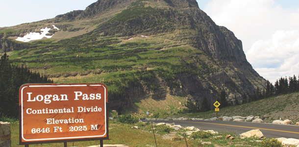
A simple wooden sign marks Logan Pass and the Continental Divide in Glacier National Park, Montana. It’s fitting, given the wild, untamed mountains and natural beauty that surround it. From here, you can see tall peaks, deep glacier-carved valleys, waterfalls and wildflowers. Although this is the geographic pinnacle of the Going to the Sun Road, each turn opens up another spectacular view that takes your breath away yet again.
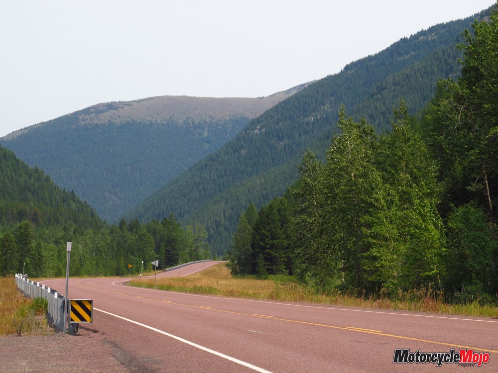
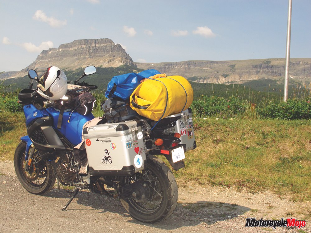
Glacier National Park and surrounding area offers stunning vistas, no matter which direction you ride in. I created a counterclockwise loop, beginning in Saint Mary, riding west on the Going to the Sun Road to West Glacier, then back east along Highway 2 and north on Highway 49/89. The whole route is 220 kilometres and can be done in a day, but allow at least two days to explore the area.
 Named for its glacier-carved terrain and remnant glaciers, Glacier National Park preserves more than a million acres of forests, alpine meadows and lakes. It’s home to nearly 70 species of mammals, over 270 species of birds and the headwaters of both the Pacific and Atlantic Oceans, as well as Hudson Bay. Now a protected sanctuary, visitors seek out its rugged peaks, clear waters and mountain trails.
When Europeans first arrived, the area was controlled by native American tribes whose ancestors had inhabited the area for more than 10,000 years. The vast prairie east of the mountains was Blackfeet country. The Salish and Kootenai Indians lived in the western mountain valleys. It’s easy to understand why they all referred to this Rocky Mountain paradise as the “Backbone of the World.”
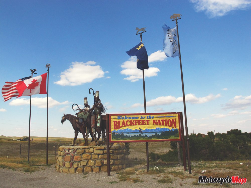
The park’s eastern side is where the prairies meet the mountains. As you approach from the south, parallel to the mountains, the vast prairie and big blue sky is endless. It’s so transfixing that the abrupt transition can almost catch you by surprise. Stalwart sentries from the Blackfeet Nation extend a warm, yet poignant welcome, their permanent gaze trained on country that was once ancestral land. The boundary they now patrol, bordered on the north by Alberta and on the west by Glacier National Park, marks a reservation that is a fraction of the size of the land they once called home.
It was late afternoon by the time I arrived at my campground just north of Saint Mary, on the eastern edge of the park and the western boundary of the Blackfeet Reservation. Here nature presented another juxtaposition of beauty and tragedy, visible from my riverside campsite. Forest fires were ravaging areas to the west, creating a smoky haze that persisted for my entire time in the area. That same smoke created a stunning evening sky.
Having ridden all day across Montana plains, I was ready to eat and replenish for the next leg of my journey. There’s a moderately stocked, highly priced grocery store in town, as well as a fantastic little café. Known for its pies, the Park Café is so popular that there’s usually a long waiting line, but if you can persevere, the home-cooked food is delicious.
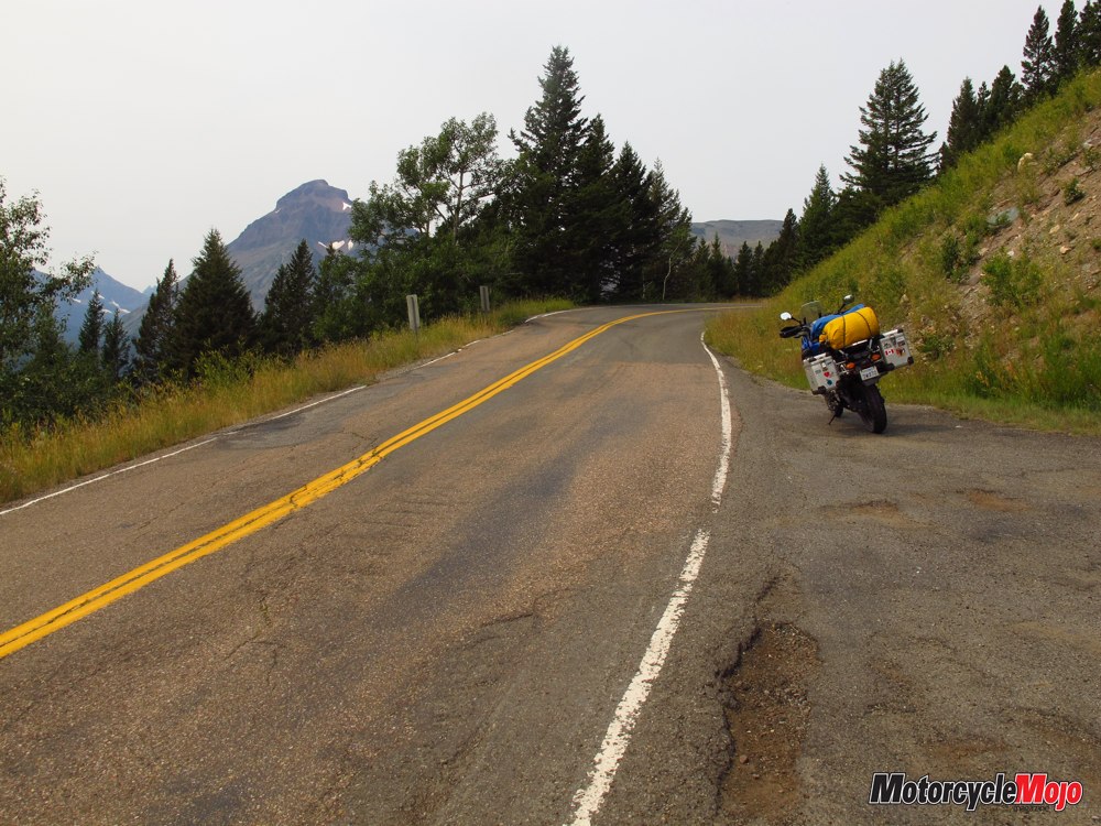
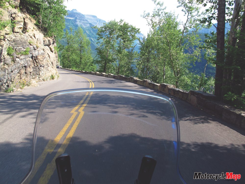
 Going to the Sun Road crosses 80 kilometres of Glacier National Park between its east entrance at Saint Mary and the west entrance, near the community of West Glacier. It’s narrow, steep and winding, with many places to look over the edge while riding. Even so, the greatest hazards are the brake lights on the vehicle in front of you. The magnitude of spectacular scenery captures you time and time again, whether you’re on two wheels or four.
Make sure to stop at the Saint Mary Visitor Center at the east gate. There’s plenty of history, culture and natural beauty along this corridor, and the National Forest Service attendants are a wealth of information. They can help you plan, prioritize your stops, and make sure you don’t miss something significant. Pick up a park map, which identifies the highlights.
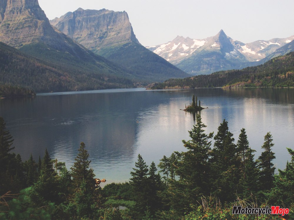
My first stop was at Wild Goose Island, a tiny island positioned resolutely halfway between two shores of mountain-flanked Saint Mary Lake. Legend says that it was the meeting place for a pair of lovers who swam out to the island from their respective tribes on opposite shores. When they brought back news of their intended union, disapproval by their tribes prompted them to return to the island, where they turned into swans and flew off together, never to be seen again.
Further west is Sunrift Gorge, a narrow ravine carved by glacial runoff. A well-marked trail takes you past delightful channels and pools to a series of stunning waterfalls. Given the boisterous manner in which water cascades over the rocks, many people think they’ve arrived at the waterfalls and turn back way too soon. Continue on past the wooden bridge and look to your right to know you’ve arrived. In spite of being there at peak season, I was often alone on the trail as it cut through dense vegetation. Not anxious to startle any bears stocking up for winter hibernation, I deliberately made noises to herald my approach.
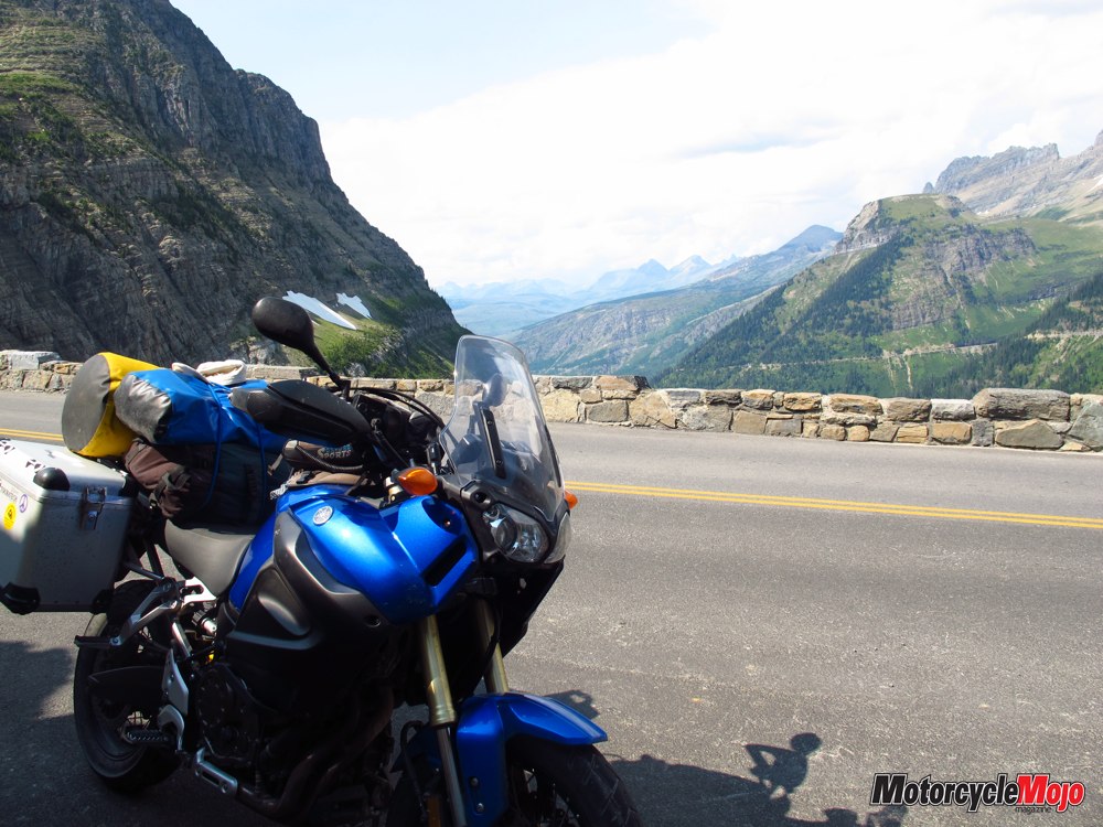
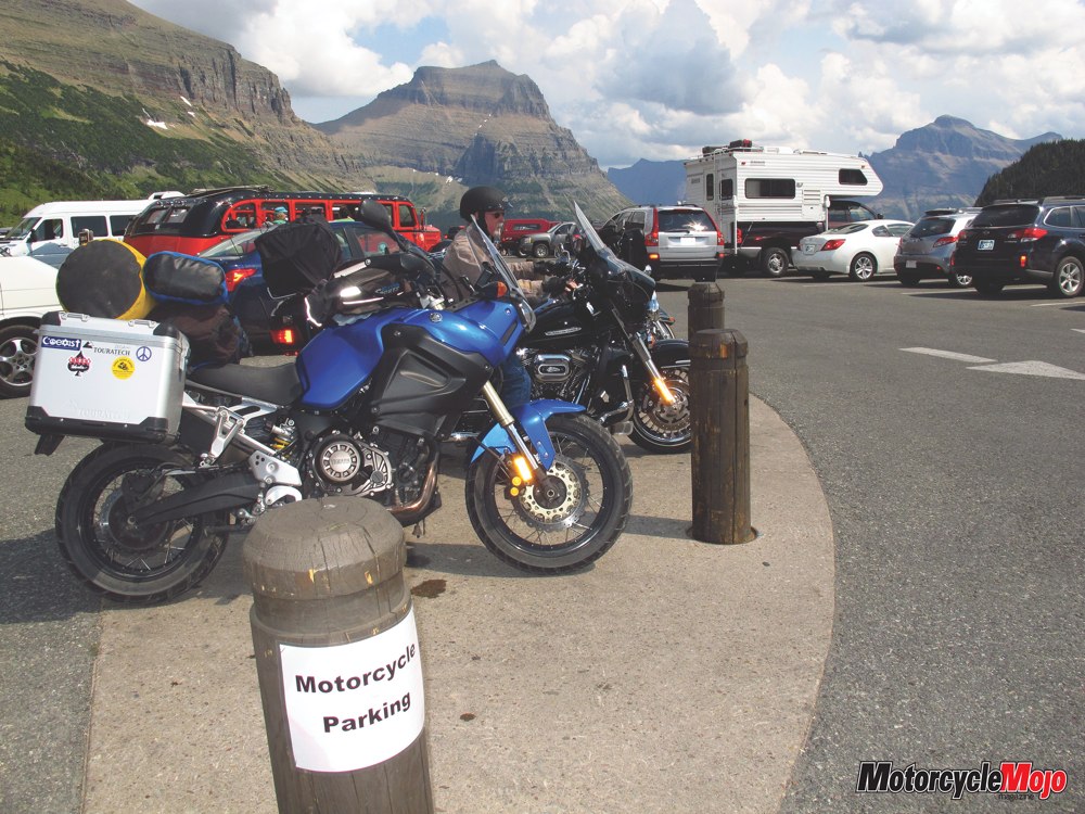
Gearing up again, I continued past Jackson Glacier overlook, purportedly offering the best view of a glacier from anywhere on Going to the Sun Road. It’s unquestionably spectacular, but I was happy to ride uninterrupted before stopping at Logan Pass, which at 2026 metres is the highest point on Going to the Sun Road. Clements and Reynolds Mountains are both visible here, and if you’re lucky, you’ll catch sight of wildlife ranging from marmots, mountain goats and bighorn sheep to the occasional grizzly, I’m told.
 Unfortunately, car and RV drivers are often out of luck in finding a parking spot at this popular stop. Not so for motorcycles. There are several designated areas to park your bike, and there’s always room for one more.
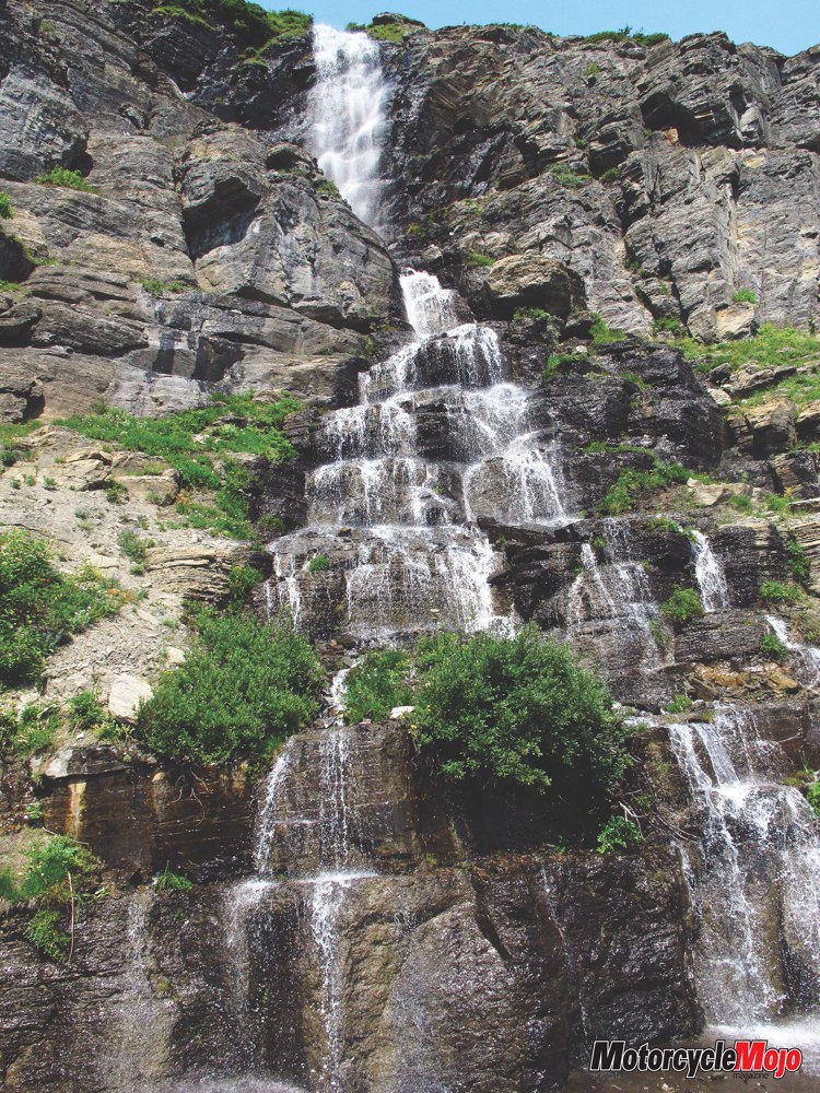
The temperature was sweltering, even at higher altitudes, and it wasn’t long before I was back on the bike, looking with anticipation for the Weeping Wall. Guidebooks caution drivers to roll up their windows against its mist. Perhaps that’s advisable in spring when it’s a gushing waterfall, but that mist felt glorious on a hot August day.
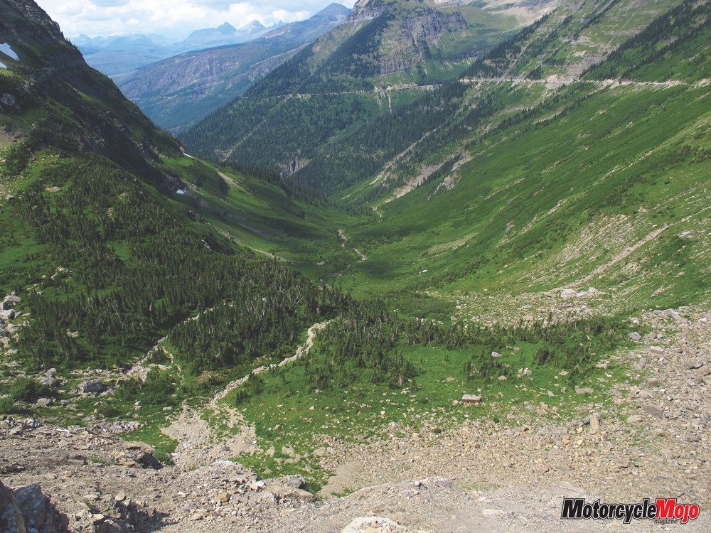
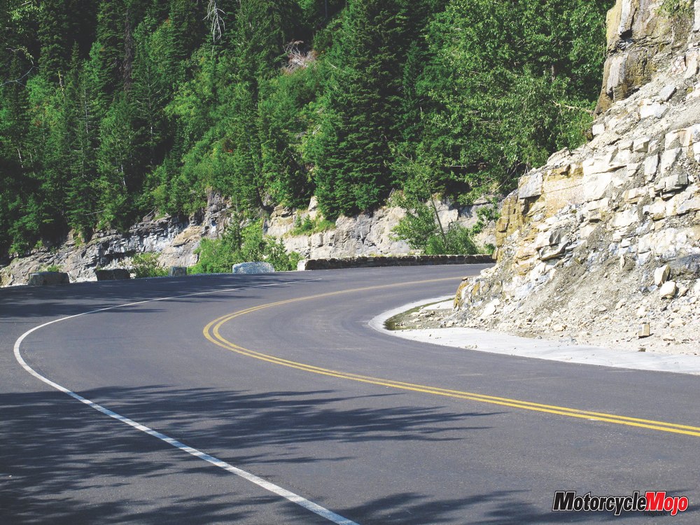
The long descent from Logan Pass toward West Glacier is just as breathtaking as the summit’s approach. The ribbon of pavement clings to the side of the mountain as it corkscrews down and around. Squat rock walls separate you from the precipice and make it easy to see over the edge. Waterfalls, glaciers, rugged mountains, streams, wilderness and ancient rock all make it a magnificent ride. Plentiful turnouts provide ample opportunities to stop and take it all in.
West Glacier Village, the western gateway to Glacier, is slightly more cosmopolitan than Saint Mary, offering a variety of lodging, dining and shopping opportunities. By the time I arrived, it was time to gas up, get supplies and find a campsite for the night, before completing the loop the next morning.
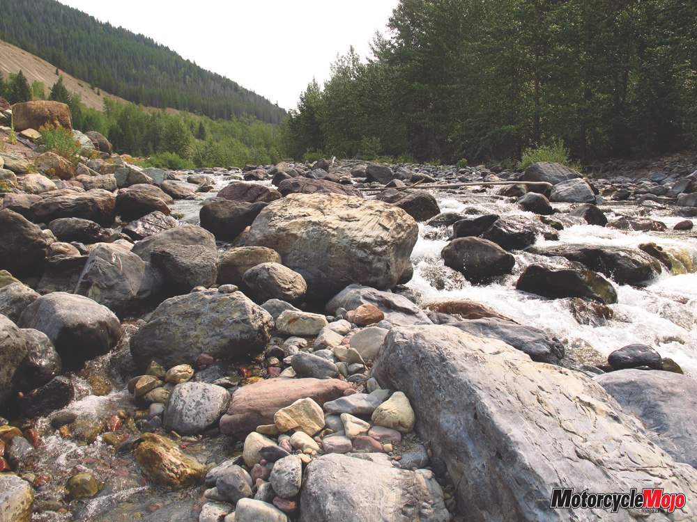
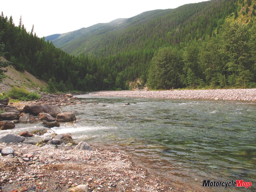
In contrast to Going to the Sun Road, the sweeping curves on Highway 2 offer a tamer, yet still wonderful cruise. The terrain changes from mountains to plains as you head east toward Blackfeet country. Glacial rivers flow alongside the road, their water tumbling over millions of colourful rocks. It’s not often that one gets up close and personal with glacial runoff, so I had to stop and test the water. It was definitely cold, even in August.
Turning north on Highway 49, I entered the hamlet of East Glacier. This is huckleberry country, and like in many places in northern Montana, you’ll find everything from huckleberry pancakes and pies to ice cream and drinks. Stock up on groceries, home-baked pastries or fresh deli sandwiches at Brownies Bakery and Deli, set in a historical, 1920s log building. Savour them from the porch while facing the majestic Rockies, soaking up the wilderness atmosphere, and breathing in the crisp mountain air. Continuing north on 49, you’ll need to keep your wits about you. The seasonal road has lots of tight twists and turns through the trees, but it’s quite rough in a number of spots, especially heading south. The shoulder can be rough patched or completely gone, but the terrain is beautiful, and it’s an exhilarating ride. The alternative is to continue on Highway 2 east and head north on Highway 89. It’s also scenic, but tamer, and the road is in better shape.
Travelling through remote wilderness calls for a bit of foresight and prudent planning. While Glacier National Park is open all year long, Going to the Sun Road can be inaccessible from time to time due to construction and weather. Check the plowing status page as open and close dates change yearly, but the earliest it could be open in 2014 was June 20, and it will close on September 22. Weather is always unpredictable, and the temperature can vary dramatically depending on elevation. Be prepared. Mountains continuously reclaim their natural state, creating an unending battle to keep roads in good repair. The Going to the Sun Road is now 75 years old, and vital preservation work is needed.
Road construction and long waits are a fact of life, so be patient. There is only a single, two-lane road, so when maintenance is necessary, there’s no choice but to disrupt traffic flow. Gas is not available in the park or on the Going to the Sun Road. There are a number of picnic areas, but meals are available only at Rising Sun, Lake MacDonald Lodge and Apgar Village. In 1932, Canada and the United States declared Glacier National Park and neighbouring Waterton Lakes National Park as the world’s first International Peace Park. If you’re interested in a longer ride, a 507-kilometre loop, dubbed the Crown of the Continent, takes you through both parks via Alberta, Montana and British Columbia.