
For centuries, the Rock has been blessed with quaint seaside villages that beg to be discovered by motorcycle
 “Look what the storm just blew in!” The pub waitress smirked as I stumbled in out of a torrential rain in Placentia, Newfoundland. Water was still running down my neck and dripping off the end of my nose. “We don’t open for an hour, but I can’t turn away a drowning man.” She brought me in and offered me hot chowder to warm my bones and several dining room chairs to hang my dripping gear.
Bad weather. Great people. That would characterize my time on the eastern shores of Newfoundland. Not that the weather is always thus. One friendly fellow commiserated, “You’ve arrived just at the end of two months of sunshine every day.” I hoped the town’s name, from the French for “a pleasant place,” might yet be a sign of things to come.
“Do you have a place to stay?” asked Jean. (She was now Jean and I was Jeff, not just a waitress and a drowning man.) “There’s a wonderful bed and breakfast just steps up the road. I can call for you.” And so it came to pass that I settled in for the night at Rosedale Manor, a Southcott-style home built in 1893, and recently beautifully restored. After sleeping on turnoffs and old logging roads, I certainly enjoyed the upgrade, with porcelain basin, refinished antique furniture and a welcome to restore all faith in humanity. Breakfast included, it was still less expensive than most hotels. And what a breakfast! Linda, the owner, had partnered with a born and bred Placentia boy to run Philip’s Café. Philip made all his own jams and breads. And Linda kept the coffee and toast coming. Along with the potato cakes, eggs and ham, it was enough to keep me going all day long as I explored the Avalon Peninsula.
Discovering the Colonies
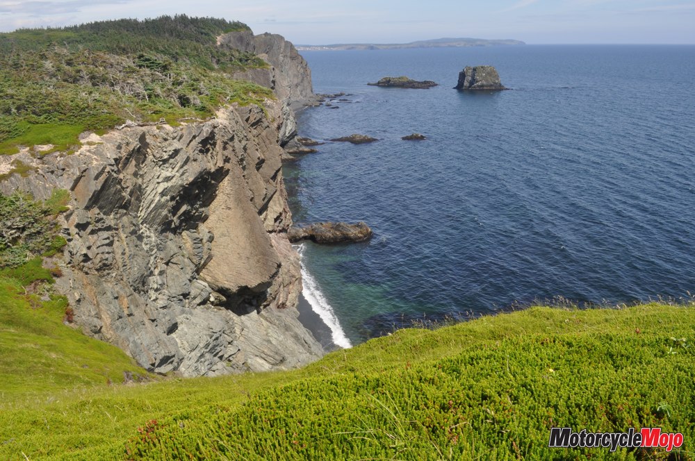
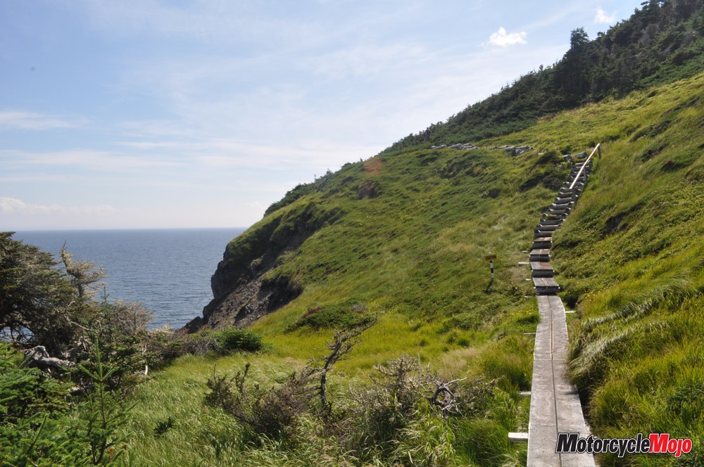
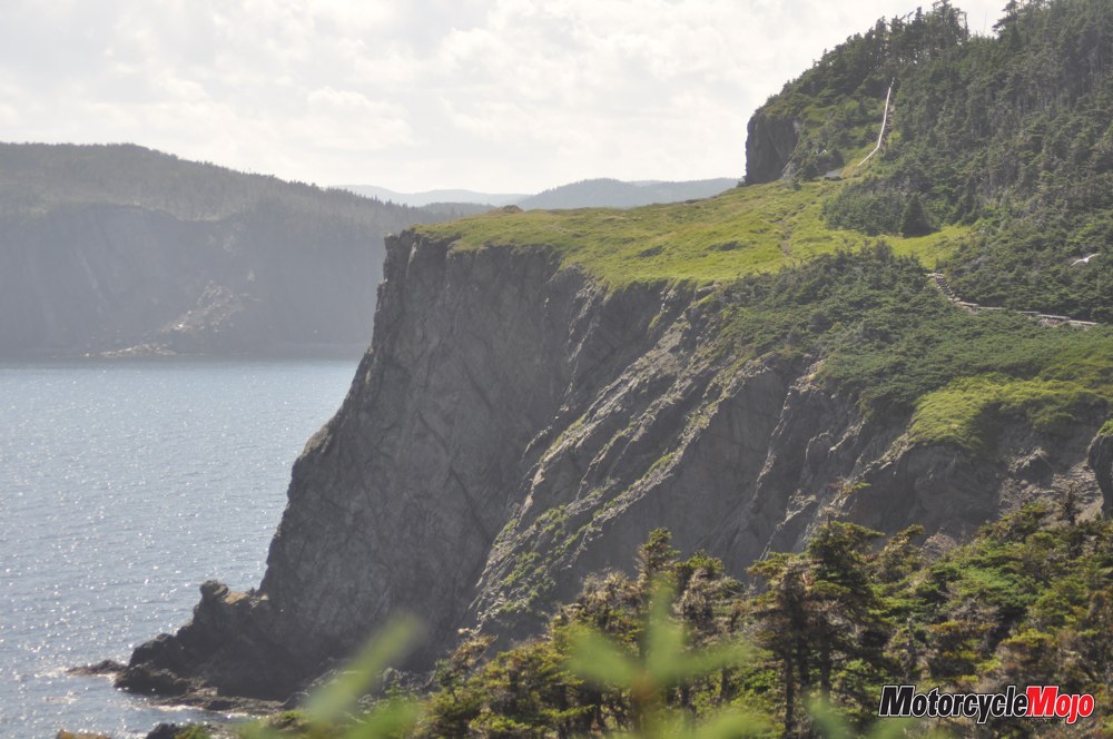
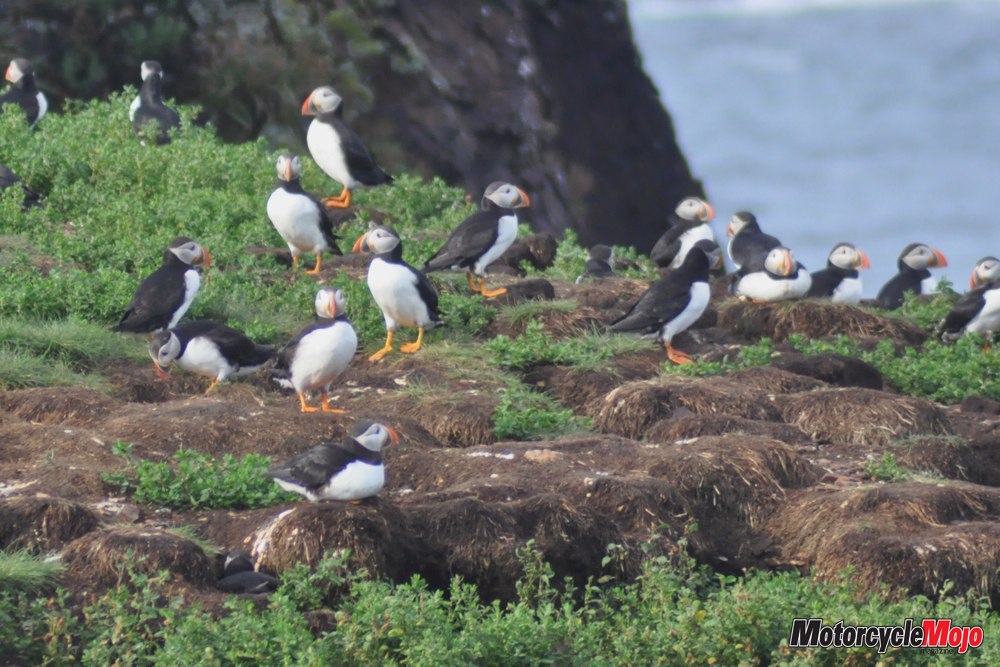
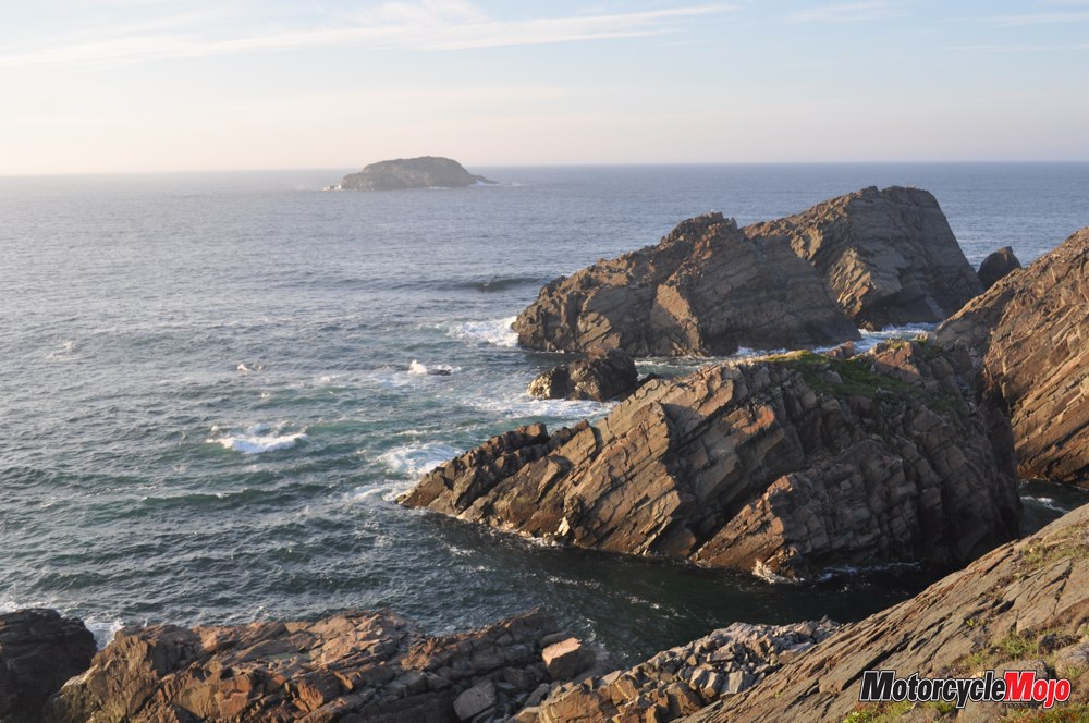
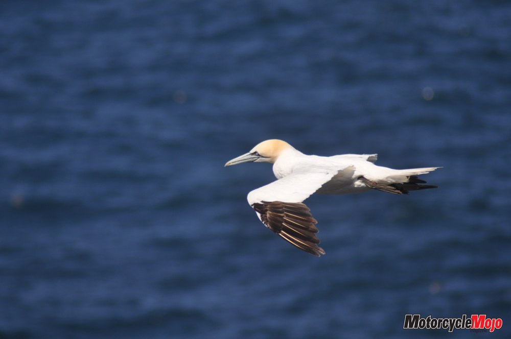
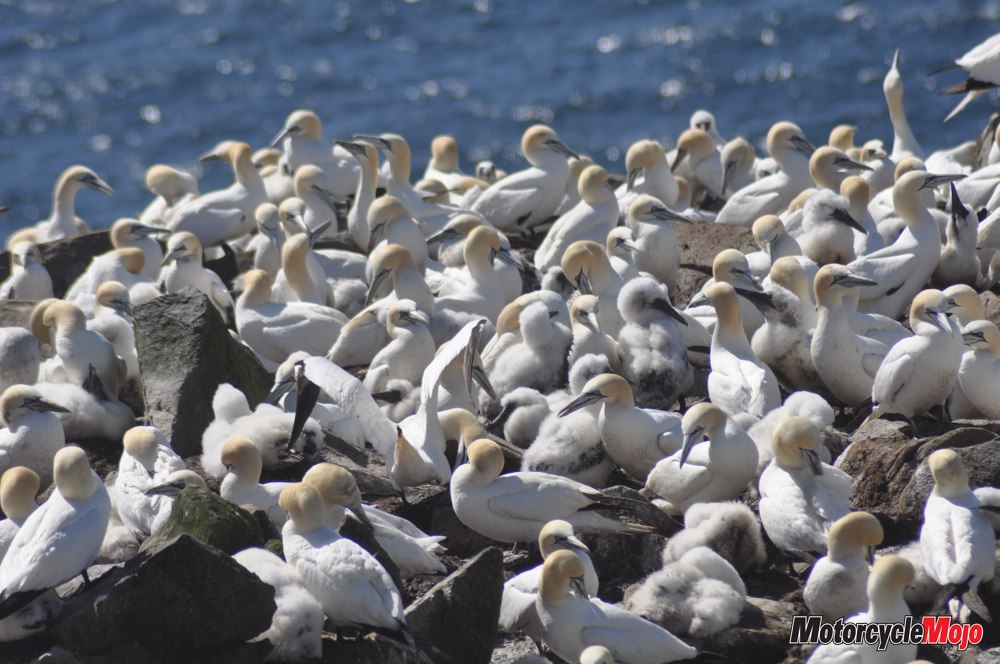
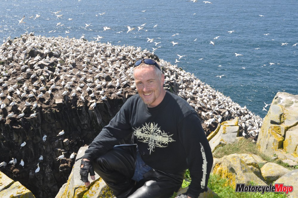
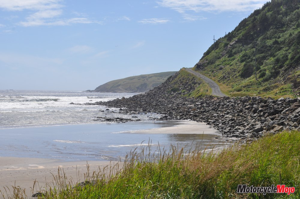
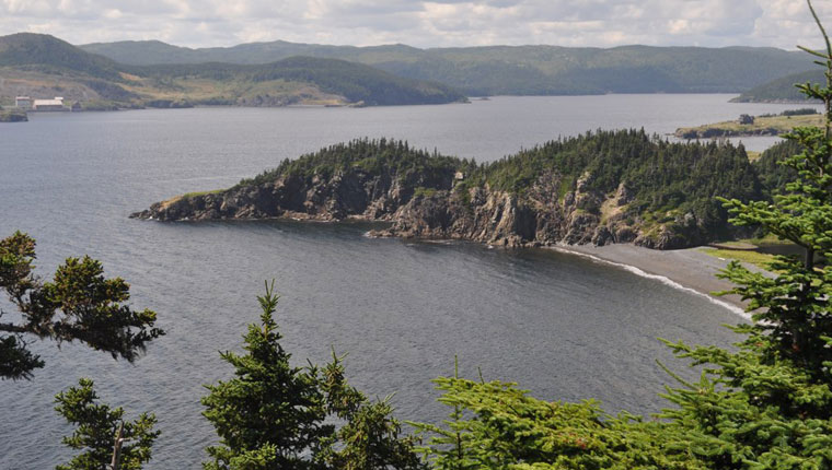
The route south to St. Bride’s was a terrific, twisty road, cresting over ridges and dropping into tiny villages along the shore – Barasway Cove, Patrick’s Cove, Gooseberry Cove – one after another, all picture-perfect. This road, all the way to Salmonier, was shown on the map as “The Cape Shore Drive.” However, I detoured south to Cape St. Mary’s Ecological Reserve, where I then hiked a trail through grasslands atop sheer cliffs. I passed by grazing cattle and bleating sheep on my way to “Bird Rock.” Still some distance away, I began to hear what sounded like the rattle of an old tractor engine. Coming over a knoll, suddenly I was face to face with the ocean 100 metres below, and on the cliffs, the largest (and possibly noisiest) gannet colony in the province. Eleven thousand pairs of nesting gannets, kept company by common murre, black-legged kittiwake, razorbills and a small number of black guillemot. Bird Rock and the adjacent cliffs are like an avian high-rise. Only a few metres away, I sat on tufts of tall grass, watching families caring for their young, safe from both land and sea predators.
 From here I rode out to the main highway, then turned south once more to follow a winding route where the tall brush crowded the shoulder. Were a moose to step out, I wouldn’t stand a chance, so I slowed to a more cautious pace. I arrived at Point Lance, one of the most remote outports on the entire peninsula. Until 1950, the only way in or out was by boat.
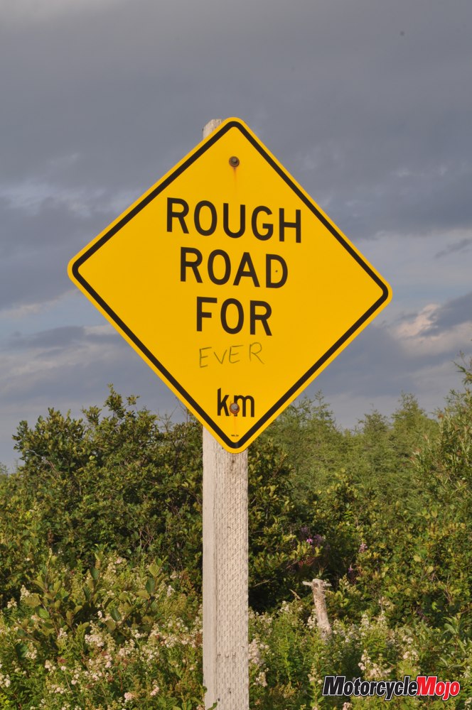
My journey led me north through Branch and North Harbour, where I made a short dodge west to visit Cataracts Provincial Park. The road was potholed and rugged, but the pounding twin waterfalls were impressive. Returning to the pavement, I continued east on Highway 91, then south around St. Mary’s Harbour. Called the “Irish Loop” on the map, the red line ran all the way around the Avalon Peninsula to St. John’s. I followed it along the shore to St. Joseph’s before cutting inland and emerging at Riverhead, where again I enjoyed the meandering road as it hugged the shore virtually all the way to St. Vincent’s and Peter’s River. From there, Hwy 10 led me through a long stretch of the Eastern Hyper-Oceanic Barrens where a herd of over 3000 caribou grazed for mushrooms, greens and caribou lichen. I felt as though I had been whisked to Canada’s Far North. In fact, this is the home of the world’s most southerly herd of caribou.
The Absolute Lord of Avalon
 On the eastern shore, Ferryland, like so many of these coastal villages, offered a storied past. The name is an Anglicized version of possible French, Spanish or Portuguese origins. Since the early 1500s, “The Pool” was well known to – and contested by – fishermen of all four nationalities, including English. However, by the end of the century, the English had gained control, and in 1621, permanent settlement began. Two years later, Lord Baltimore was granted a Royal Charter for the “Colony of Avalon.” And it is to this that the peninsula owes its name. Baltimore himself came to Avalon with his family and 40 Catholic colonists. Attacks by the French, a particularly harsh winter and illness among the colonists, however, diminished his enthusiasm. In the spring, Baltimore packed up his colony and moved south to an area he named Maryland. Even today, the Great Seal of the State of Maryland attests to Lord Baltimore’s claim as “Absolute Lord of Maryland and Avalon.”
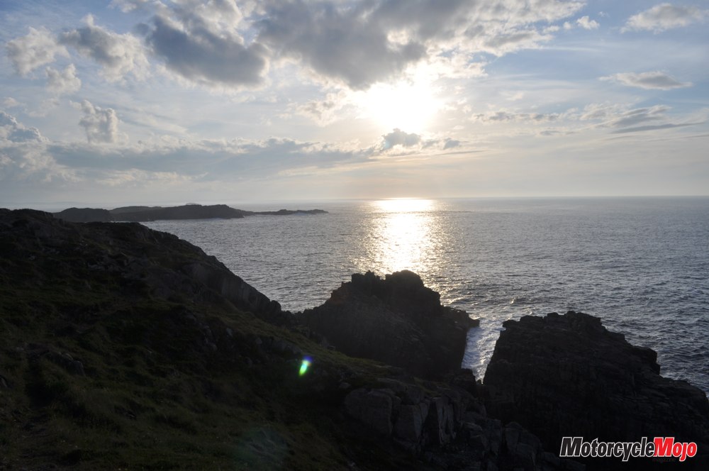
I arrived at dusk in St. John’s where, unbeknownst to me, the George Street Festival was in full swing. George Street is said to have the most bars and pubs per square foot of any street in North America, and each year, up to 100,000 people party on the “biggest little street” for six straight days, leading into the annual Regatta Day civic holiday. Failing to find accommodations thanks to the crowds, I decided to try my luck vagabonding on Cape Spear. This National Historic Site is the most easterly point of land in North America, and it’s the first place on the continent where the sun shines each day. To my surprise, I was not alone on the benighted cape. Several cars filled with college kids in sleeping bags were parked in the lot. Clearly, being first to see the sun was not an original idea. Nevertheless, it was a great way to start a new day.
Standing Watch
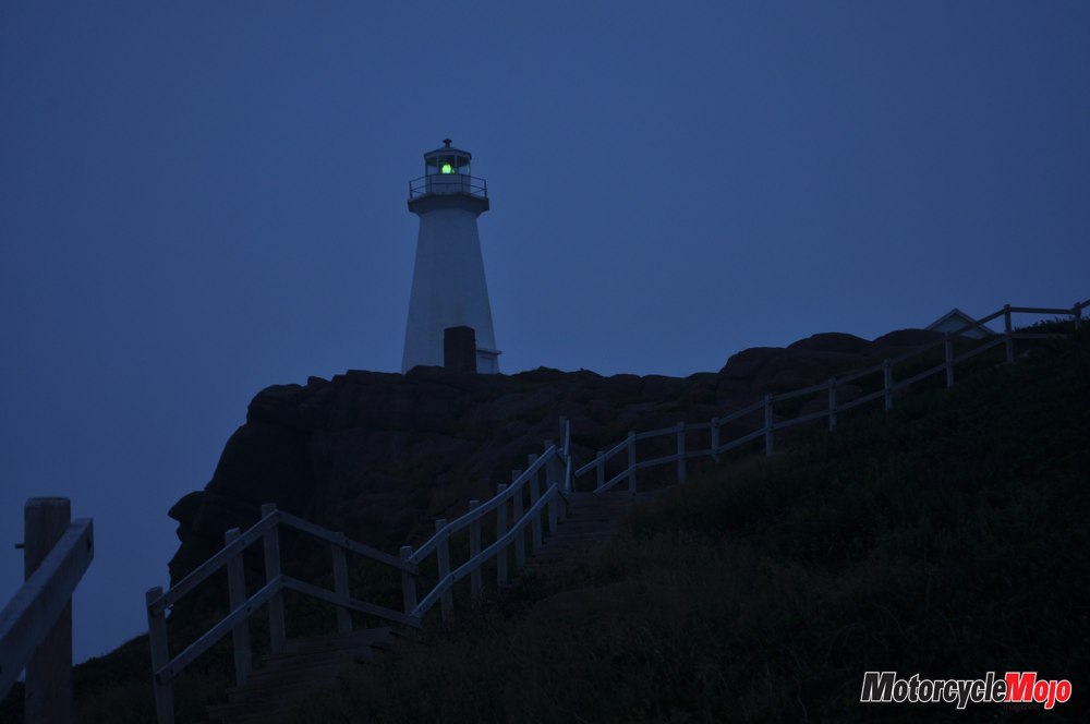
Cape Spear is the site of the oldest surviving lighthouse in Newfoundland and Labrador. In service from 1936 to 1955, the building is now a museum, while a modern beacon stands just down the hill. The remains of a World War II military bunker also stand on this point, along with a battery of two massive “disappearing” guns that were built to protect ships using St. John’s harbour. These guns could be raised to fire, then lowered behind a protective concrete wall. Although the military buildings are gone, the bunker remains. I wandered into the dark depths with a flashlight. Cold and damp even when they were inhabited, the tunnels are now dank and dilapidated.
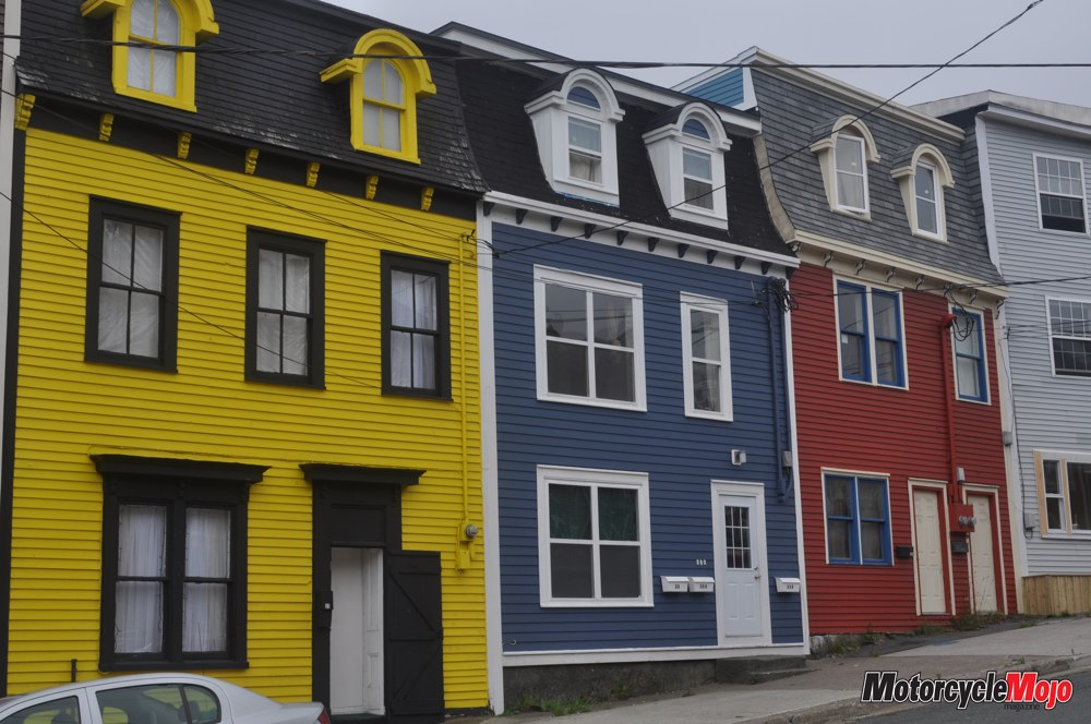
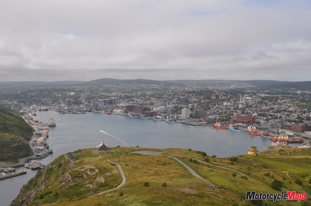
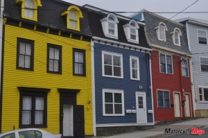
I rode back into the heart of old St. John’s for breakfast. Here, a passerby noticed my noticed my Ontario licence plate and, even though I was just fine, he stopped to ask if I needed anything and could he help. I asked why the downtown was so quiet in the middle of the week. “This is Regatta Day,” he explained. “Everyone is at the regatta and everything is closed.” The Royal St. John’s Regatta is a traditional rowing event that has been held the first Wednesday in August since 1818, making it the oldest continuous organized sport in the world. “Don’t go down to Quidi Vidi today,” advised my interim guide. “I doubt you’ll get through. All the roads are closed.” I was able to tour the city core more easily as a result, taking photos of the iconic brightly coloured houses that line the steep streets, marvelling at the number and variety of ships and containers in St. John’s Harbour, and visiting the place where, on April 12, 1980, Terry Fox dipped his leg in the Atlantic Ocean to begin his gruelling Marathon of Hope. The harbour has been a busy place almost continuously since Sir Humphrey Gilbert claimed it for the King of England on August 5, 1583. By the 1620s, migrant fishermen were beginning to settle here, and within 50 years, it had become the “English Shore” from Bonavista to Trepassey, with St. John’s as the largest of the settlements. When the French attacked, Britain installed a military presence on Signal Hill and built Fort Amherst on the Narrows to protect the harbour and the city. But the value of this port was perhaps never greater than it was during World War II as Corvettes patrolled and protected our waters from German U-boats, escorting over 6000 merchant vessels to and from St. John’s. As the war dragged on, morale among the Corvettes’ crews was low and faltering. In response, the citizens of St. John’s formed welcoming committees to bring cakes to the crew members, and to inform them of local entertainment. As well, countless families warmly welcomed them into their homes and their hearts. Simple hospitality, perhaps, but it may very well have made the difference in a struggle that was on a razor’s edge for many long years. Signal Hill, overlooking the city, was also the site where, on December 12, 1901, Guglielmo Marconi received the first transatlantic wireless radio signal with a telephone receiver and an antenna held aloft by a kite. There has been so much history made here that a mural on Water Street now reminisces: “If these streets could talk . . .”
Connecting Continents
As the day finally began to clear of cloud and fog, I set out to tour The Baccalieu Trail. First stop: Harbour Grace, which made world news in 1932 when Amelia Earhart stopped in town for the night during her quest to become the first female pilot to fly solo across the Atlantic Ocean. Her statue and her plane stand prominently at the Town Information Centre. Next I cut across the peninsula to Heart’s Content to see the historic site where, in 1866, the first transatlantic telegraph cable came ashore. Almost as thick as my arm and weighing over 550 kilograms per kilometre, the cable was laid across 3500 kilometres of ocean floor, effectively cutting the time for communication between England and North America from 10 days to mere seconds. It was an amazing feat and the result of dogged perseverance over failed attempts and a multitude of challenges. It seemed almost cruel that it was all made obsolete by Marconi’s wireless invention only 35 years later.
A ride through Dildo (you have to, don’t you?) completed my return trip to St. John’s for the night, where, after the regatta, George Street was rocking once again. In the morning, The Discovery Trail led me first to the village of Trinity. Apparently one of the best-known communities in the province, it was a complete and pleasant surprise to me. With a population of only 350, the village boasts 50 architecturally significant buildings, including a working forge, a cooperage, and a home built in the 1760s. The entire town is done in historic style and is photogenic from street to spire. Travellers come from far and wide to roam the shops and to take in a play at the Rising Tide Theatre Arts Centre. I stopped for homemade moose goulash at Skipper Bob’s café. Nine kilometres north, I found the Skerwink Trail at Port Rexton. So named for the “skerwink,” or shearwater, a kind of seabird that nests here, the trail was a wonderful discovery.
Rated by Travel & Leisure magazine as one of the top 35 hiking trails in North America and Europe, the Skerwink Trail runs 5.3 kilometres along the shore of Trinity Bay. In the interest of time, I intended only to scout a kilometre or two, but the views became so increasingly spectacular that before I knew it, I had finished the loop. It was the best part of my day. My final port of call for the day was Cape Bonavista, where, in 1497, John Cabot came ashore on this “New Founde Land,” and claimed it for the King of England. His news of enormous quantities of cod touched off a five-century scramble for fish, the impact of which continues even today. A statue stands in his honour on the cape, while a full-size replica of his ship, the Matthew, sits on display in town. Before the sun set, I turned south and followed the coast down Hwy 235 through King’s Cove and Summerville, where the red-and-purple skies tinted every cape and bay.
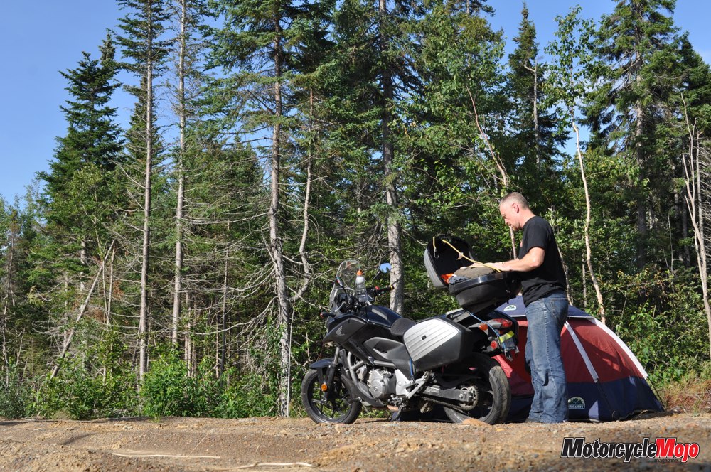
Finally, ever wary of night travel and the possibility of moose, I stopped to sleep near a turnoff on the Trans-Canada Highway in Terra Nova National Park. Consistently Great Up the next morning at sunrise, I continued as far as Corner Brook, where I discovered I was badly in need of a rear tire. The parts manager at Twin Peaks Motorsports phoned all over the island in search of the tire required by my Honda NC700X. At one point, no fewer than four employees were on the phone for me. And when it looked as though I was out of luck, and was going to miss my ferry at Channel-Port aux Basques, that’s when the sales manager took the tire off a new CB500 he had on the floor in order to get me on my way. Talk about service. Talk about gratitude. I made the ferry in plenty of time, just as the rain began again. So let me rephrase: Sometimes bad weather; consistently great people. Riding The Rock was the experience of a lifetime. And when it was time to leave, there was still so much to discover. After 500 years, New Founde Land continues to be an explorer’s dream.