
An appointment with family history beckons from across the Canadian Rockies
Crowsnest Pass was a well-worn trail long before it received its intriguing name. First Nations people used it for generations, crossing seasonally to hunt bison. Europeans tackled it in the 1870s looking for gold and found coal instead. Motorcyclists have discovered the real gold surfaces when riding through this mountain grandeur. The second-lowest and most southerly pass in the Canadian Rockies, Crowsnest offers an easily navigable route through the towering mountains in British Columbia to the foothills and high plains in Alberta. I rode from west to east – the direction most commonly used by explorers. It was fitting, as I, too, was exploring, but the journey was a more personal one: to learn about my heritage.
 A mix of anticipation, apprehension, and excitement edged my approach. I wasn’t sure what to expect, but it wasn’t concern about the technical aspects of the ride that intruded. Rather, it was that I was going back. Back east into Alberta, and back in time to a place where my refugee Mennonite grandparents tried to establish themselves in a new land. There’s nothing like a ride through nature’s masterpiece to bring things into perspective and connect you to what’s important.
Three weeks earlier, I’d left Ontario for what I expected to be 12 to 18 months of travelling the Americas by motorcycle. Although I was looking forward to the two-wheeled adventure, my primary goals were to study indigenous wisdom and learn about the role of culture in shaping who we are. For me, that meant visiting places where my grandparents homesteaded and my parents were born.
Roundabout Way
After rounding the north shore of Lake Superior, I dipped into South Dakota to visit Crazy Horse Memorial, staying longer than planned. A commitment to attend the Horizons Unlimited Travellers Meeting in Nakusp, British Columbia, meant that I’d have to go there directly, then backtrack into Alberta.
 Breaking camp after three quick days spent with travellers from around the world, I loaded up the bike, pondering what the next stretch of road would bring, both literally and figuratively. Although the northern route on the Trans-Canada Highway was shorter, I opted for a more relaxed two-day ride and headed south toward Highway 3, known as the Crowsnest Highway.
Following an old gold rush path, it would take me over the legendary Crowsnest Pass, albeit on a broad two-lane main road with well-maintained pavement. It promised less traffic, no major urban centres and a glimpse into a fabled history.
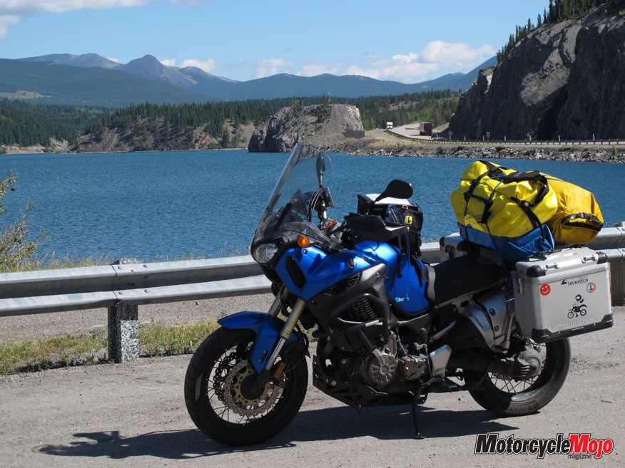
In British Columbia, riding through the mountains often involves getting shuttled across a lake via ferry. That’s how I found myself chugging across Kootenay Lake, sharing stories and laughs with fellow riders also returning to Alberta from Nakusp. They were taking an off-road route, but there’s only one way across the water, so riders of all persuasions gather on the ferries. A late start, a wrong turn and a few photo stops on roads that are rarely straight meant an all-day ride to cover 400 km. That left only 325 km to Okotoks, Alberta, near Calgary, where I’d spend a few days retracing my family history before heading west again to the coast.
I stopped for the night in Cranbrook, often considered a gateway to the Canadian Rockies. Boasting being the sunniest location in British Columbia, the community of almost 20,000 is nestled between the Purcell and Rocky Mountains, so the view in any direction is spectacular. I enjoyed it from my campsite in a delightful family-run RV park a couple of blocks away from the main drag.
Ascending Sun
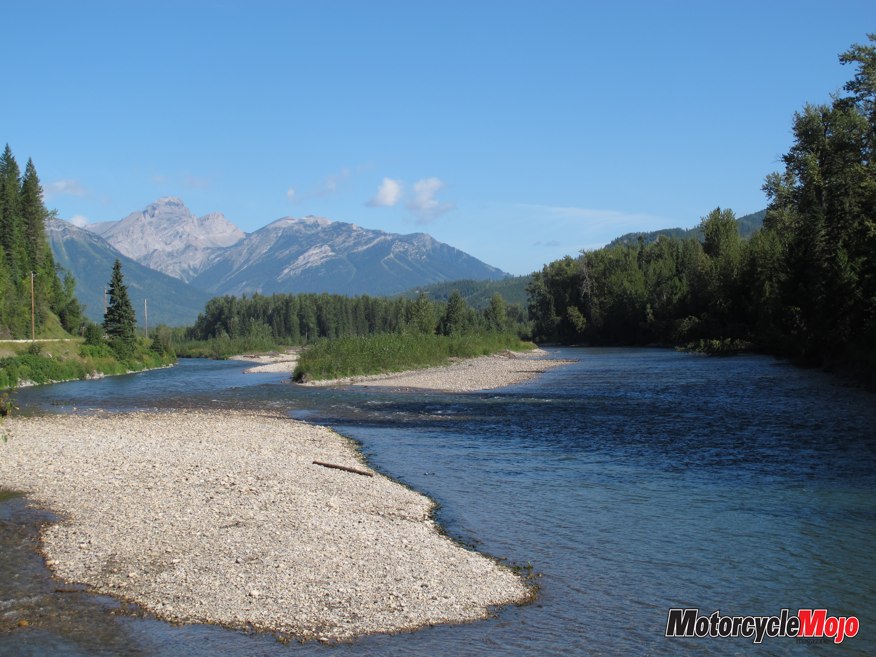
 I’d been told that for a literally awesome spiritual experience, approach Crowsnest Pass at sunrise, when muted morning light creates a soft beauty as the sun climbs over the mountains. Although I slept through the sunrise, I rode under sunshine and blue skies the entire day. It was natural to relax into the ride as the smooth surface followed the Elk River to the village of Sparwood, 125 km up the road and the last community before the pass. With fuel, restaurants and coffee shops, it’s an ideal place for a mid-morning stop. Here the road turns southeast, following Michel Creek on its final approach to the pass. No matter what time of day you’re riding, allow plenty of time to stop at one of the numerous pullouts and breathe in the beauty.
Surprisingly, the road is tame, even if the setting is not. Exercise caution through this remote wilderness. The road carves through prime wildlife habitat, and species such as bear, cougar, deer, elk, and bighorn sheep can emerge onto the road unexpectedly. Approximately 200 large animals are killed annually by vehicles on the Crowsnest. Although I saw none that day, I’m sure they saw me.
Temperature highs in July and August average 23 C, and the nights can be cool. Be prepared for temperature extremes and rapidly changing weather. Those year-round fluctuations and extremes wreak havoc on roads, compounded by the fact that mountains are always trying to reclaim their land. The roads were generally in excellent shape, but also be prepared for construction and changing conditions.
A Continent Divided
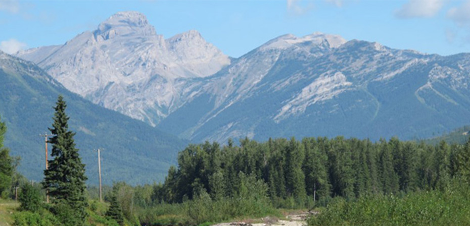
The dramatic peaks that flank your ascent are reminiscent of the powerful tectonic activity that forced ancient rock from beneath the earth’s surface. Evoking images of the Scottish Highlands, alpine meadows are sculpted by small ponds dotted amidst rocky outcrops. Gentle curves increase in intensity as you gain elevation, but there are none of the sharp bends, abrupt drop-offs or white-knuckle handlebar moments typical of other passes. Were it not for the sign marking the Continental Divide, you wouldn’t realize you’ve just crossed Crowsnest Pass, which doubles as the border between the provinces.
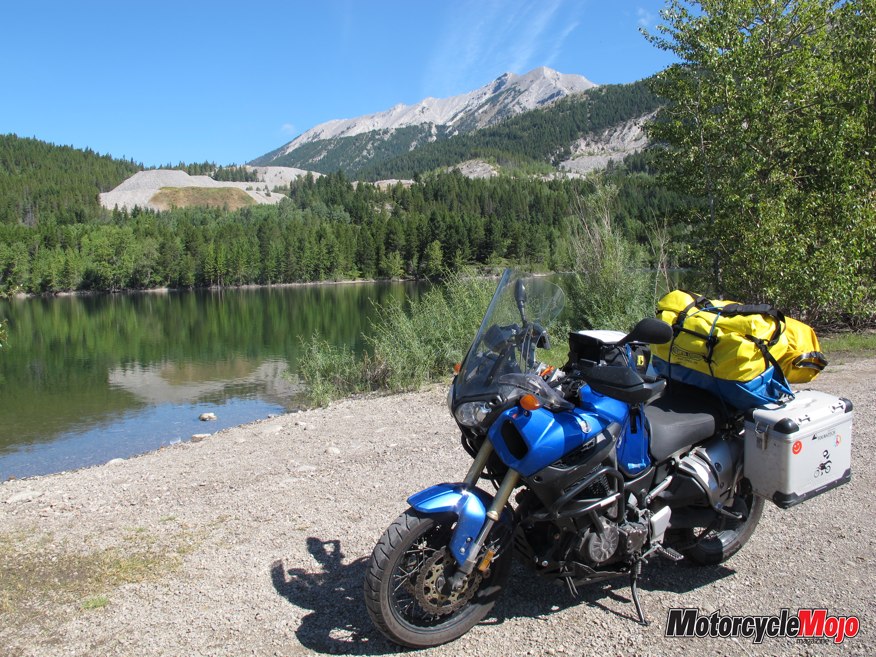
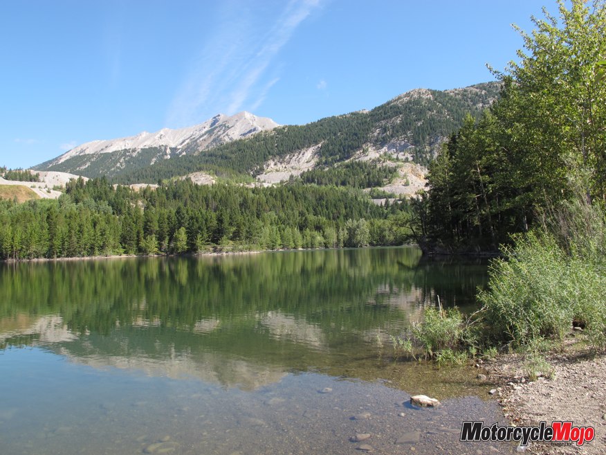
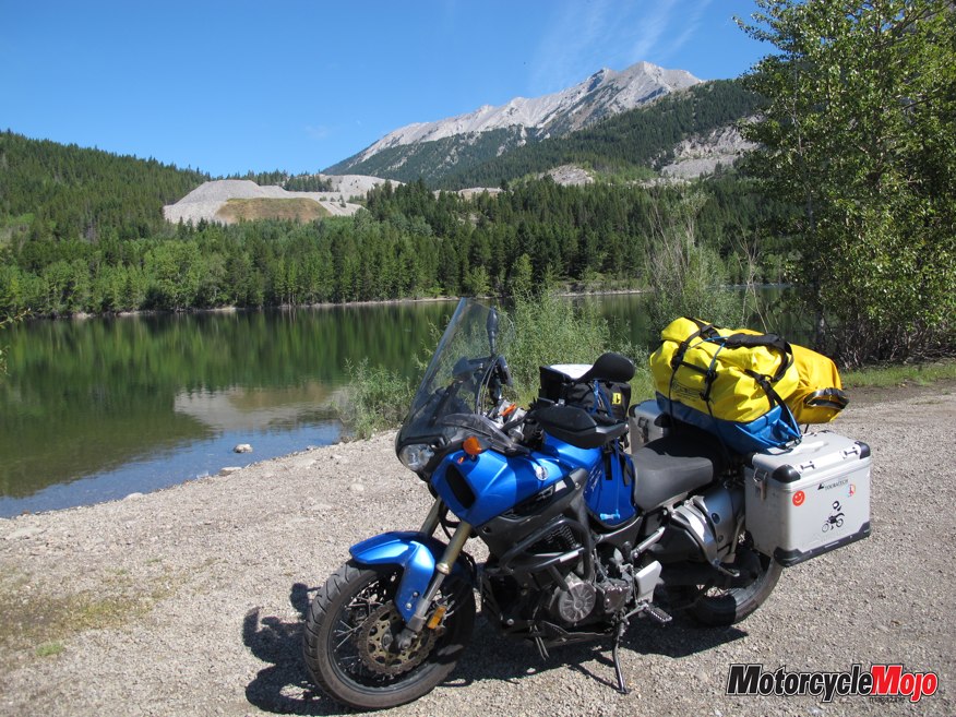
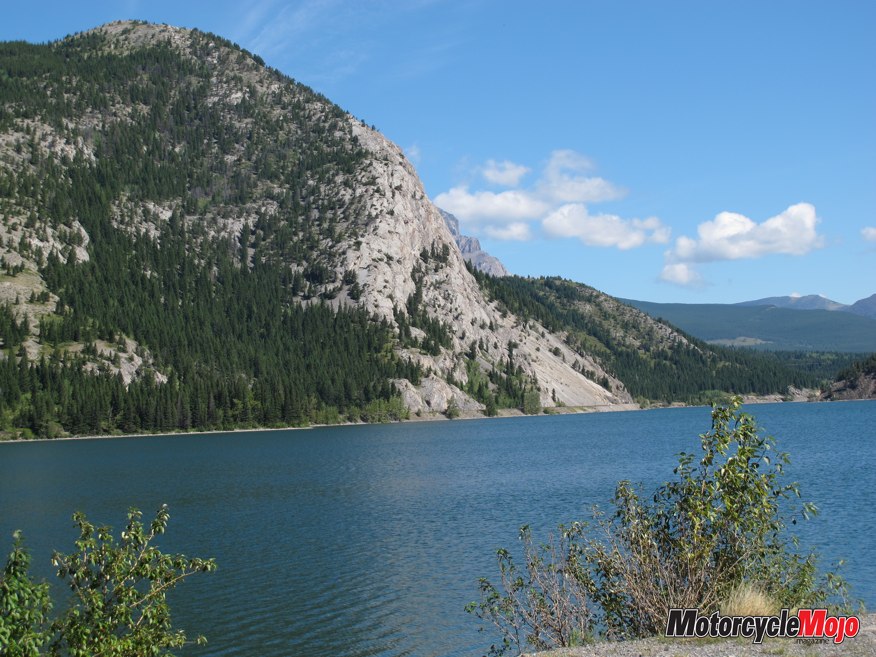
If you’re looking for points of interest, events or accommodations, a prominent Alberta Tourism Centre here is well stocked with information, maps and advisers schooled in local history. Crystal-clear blue waters against a mountain backdrop will captivate you as you ride across Island Lake before hugging the shoreline of the larger Crowsnest Lake. The land here has provided natural resources for humans since First Nations people arrived at least 10,000 years ago to extract chert with bone and stone tools to use in arrowheads, scrapers and knives. The dance hall heritage site on Crowsnest Lake, where you can still camp, was a regular summer camp, with celebrations a regular occurrence. Then in 1873, while prospectors were searching for gold, coal was discovered. With the confirmation that the pass was suitable for construction of a railroad, the landscape and history were irascibly changed.
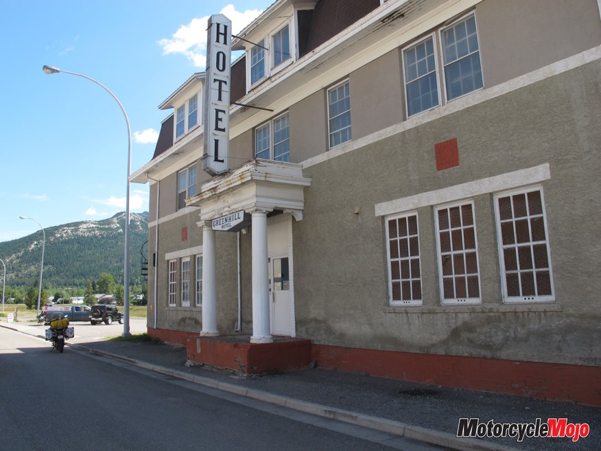
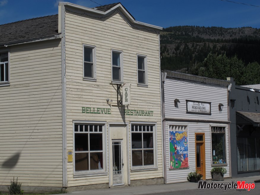
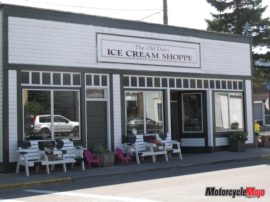
The Municipality of Crowsnest Pass (pop. 5565) is an amalgamation of five former frontier towns loosely strung together over approximately 15 km, each with its own colourful and often-tragic history. Beginning just east of Crowsnest Lake, Highway 3, now wider with additional lanes, takes you tangentially through each of them—Coleman, Blairmore, Frank, Hillcrest and Bellevue. Fuel, accommodations and restaurants are readily available along this stretch, but turn off the road onto the town’s main street to experience its heart. Seen It All From rum running and cattle rustling to shootouts and train robberies to massive strikes, devastating fires and public hangings, these towns saw it all. Small, white plaques on derelict and restored white-frame or brick buildings commemorate a bygone era. You’ll also find small, locally owned eateries where you can sit back and watch the comings and goings. By the time I arrived in Coleman, I was looking for a picnic area under a shade tree to park my motorcycle, have lunch and rest.
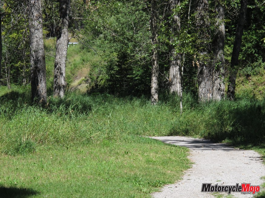
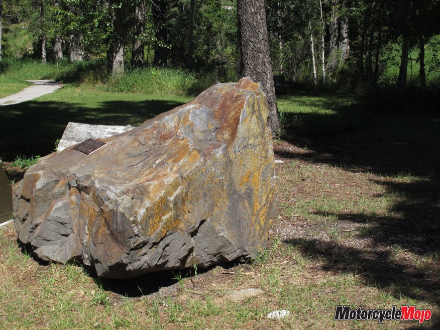
I found it at Flumerfelt Park, where a walk down the Miner’s Path took me back in time. Follow it as it meanders along the Nez Perce Creek and you can almost hear the footsteps of small knots of coal miners, lunch buckets in hand, trudging the unlit path to arrive in time for their shift labouring underground. It brought to mind my grandparents with their own dreams for a brighter future in this land. Although their homestead was farther away, crop failures during the dust bowls of the 1930s meant my grandfather turned to a coal mine to provide for his growing family.
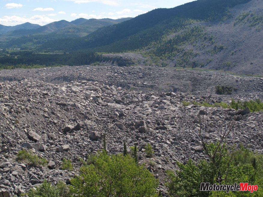
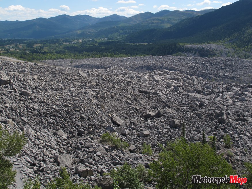
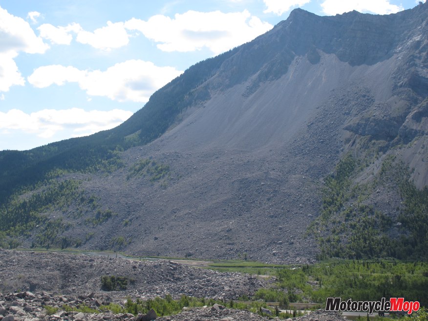
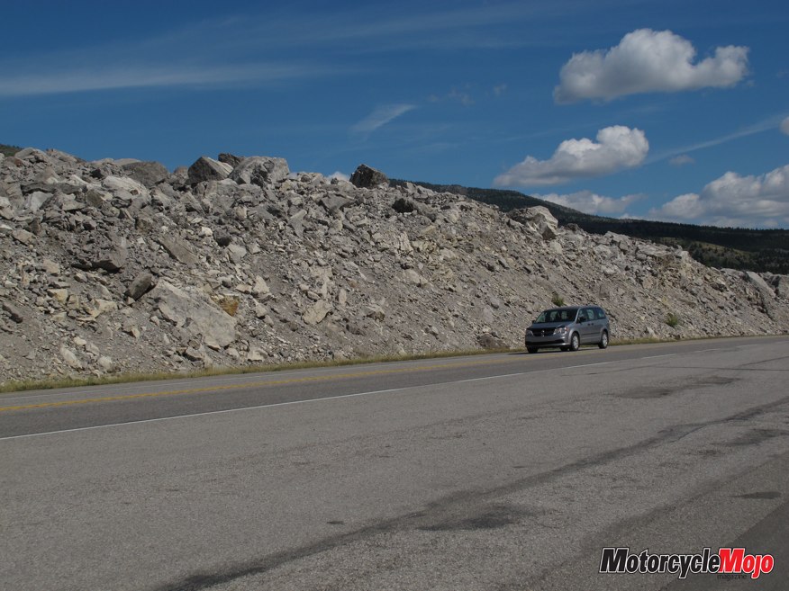
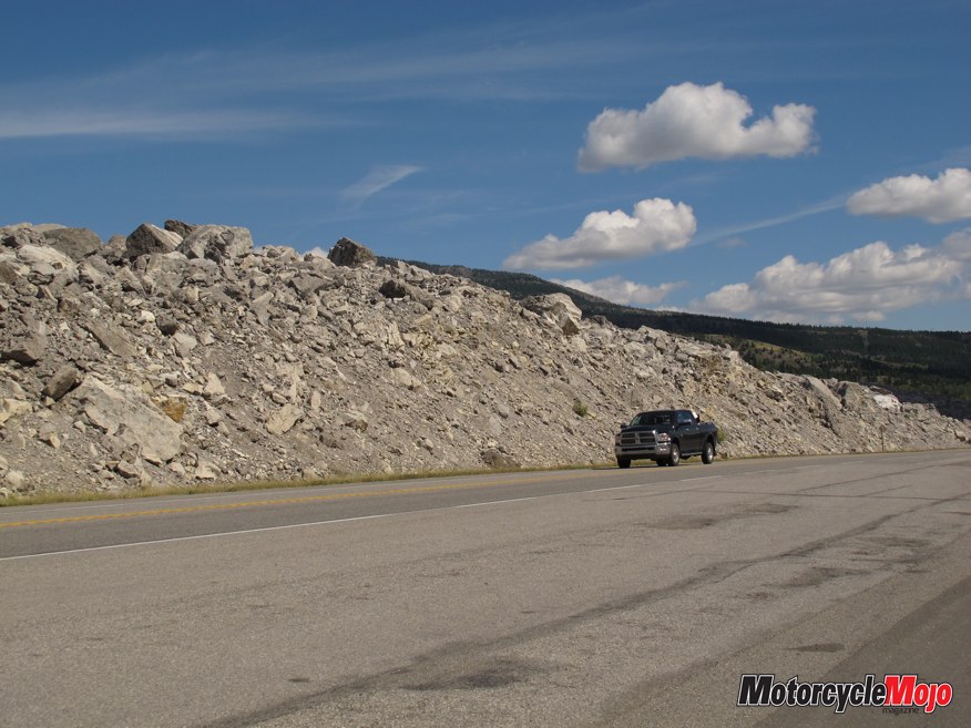
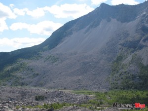
It’s the town of Frank, where the Frank Mine was opened on Turtle Mountain in 1901 that makes you take pause over the immensity and ferocity of Mother Nature’s power, unmistakable to this day. On April 29, 1903, at 4:10 a.m., 30 million cubic metres of limestone broke loose from the mountaintop and slid into the valley of sleeping residents. In less than 100 seconds, three square kilometres were buried up to a depth of 30 metres.
Depending on the account, miraculously, only between 70 and 90 people died. The road was reconstructed through the rubble, and today you ride through the massive debris field, piled high on either side with rocks, some purportedly as large as a bus. Well worth the stop, the Frank Slide Interpretive Centre looks out over the devastation. Through guided walks and dramatic vignettes with firsthand accounts of people who survived the tragedy, you can relive what it must have felt like on that day.