
A day ride around Lake Koocanusa provides time to hike into nature’s most beautiful wilderness
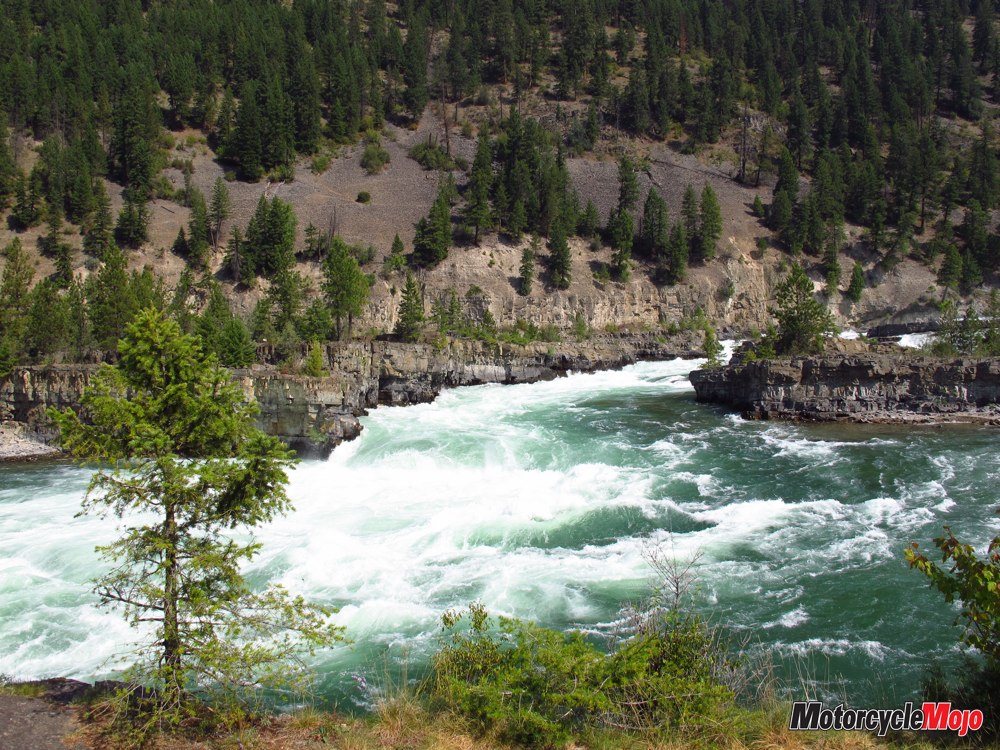
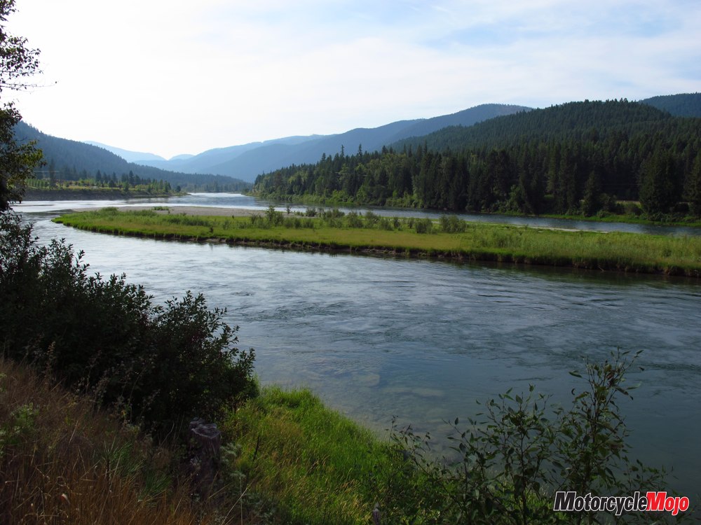
Sitting on a rock outcrop at the base of a small pine, I’m hypnotized by the turquoise Kootenay River, churning and tumbling over the falls beneath me, taking away all my cares and worries and replacing them with peace and tranquility. While travelling throughout the northwestern states, I’d been drawn to the region by its natural wilderness beauty accessed by fantastic roads. Butler Motorcycle Maps classified a number of roads in the area as the best motorcycle roads in Montana, and that piqued my interest. Kootenay River forms the soul of this area, supporting life here since the dawn of time.
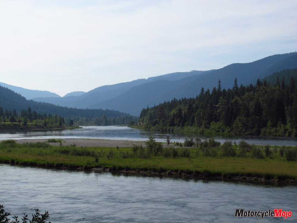
Originating in British Columbia’s Kootenay National Park, the river loops down into northwest Montana, northern Idaho and back into British Columbia’s Kootenay Lake, before ultimately feeding into the mighty Columbia River. Rivers don’t know borders. The Kootenay naturally ties together the history, culture and economy of two countries. Roads have now supplemented that function, roads that make for great riding.
The Hub

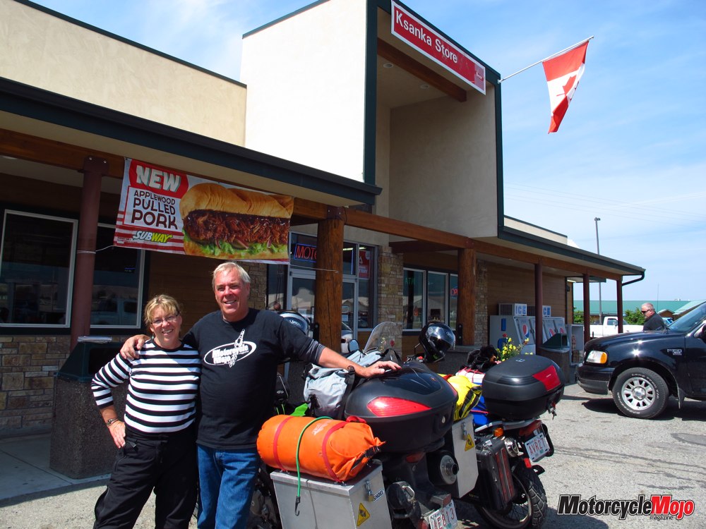
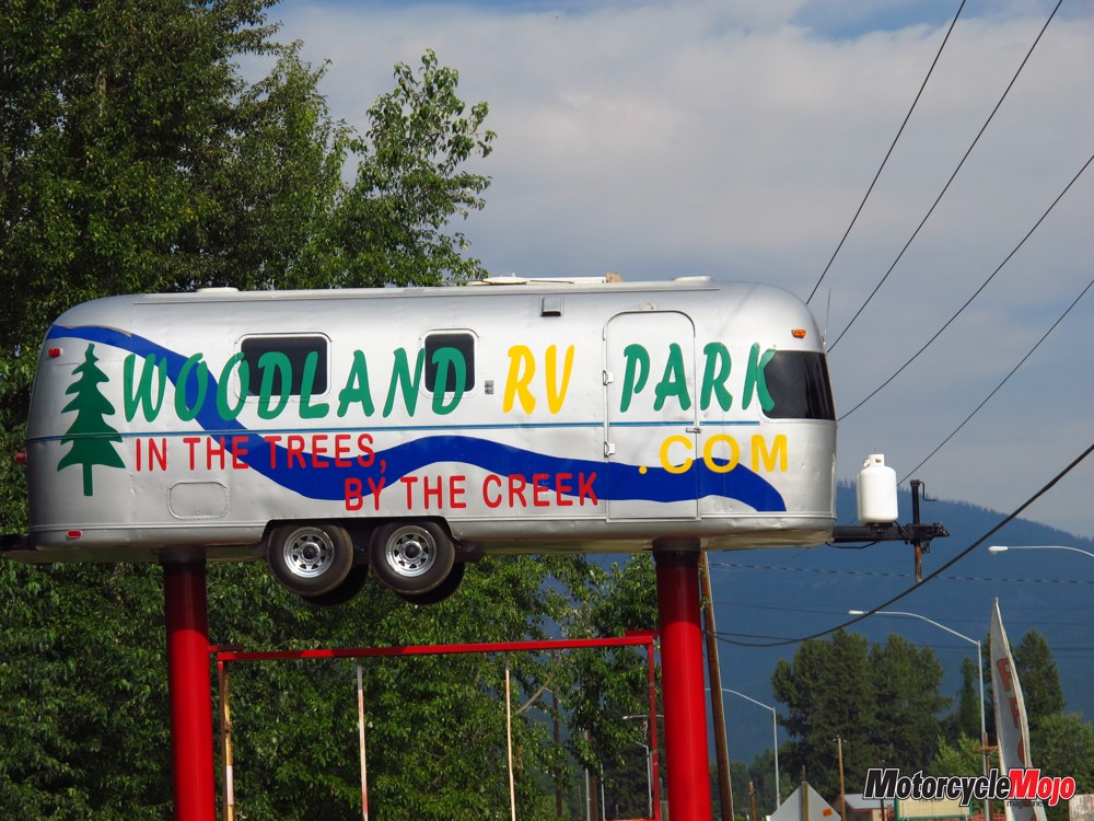
There are plenty of inexpensive places to stay, whether you’re camping or staying in motels. I was camping, and because I wanted a site with Wi-Fi, I chose Woodland RV Park in town, paying US$16 for two nights. That included water, electrical and Wi-Fi in a pretty treed park. Showers were an additional 50 cents. To find it, look for the Airstream trailer on top of a signpost! Outside of town, the Kootenay National Forest has many developed recreational campgrounds as well as unlimited places to camp in undeveloped areas.
Emerging from the fur trade, lumber industry and mining, the town now thrives year-round on events. The Chamber of Commerce listed 21 events when I was there in August, including a popular Blues Festival and Ignite the Nites – a car show established in 1961 that fills the town with aficionados from hundreds of kilometres around. But, I was there to ride.
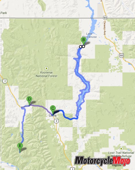
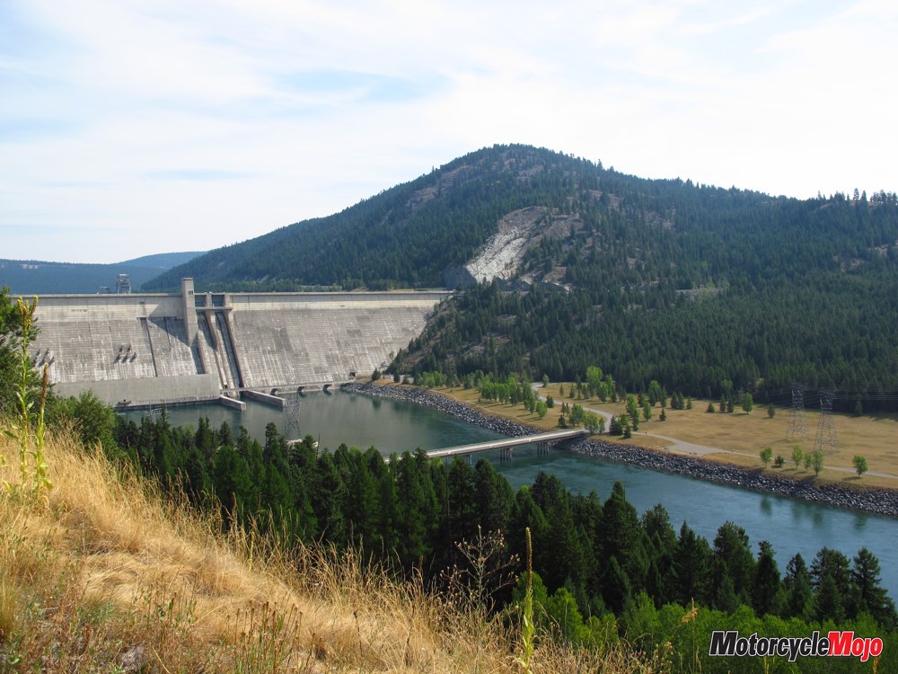
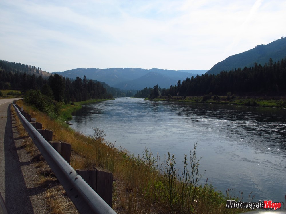
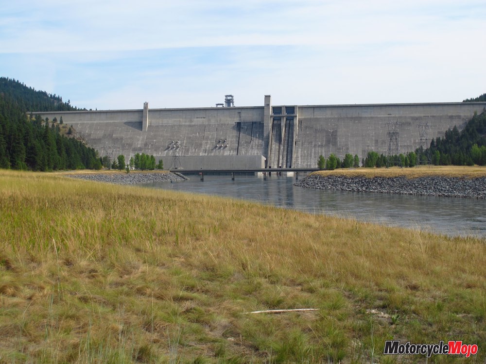
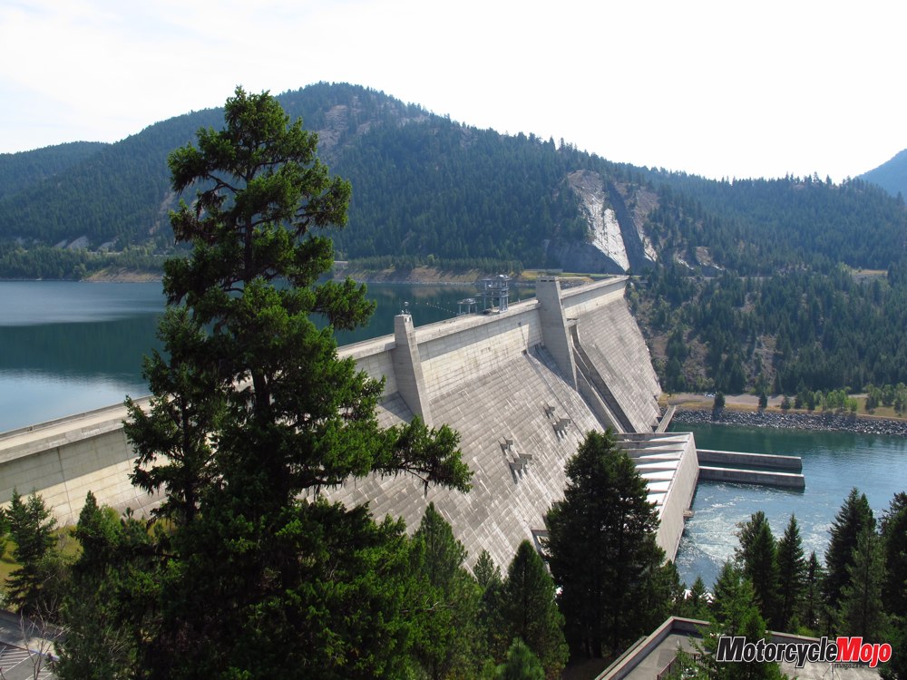
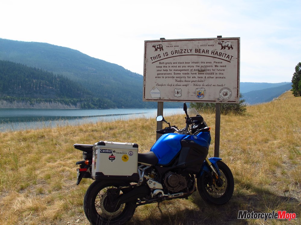
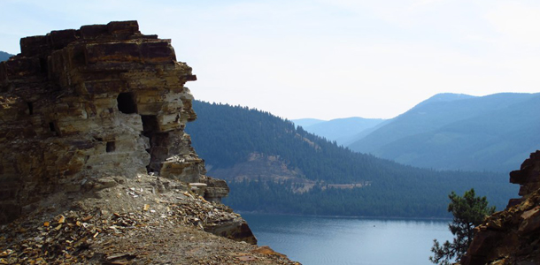
When it was time to leave Woodland RV, I headed 27 km north on Hwy 37, upstream along the Kootenay, feeling humbled by its beauty, breadth and strong, fast current. Reaching Route 228, I turned north toward the 129-metre-tall, 931-metre-long Libby Dam. Completed in 1972 as a joint U.S.–Canada project for flood protection and hydroelectric power, it holds back a 144 km-long reservoir of water creating Lake Koocanusa, 77 km of which are in Montana, with the other 67 in British Columbia. Butler Maps gave the road around the lake its highest designation, so it was a must-see.
Juxtaposed

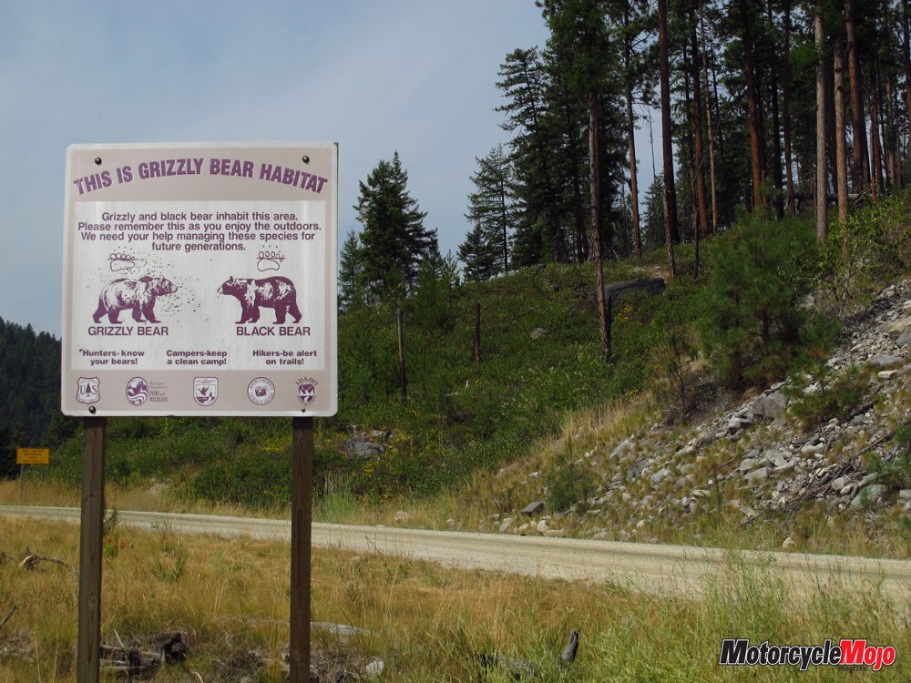
There’s no doubt that the Libby Dam is impressive. The visitor’s centre on Route 228 offers tours, and the view from the top is breathtaking. The scenic dam marks the gateway to an adventuresome ride, and as adventure tends to go, a word of caution is in order before continuing around the lake: This is remote wilderness, and along with the tremendous experience comes additional risk. Count on not having cellular service. Depending on your route, there’s little traffic, so if you or your motorcycle is disabled, it may be a while before help arrives. Bring plenty of water and fuel. There are no services along the west side and only a few on the east. That said, the riding is superb.
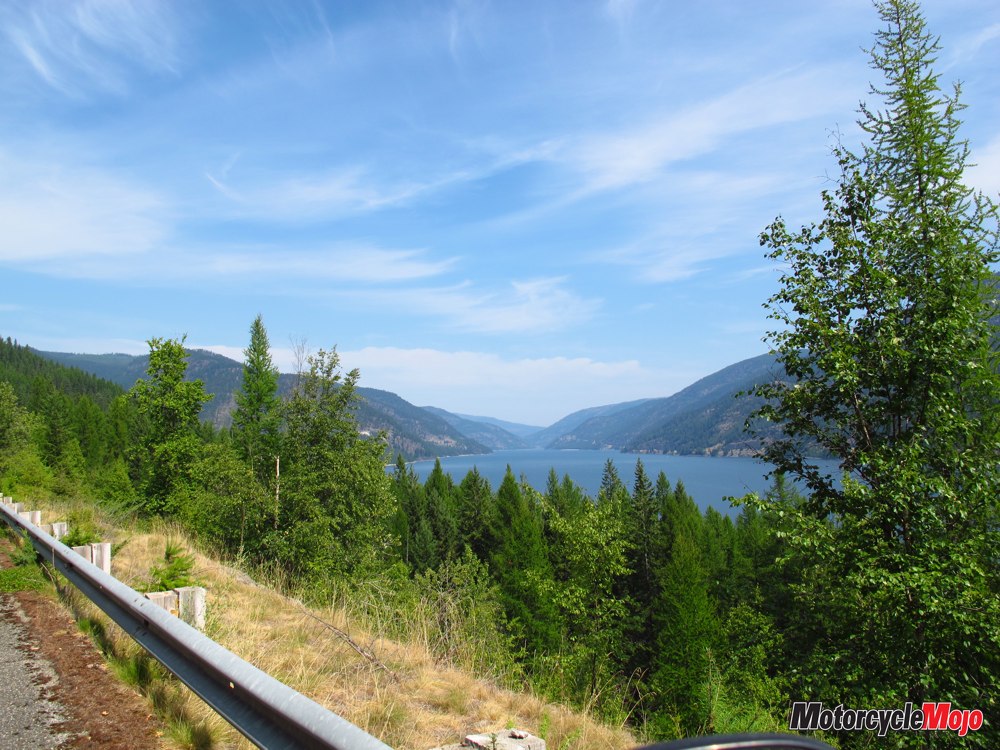
Heading north, the narrow ribbon of asphalt that cuts through the forest and clings to the side of the mountain creates a road that continuously twists, turns and changes elevation through remote backcountry. All the while, there’s a spectacular view of the lake. The road is a little rough in places but not enough to be of concern. The speed limit is 45 mph – and you don’t want to go any faster.
Bear Habitat

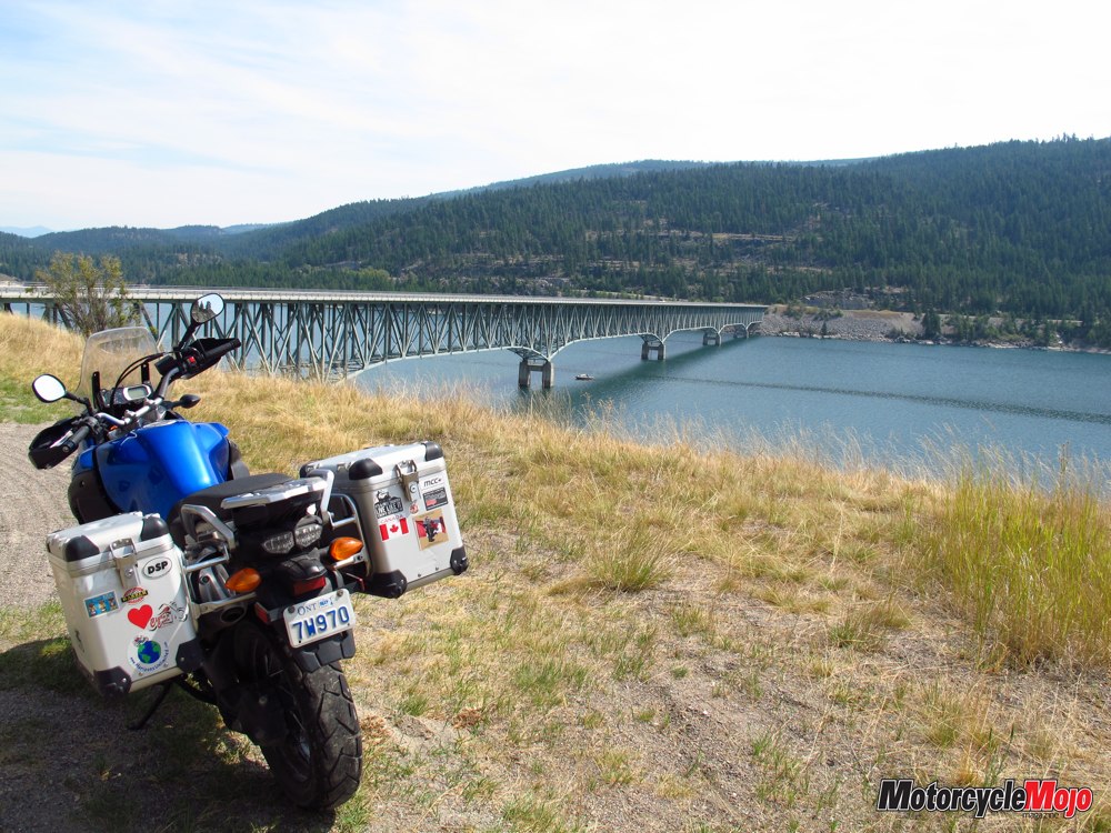
The bridge brings you back to Hwy 37.

After lunch, they headed north and I returned west, this time following Hwy 37 along Lake Koocanusa’s eastern shore. It’s designated as a Scenic Byway and the scenery is indeed lovely. However, it’s much wider, more heavily travelled and lacking the thrills of the western route. There are more opportunities to stop for sightseeing, fishing and camping. Koocanusa Marina, about 10 km north of the dam, has a restaurant, large RV campground and gas. The speed limit is 70 mph, so the trip back was a lot quicker. Temperatures had been in the mid-30s for most of the day and I was looking forward to getting back to my campsite under the trees and removing my gear. Local Fare There are no big-box stores and I didn’t see any restaurant chains, just local enterprises. Even though it’s refreshing, it can still be tough to find healthy vegetarian fare. Rosauers, the town’s main grocery store, was nirvana. Prepared for the hikers and backpackers, it was well stocked with a wide selection of fresh produce and nutritious snacks – and meat. If your bike happens to be in need of any service, another of the local establishments, Ronan Power Products, is an authorized dealer for just about everything except Harley-Davidson.
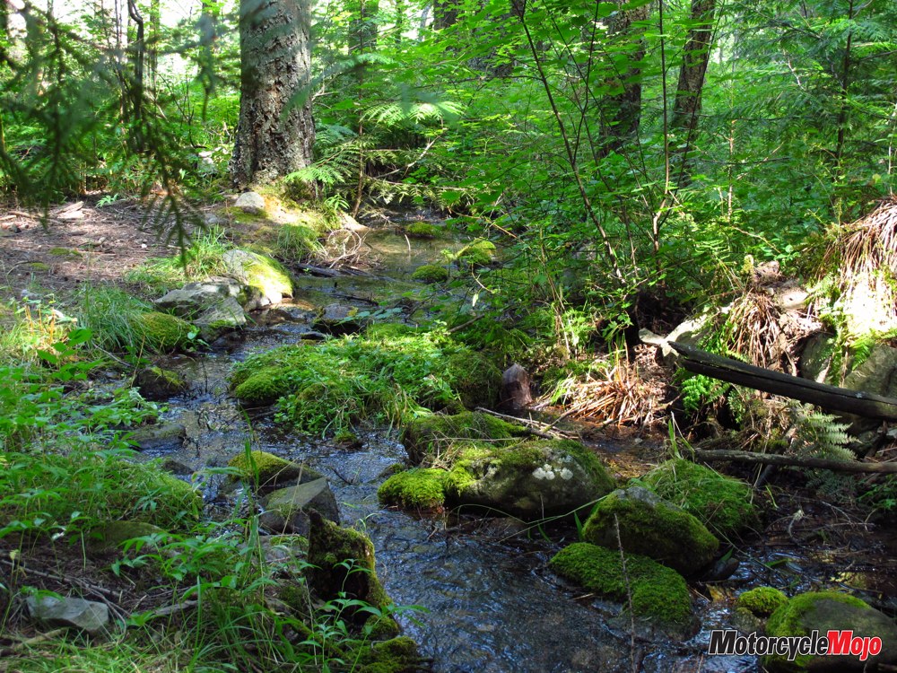
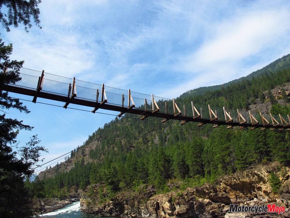
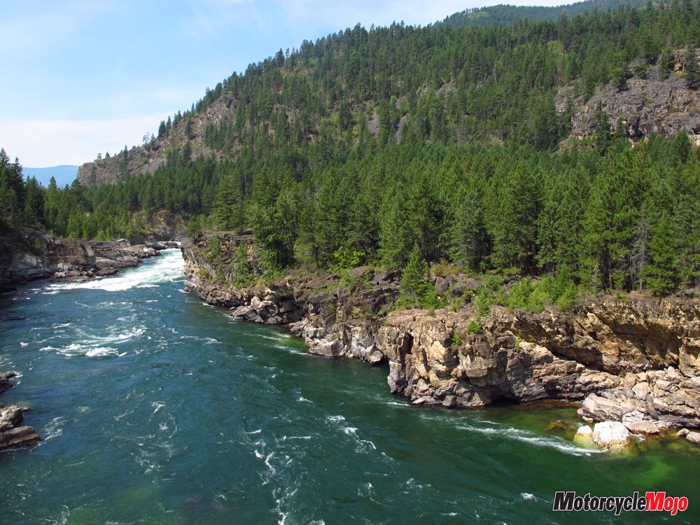
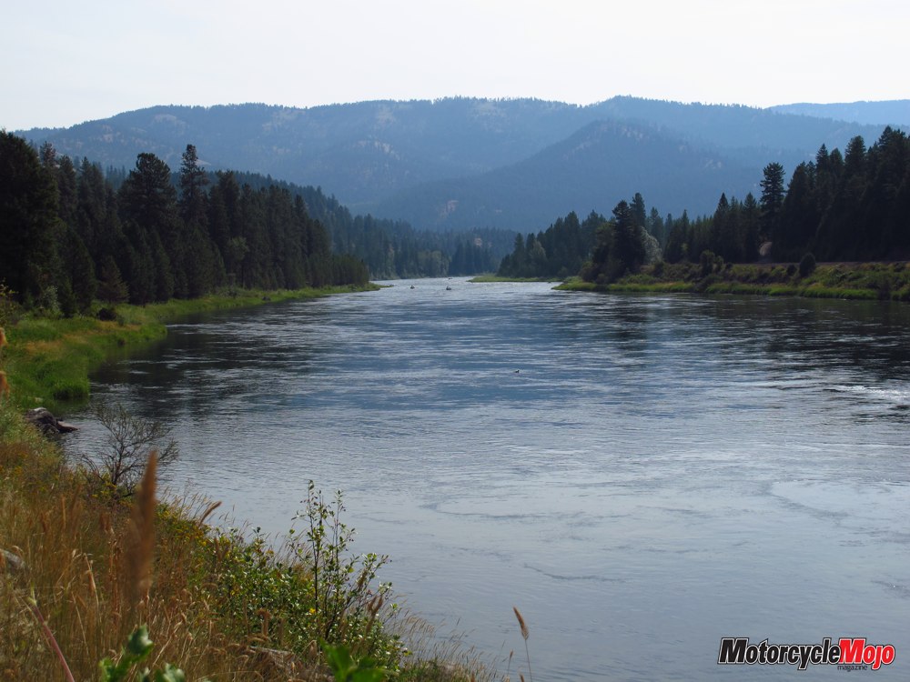
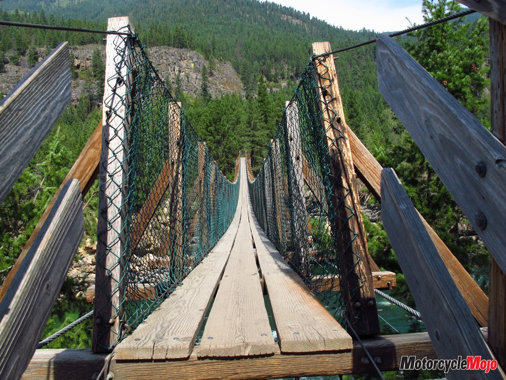
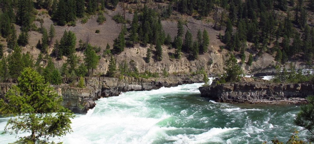
The next day’s ride took me to the natural wonders of Kootenay Falls and Ross Creek Cedar Scenic Area. Twenty kilometres west of Libby along Hwy 2, the calm river enters a canyon, suddenly gathers momentum, surges through China Rapids and spills over Kootenay Falls, dropping 28 metres in less than a couple of kilometres. The falls and surrounding area are considered sacred to the Kootenay Indians, whose ancestors inhabited the area long before European settlers “discovered” it. A clearly marked trail winds through the trees, past a picnic area, over a bridge and on down to the river. Glimpses of the river along the way are visible, but it doesn’t prepare you for the experience that awaits you. The power and energy created by the turbulent water amidst spectacular wilderness leave no question that this is a sacred space. Be prepared to spend quiet time here. Unheard Tales When you’re ready to leave, take the fork to the swing bridge, more aptly a swinging bridge, especially when a few people get on it (there’s a five-person limit). The view from it is fantastic, and there are more hiking trails on the other side. The power of the river is awesome, and you wonder where it’s been and what stories the water and rocks could tell if they could talk.
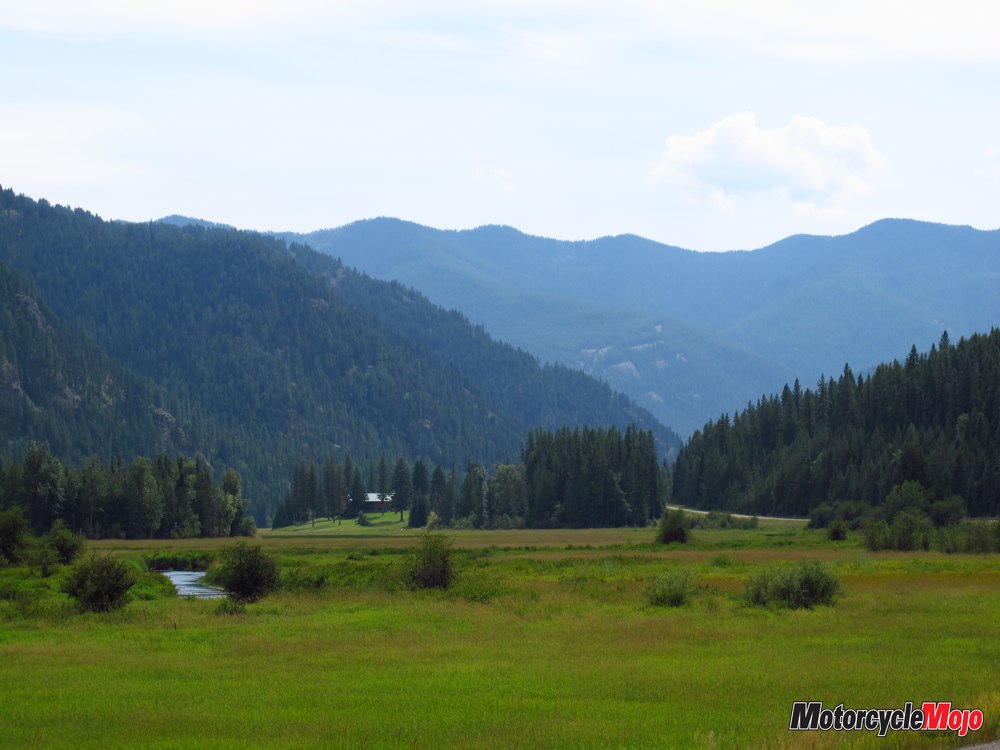
Torn between staying and leaving, I knew that more fabulous riding lay ahead. Reluctantly, I trekked back on the rocky path through the woods to the bike and geared up. At Route 56, I bid adieu to the river and headed south. This road was not marked as scenic on any map I had seen, though it was one of the most enjoyable rides in Montana, especially as it curved around Bull Lake. Then you get to the turnoff for Ross Creek Cedar Grove. Be prepared yet again to have your breath taken away before you even reach the grove. Tall cedars and spruce line the narrow, paved access road, which winds 7 km in, ending at a paved parking lot. The air is different, somehow cleaner, crisper, silent. Walking the one-and-a-half-kilometre loop through the western red cedars, some of which are more than 500 years old and 3.6 metres in diameter, was even more spiritual to me than Kootenay Falls. It calls to mind prehistoric times, or perhaps the Garden of Eden. The interpretive trail, which explains the area’s ecology and history, has plenty of strategically placed benches where you can sit and soak up the atmosphere. It’s easy to lose track of time and place, so do watch where you’re going. The loop is not well marked. People and animals have made side trails and you may find yourself on one of them, as I did, unsure of how to get back. Left Behind I lingered for as long as I dared, knowing I had 250 km of travel ahead of me yet that day. I’d been in Montana for more than a week and wasn’t ready to leave. But as with the Kootenay River I’d left behind earlier in the day, it was time to leave Montana. How better a send-off, though, than two supreme stops and roads that invite a return?