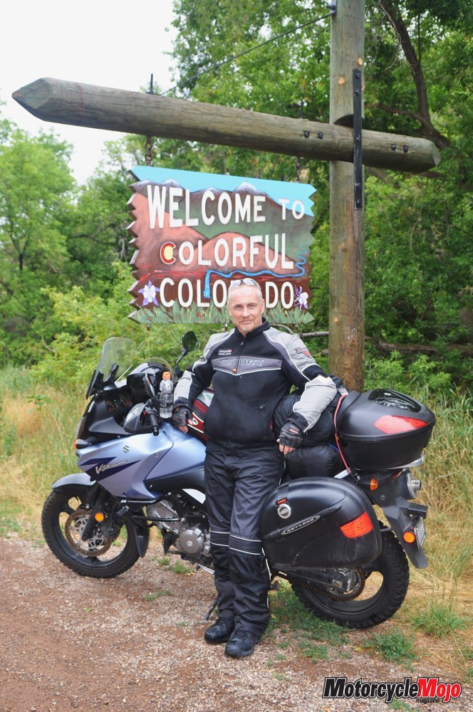

Colorado’s million-dollar highways are worth the price of admission, but the short cuts will have to wait for another time
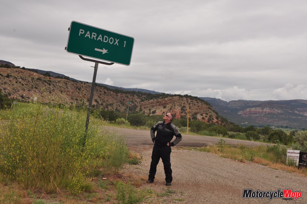
Should I stay or should I go? For the second time in a week, The Clash performed their classic song in my head. The first time was at the turnoff to Paradox in western Colorado. (It just seemed appropriate to hum at that junction.) The second, and more significant, was here as I tried to stare down the Alpine Loop just west of Lake City. The Alpine Loop is a challenging backcountry adventure route that leads through high alpine meadows and forests, up above timberline into the tundra and over two high-elevation passes.


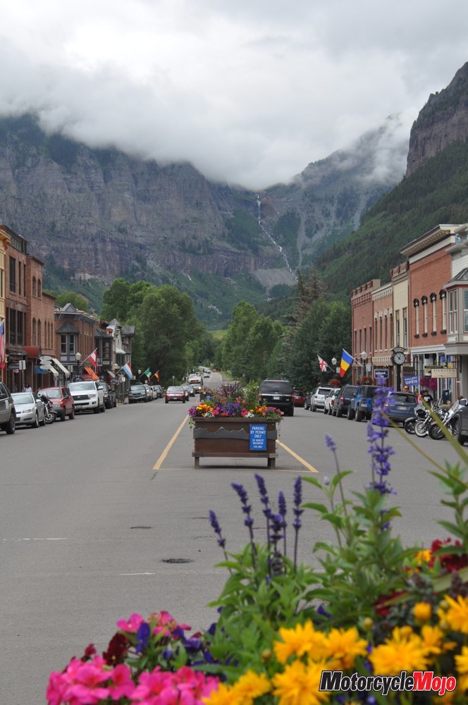
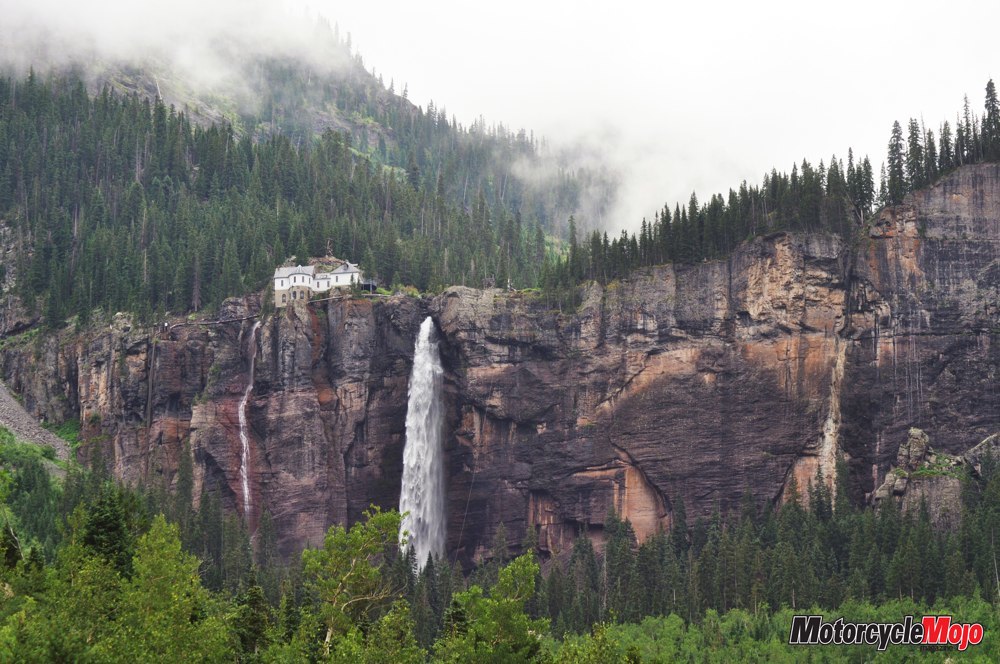
25 percent of Telluride’s electricity.
After lunch in a simple café beneath soaring ski runs, I pointed my wheels south. Clouds shrouded the peaks as I began to follow the San Juan Skyway. Almost immediately I climbed to over 3,050 metres at Lizard Head Pass and I had to don rain gear given the thick cloud cover. I was pleased with the aftermarket heated grips, which did their job quite well, the warmth travelling up my arms, even calming the bodily shiver I had begun to feel.
It’s a Physics Thing

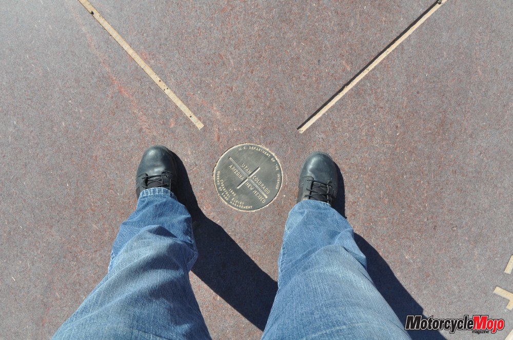
Because Arizona does not observe daylight saving time, I realized that, as I finally stepped onto the surveyor’s medallion set in concrete, I had discovered a way to be in four places and two time zones at once – with only a rudimentary understanding of space–time theory. Take that, Albert Einstein!
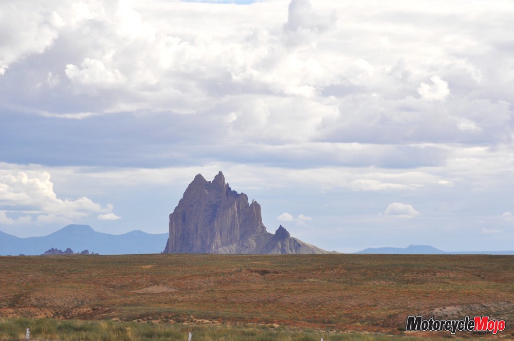
Retracing the gently winding route to Cortez, I noticed an unusual formation in the distance to my right. It stood out as much for its shape as for the way it contrasted with the flat desert stretching away to the horizon. I realized I must be seeing Shiprock in New Mexico, so named for its resemblance to a tall ship in full sail. I kept it in my sights as I followed bumpy back roads south for a closer look. Finally returning to Cortez, I set up camp for the night in Mesa Verde National Park. I unrolled my bivy and laid it out on top of my new Thermarest LuxuryLite mesh cot. “Luxury” maybe, but one I might never again go without. From a light 40 x 15 cm roll, the cot is a very quick setup and provides off-the-ground comfort in a tight sling that eliminates those inevitable hard spots where your hips and shoulders meet the dirt. (It even makes it possible to sleep comfortably in a Walmart parking lot, if necessary; don’t ask me how I know.)
Mysterious Departure
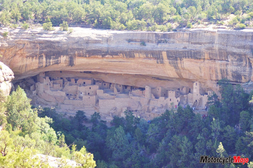
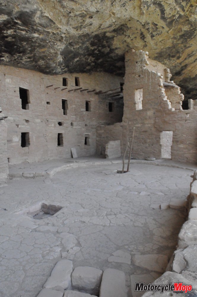
I arrived bright and early at the main lodge for the “700 Years Tour,” keen with important questions like, if we walked fast enough, could we do it in 650? If our ranger-guide wanted to roll his eyes at a joke he had heard a hundred times, he never let on. Instead, he led us on a journey so fascinating that I was sorry when it was over. Mesa Verde National Park was created in 1906 to preserve more than 600 cliff dwellings of the Ancestral Puebloan people (often called the Anasazi). After visiting several ruins and archaeological digs on level ground, we descended to Cliff Palace, the largest of the dwellings that cling to the precipitous walls of Mesa Verde. It was absorbing to see how ingenious and resourceful these people were. On uneven and precarious foundations, they constructed buildings that were square and true; from the rabbitbrush they crafted both waterproof baskets and ink for pottery design; and from the strings of yucca leaves they made needle and thread to sew animal skins for clothing. For more than 700 years they lived and flourished here under the “green mesa.” However, in the late 1200s, they abruptly dropped everything and moved away, leaving behind buildings, pots, tools and a mystery that historians and archaeologists have yet to unravel.
An Expensive Road
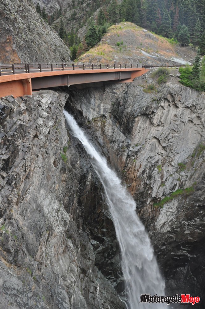
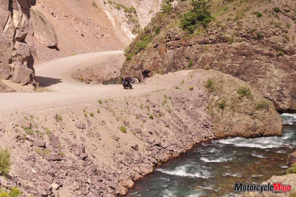
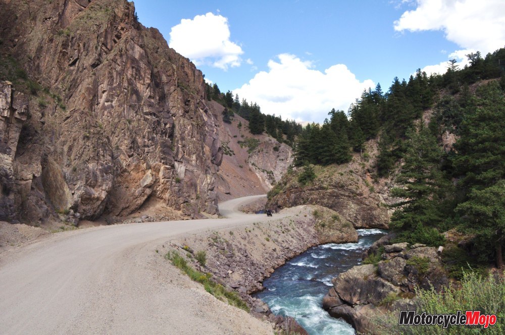
In the afternoon sun, I set out on Highway 550, a continuation of the San Juan Skyway Loop, and perhaps its most glorious stretch of road. It was so stunning, I gasped out loud once or twice, and every turn revealed rich reds and greens both in the steep mountains above and the dizzying valleys below. From Durango to Silverton, the Skyway loosely parallels the Durango-Silverton Narrow Gauge Railroad, which wows tourists as it hugs the sheer canyon wall. The 40 km from Silverton to Ouray is often called the Million Dollar Highway. Explanations vary among locals as to the name’s origin. Some say it is because of the cost of building the road through such forbidding heights.
Others claim it is because of the now defunct gold mine near Red Mountain Pass. Still others say that when gold ore was being hauled out in wagons, the gold dust would fall through the floorboards and the road would glint with gold dust in the sun. Which is true? Maybe all. Or none. Whatever the case, the quality of the road and the unparalleled scenery alone are worth top dollar. Departing Silverton, and again nearing Ouray, I crept along switchbacks that often exceeded 180 degrees, rain falling in sheets. Without guardrails, the white line was quite literally the edge of the road. An errant twitch to the right and there would be nothing but mountain-thin air under my wheels. Suffice it to say, I was “alert.” And despite new waterproof riding pants, my crotch and feet began to feel uncomfortably wet. I considered writing the manufacturer to suggest that perhaps an adjective should be removed from the packaging. The next morning, I awoke to a partly sunny sky in Black Canyon of the Gunnison National Park.
I laid out my wet jeans, riding pants, socks and boots, and in 30 minutes all but the boots were dry. So I kept my shoes on and strapped the boots, tongues wide open, to the outside of my trunk. They too were dry in an hour.
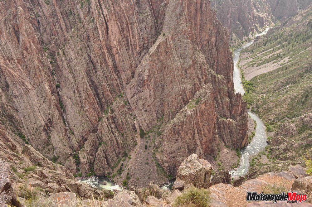
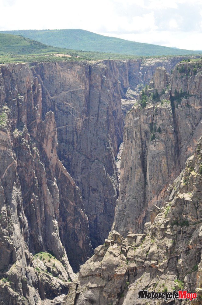
Into the Depths
After watching the seven-minute historical video in the visitor centre, I stopped at several places to peer over the edge of the canyon into the depths below. It seems the canyon is black not just in colour, but also in its mystery and foreboding. These are some of the steepest cliffs and craggiest spires in North America. In just 75 km, the Gunnison River loses more elevation than the Mississippi River does in its entire 2,400 km from Minnesota to the Gulf of Mexico. So the river’s turbulent roar can be both deadly and deafening. Never have human beings settled below the canyon’s rim, and few who’ve attempted to run the river have survived. While experienced rock climbers do accept the canyon’s challenge, an ominous signboard at the rim is quite frank: “The National Park Service has recorded a number of successful rescues of even the most prepared adventurers, but warns that a number of individuals have been impossible to rescue or recover.” I decided to stick to the safety of my motorcycle.
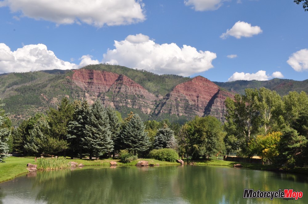
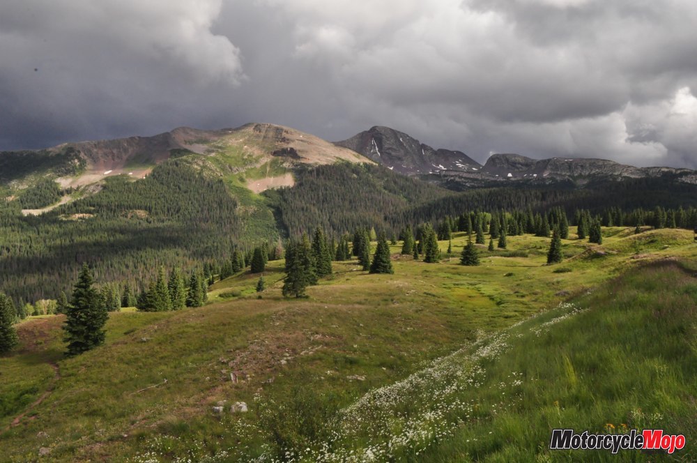
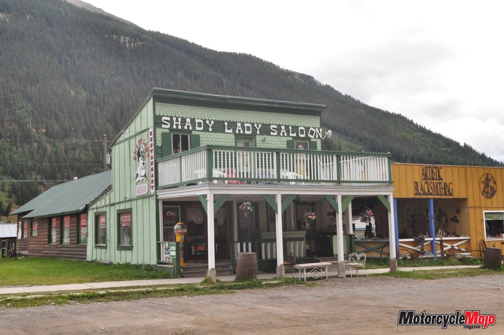
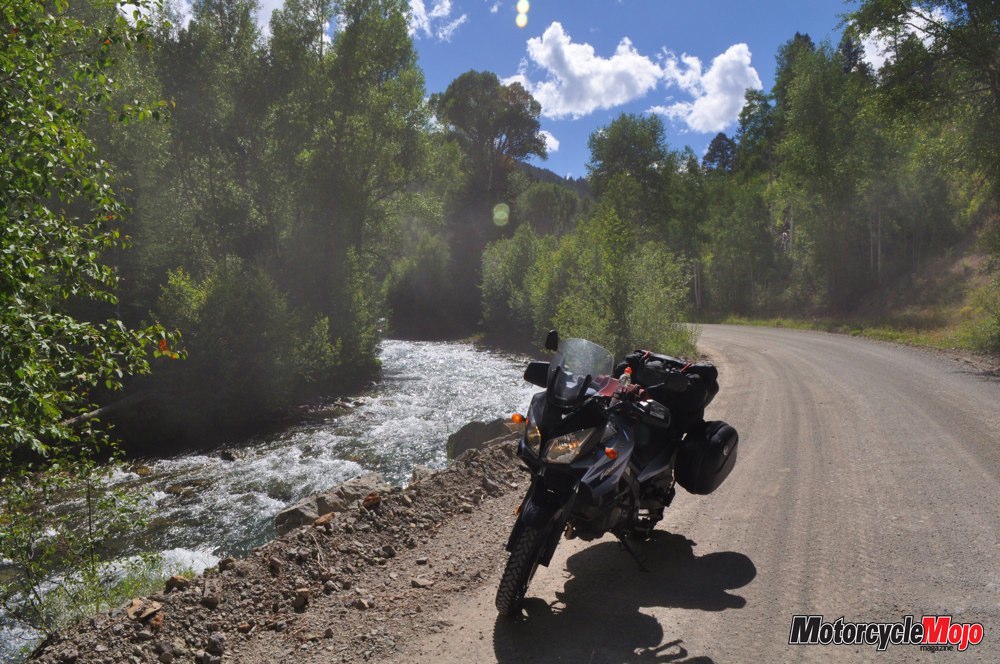
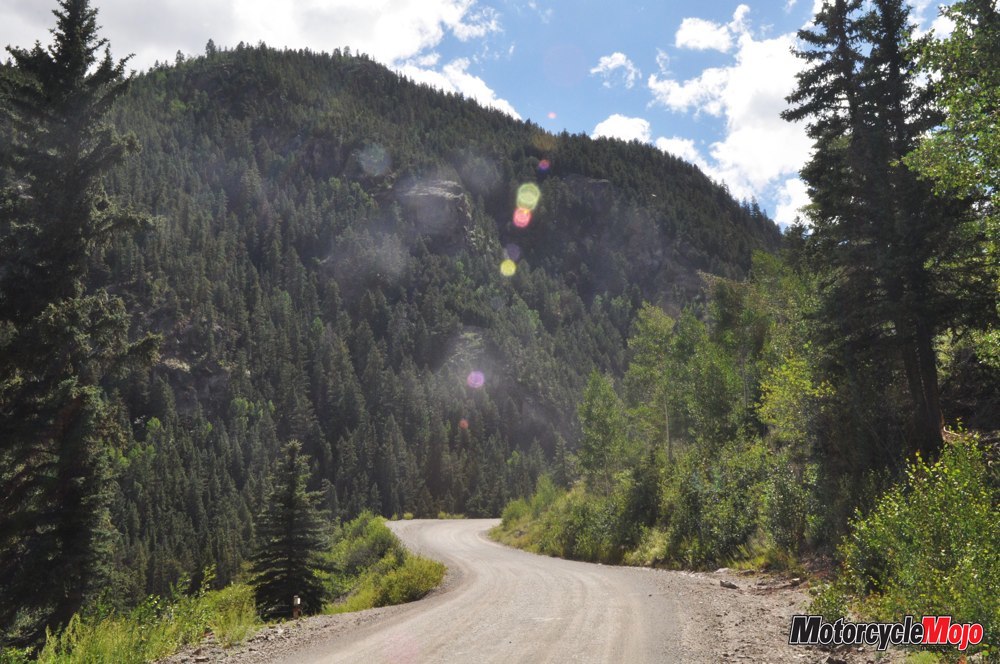
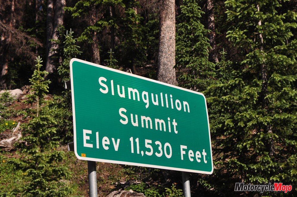
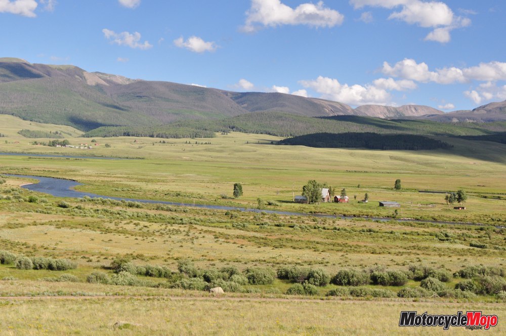
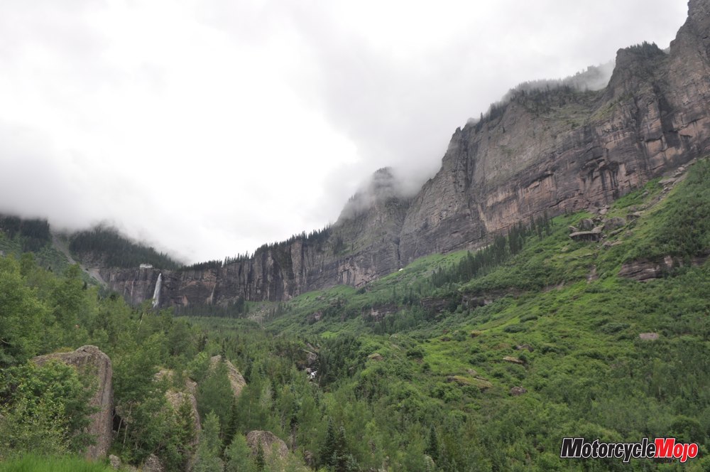
Heading south, I found Route 149 is a paved two-lane with lots of tar snakes that, had the day been hotter, may have been a slippery challenge. I revelled in the open valleys sweeping up to the foothills and dotted with ranch houses many kilometres apart. Soon, I was passing through the fragrant evergreens of Uncompahgre National Forest. Rolling into Lake City was a surprise, as I had pictured it more dry and desolate. In fact, it was verdant and treed, quite beautiful, with a population that is particularly devoted to the outdoors. Rafts, Jeeps, ATVs and UTVs were everywhere, many available to rent at several outfitters. Riding south out of town would bring me over Slumgullion Pass (I just like saying the name) at 3,463 metres to more high-country ranches. The rapidly changing elevations would join forces with the unsettled weather so that one minute I wanted to put on every bit of clothing I had, and the next I wanted to lose them all. Ride, pause, repeat, until my thoughts began to turn with respect to any mid-life female friends who may be facing The Change.
Should I Stay or Should I Go?
But before I left town, a road sign caught my eye: Alpine Loop – Engineer Pass – Right. With a will of its own, the V-Strom veered and I found myself in the staging area, “just to have a look.” I confess that I, too, was curious about what was just over the knoll. And I began to follow the twisting gravel road. Then I wondered what was around that corner. Then over that hill. I ventured perhaps 10 km before the rising music of The Clash was interrupted by an ad for a Canadian gaming organization: “Know your limit. Play within it.”
Though I indeed had a worthy bike, the truth was I still didn’t have much off-road experience, and a remote mountain pass at 3,900 metres is no place to injure yourself, especially without a companion. It wasn’t worth the gamble. Resignedly, I turned back. But not without making a firm resolve: It was time to expand my repertoire of riding skills. When I got home, I would immediately enroll in an off-road riding course, and the Alpine Loop was added to my “Bike It” list for another day. With a look of defiance, and in my best Schwarzenegger voice, I shouted over my shoulder, “I’ll be back.”
Mesa Verde National Park: Finding protection in 610-metre-high cliffs, the Ancestral Puebloan people shaped sandstone into blocks and mortared them with dirt and water into sturdy walls up to four storeys high. Living rooms averaged two by three metres, and were plastered on the inside and decorated with painted designs. Crops, which were grown on top of the mesa, were carried via footholds gouged in the sheer rock to storage in the cool stone rooms below. A corn-only diet led to mental illness among the people and unstable leaders who became bloody tyrants.
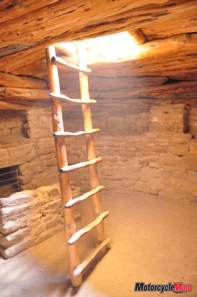
Fortunately, the Anasazi (as they were also known) added meat, and later beans, to their diet. Believing humankind came to this world from below, the people built round underground rooms called kivas for religious, social and utilitarian purposes (such as warmth in the bitterly cold winters). Entrance to the kiva was by ladder through a hole in the roof that also acted as a chimney for the billowing smoke of a fire (effectively keeping insects out). A vent in the rear wall fed fresh oxygen to the fire and a short wall in front of the vent kept the downdraft from scattering ash and spark while circulating warmth around the room.