
An exploration of ancestral trails and nature’s bounty
Heading north from Grande Prairie, Alta., into the Peace River region, 460 km northwest of Edmonton, the road stretches straight out in front of you. You might doubt there is much to make this an interesting ride, but nothing could be further from the truth. Its rugged peacefulness belies the stories and bounty the landscape has produced for eons.

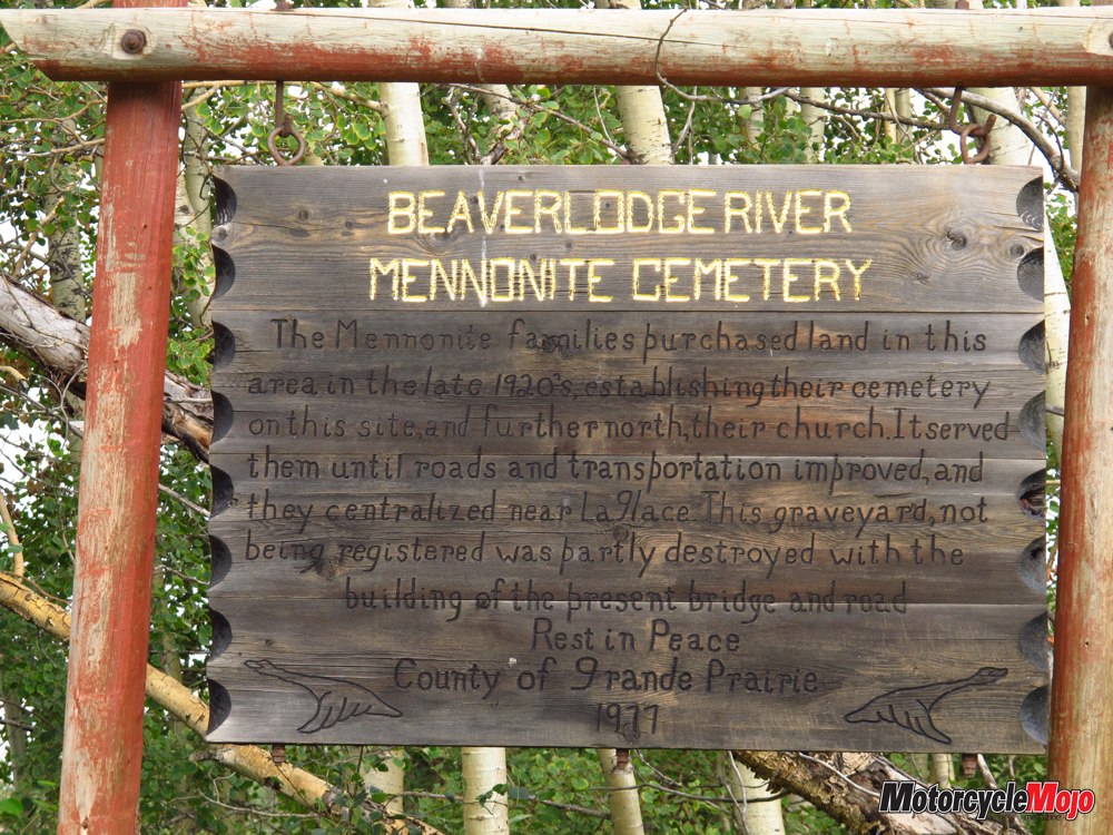
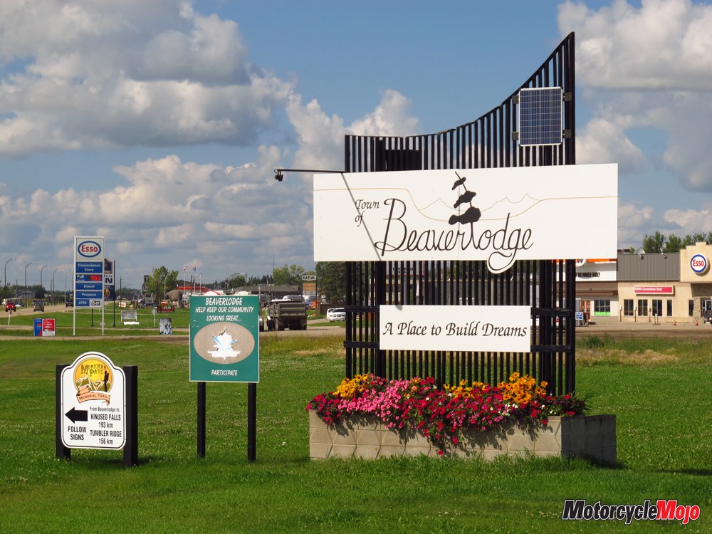
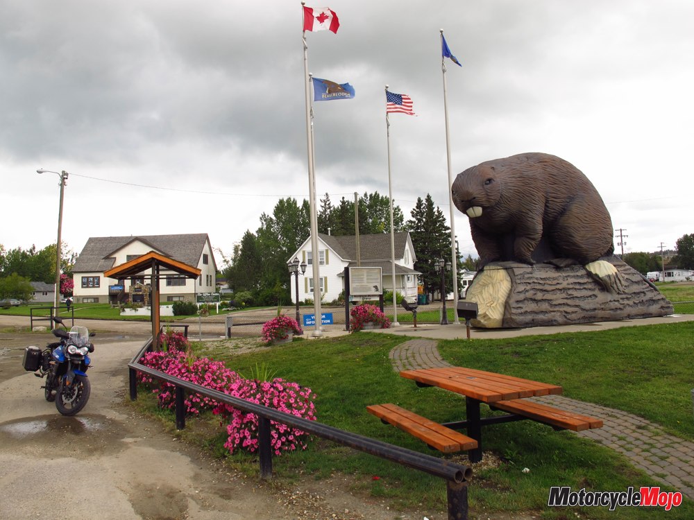
Intense negotiations with the Canadian government saw families placed in remote rural areas that governments were anxious to settle across Manitoba, Saskatchewan and Alberta. My father’s parents were part of a group of 16 families that were sent to homestead in Beaverlodge, 43 km west of Grande Prairie in the southwest corner of the Peace River Region. Originally named Redwillow, for the nearby river, the town’s name was changed to Beaverlodge, after the lodges built along the river by the Beaver Indians.
The Frontier

Having come so far and not likely to pass that way again, I set aside a day to explore the surrounding area by motorcycle. I was eager to see remote land most of us only read about and to imagine what it had been like for those who came to this harsh frontier. I loosely planned an easily manageable loop, but the area has a way of captivating and drawing in the unsuspecting traveller.
The Peace River Region stretches over 1,200 km, from Summit Lake, in the northern Rocky Mountains of British Columbia, to Alberta’s Slave River. With plentiful animals, fish and boreal forests, it’s been a rich home to nomadic hunters for more than 11,500 years. The arrival of the Hudson’s Bay Company in 1670 in the east and the advent of the fur trade brought with it guns and competition for resources. Warring Cree and Beaver Indians agreed to a negotiated truce, and the mighty river they called Unchagah, or Peace, became the boundary between their hunting territories.
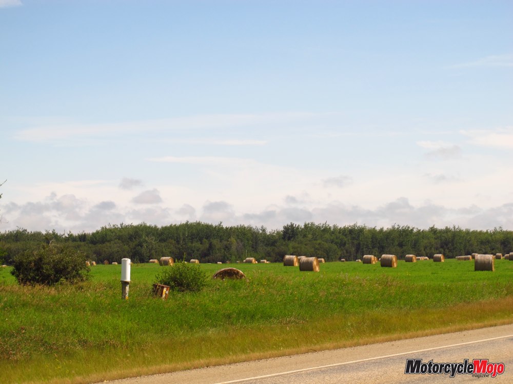
Europeans were attracted by the very fertile soil deposited by glaciers after the last ice age, mostly devoid of noxious weeds and ideal for growing wheat. A bumper crop in 1926 and prize-winning wheat of a Peace River farmer at the International Fair the same year attracted an influx of settlers. By 1930, the Canadian National Railway branch line between the Central Peace River district and Grande Prairie was completed, and 35,000 settlers had arrived in the region I was about to explore.
An Afternoon of Discovery

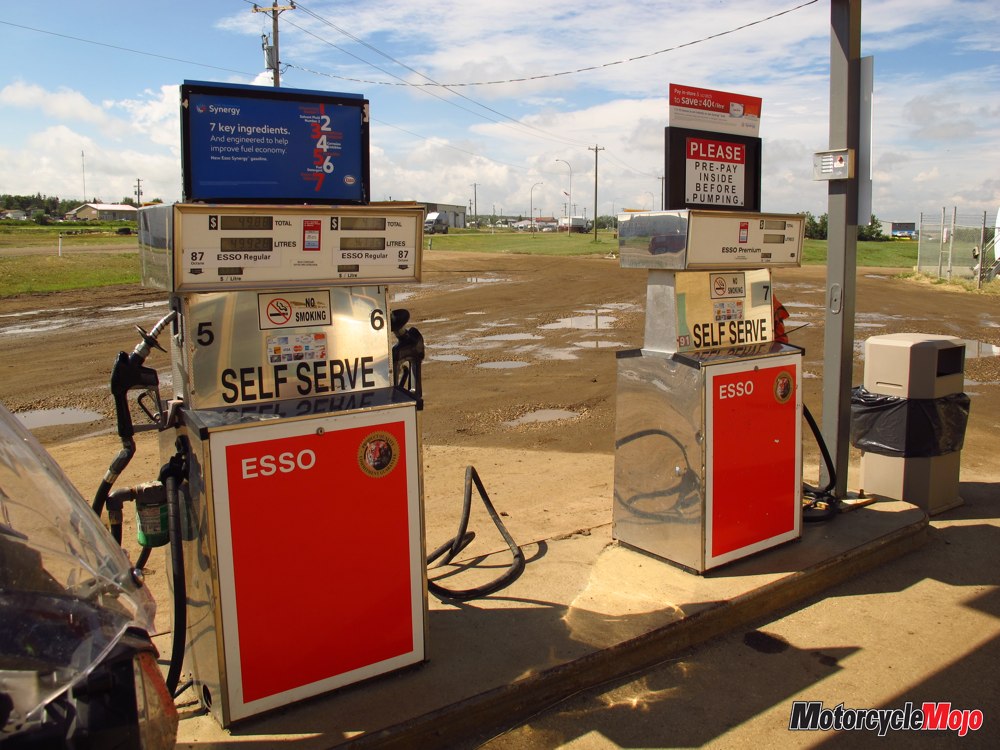
With many thoughts already swirling through my mind, I headed east on Hwy 49 back into Alberta toward Spirit River. The name conjures an intriguing town, almost sacred, but it was disappointing, with only a few buildings and an Esso station. Getting to the pumps across the rutted, muddy parking lot was a bit of an adventure, only to find out it didn’t carry the 91 Octane my bike calls for. They thought I might have better luck down the road at Rycroft, but I still had to settle for regular gasoline. It was a minor inconvenience, more than offset by the friendliness and hospitality of the residents, something I’d note throughout the day.
Pipeline
When I’d ridden through Grande Prairie a few days earlier, I wondered why the roads in town had so much mud on them. They weren’t dangerous or slippery, but it was noticeable and messy especially after a rain, and not long until my bike was the same colour as the road. The answer was here in the north. I’d been riding paved roads through prime farmland, but it was also prime oil country. Under the soil was a network of pipes, with pumping stations at regular intervals, extracting liquid gold from the earth. Tanker trucks utilize gravel sideroads, then drive across fields to fill up and haul the oil to a larger pumping station or refinery, bringing soil from the farms and side roads with them.
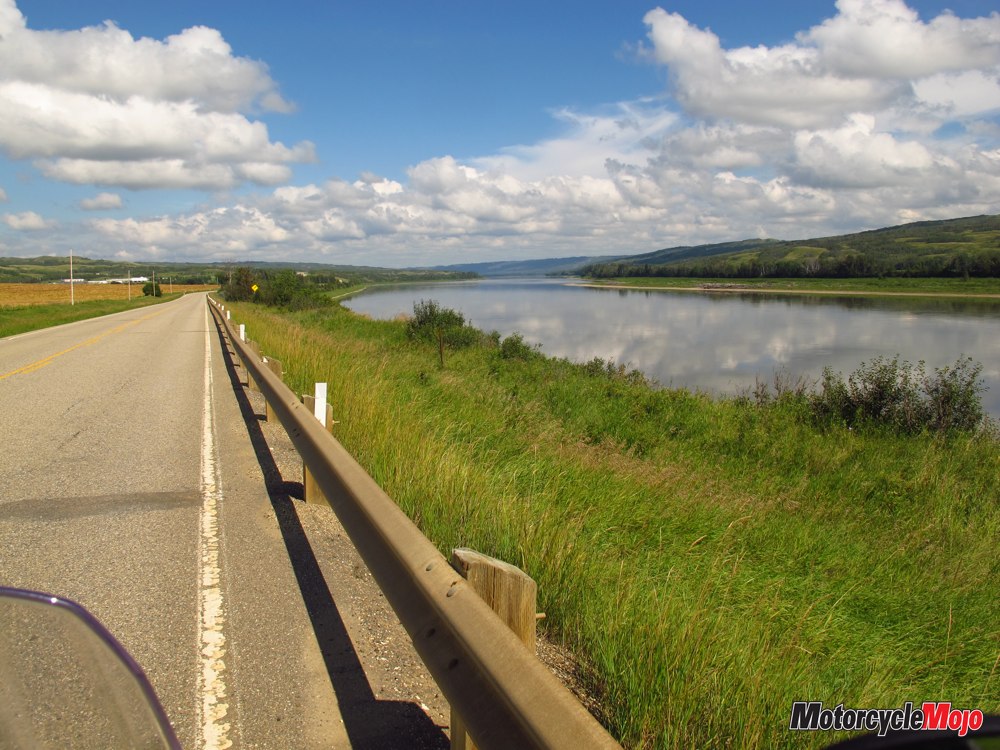
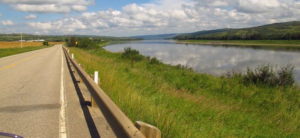
I had yet to see the Peace River, the reason I’d set out on this side trip. According to the map, it was only a short distance north of Ryecroft so after a brief stop, I turned north onto Highway 2 and deeper into the Peace River Region. And then there it was, stunning in its beauty, languidly flowing through a broad, deep valley. There’s not really a good place to stop, but I had to, just to breathe it in. There was little traffic and I’d left most of the tankers further south so it was safe to pull my motorcycle over for a few minutes. Before roads were built, the mighty Peace was the main transportation route for explorers and fur traders supplying the Hudson Bay Company.
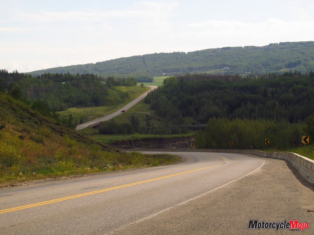
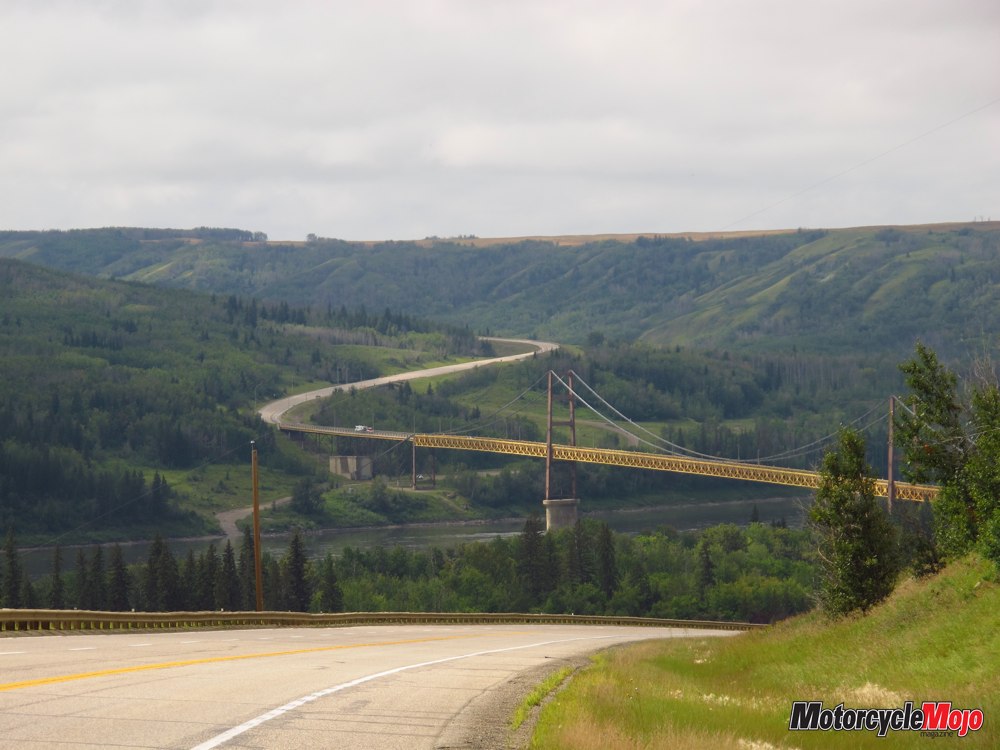
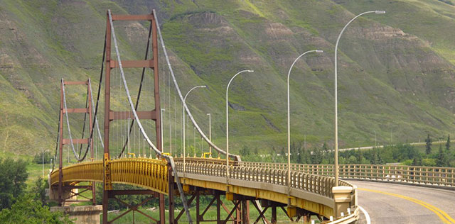
Beaver Indians had been navigating it for 8,000 years, before Algonquin Indians guided Europeans along its waters. And still the river flows, as it has for eons. What stories it could tell if it could talk! A gigantic and striking bridge carried me to the other side before sweeping curves lifted me up out of the valley and back onto flat land. But now the straight sections were shorter and the town of Peace River within reach. Small hamlets dotted the landscape, most with museums. No doubt the settlers of this land that is both peaceful and harsh were of hardy stock and their descendants are proud to share their heritage and tales of survival. As you approach the town of Peace River, there’s a rare opportunity to ride along the massive waterway by turning off onto Road 684, a paved secondary road.
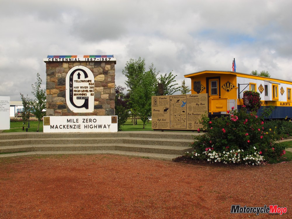
The sign points to the Shaftesbury Ferry and I missed that it was also Road 684 so I sailed right by into Grimshaw. It gave me a chance to see the Mile Zero marker for the historic Mackenzie Highway and small arboretum featuring the trees of the boreal forest. The marker is adjacent to the converted railway car that serves as the local museum and Visitor’s Centre. It also gave the attendant who gave me directions a break from his monotony. It was mid afternoon and I was the first person to stop there that day.
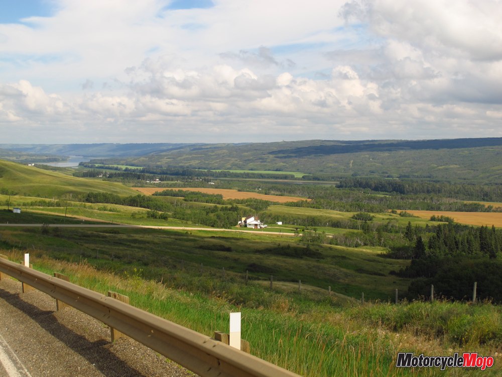
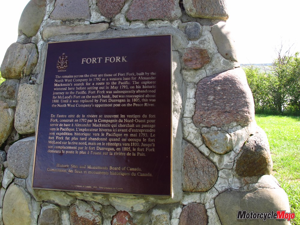
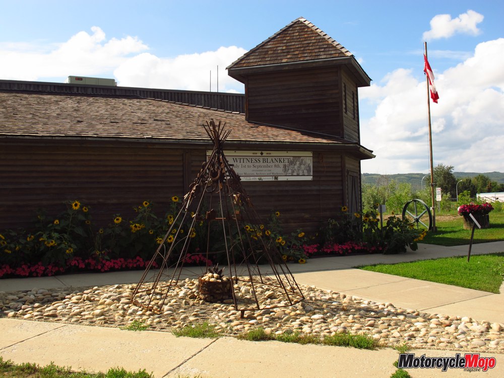
The cutoff I’d missed was only a few kilometres back so I retraced my steps. The 684 winds dramatically down to the river before turning left and heading to the town of Peace River. Sighting the river and valley again takes your breath away. It’s that powerful and beautiful. You understand why it’s called the Peace River. At the bottom, a stone cairn pays tribute to Fort Fork across the river, now designated as an archeological and National Historic Site of Canada. In 1792, it was a North West Company trading post where Alexander McKenzie overwintered before continuing his expedition to the Pacific. The ride along the west side of the river is lovely and tranquil, with gentle curves following the contours of the valley landscape. Another massive bridge takes you across into the modern town. After refueling, this time with premium gasoline, I continued to the far outskirts and the museum on a beautiful site overlooking the river, this time from the east side. Museum grounds are invariably the only place in town with picnic tables and my lunch was long overdue. As I sat under the shade trees admiring the view, it seemed a travesty to hear the noisy cigarette boats and jet skis flying up and down the waterway, in contrast to the peace and quiet I yearned for. Inside, the museum was hosting The Witness Blanket, a display honoring the children of Residential Schools and symbolizing reconciliation.
It’s made from hundreds of items reclaimed from Residential Schools, government buildings, and traditional and cultural structures across Canada. Deeply moved, I closed the door behind me and prepared to return to my Beaverlodge campsite. Highway 2 continues south on the east side of town and I followed it down to create a big loop, heading west on Highway 49 until it met up again with Highway 2 and took me further south. One could easily be deluded into thinking not much goes on in this northern wilderness. But that’s what makes the Peace so powerful. It provides a wealth of resources, from food, to fuel, and lumber, while retaining it’s primal, natural beauty. There’s a benefit to flat terrain—you can see clear across the country, or so it seems. Most of the day I’d miraculously avoided the rain.
I’d go through on wet roads just after it had passed, or skirt ahead, narrowing missing it. On the way home, the sky to the south where I was headed was again dark and angry. With such clear visibility, I could watch the clouds and track the weather, strategizing which roads to take to avoid the worst of it. Other than the spray and mud from the road, which made my Tiger look like we’d been off-roading, I avoided the downpours. I’d travelled 611 kilometres and it was late when I got back, but I wouldn’t have missed the day for anything. I’d spent the three previous days understanding the hardships my ancestors overcame to ultimately give me the life I enjoy today including the wherewithal to take that trip —a loving family and friends, a wonderful land of freedom to live in, plenty to eat, the time and resources to travel, health, and a fantastic motorcycle. Above all, the Peace River reminded me of their daily gratitude and mine, for living in a land of peace.