
Not All Those Who Wander Are Lost


Using Penticton as a home base, it’s easy to get lost in the magic of British Columbia’s Southern Interior
A midst the lush coniferous forests and towering rock formations of the Interior of British Columbia lies a dusty and rugged gem: an arid desert ecosystem that houses rare reptiles, animals and flora found nowhere else in Canada, along with a hidden collection of windy roads. Penticton, sits in the middle of this unique environment, situated between Okanagan and Skaha lakes. Cradled by these lakes, the city offers a unique experience in an exotic landscape with options to ride in every direction that weave in and out of the dense Interior. Rain doesn’t happen there often; I am reminded of this every time I pass through the area – and this time was no different.
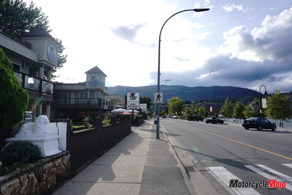
I rolled into town with my jacket soggy and eyes heavy. My ride down from Revelstoke, B.C., had been rainy most of way, and although the ride was relatively short, the rain seemed to leach energy from my body in record amounts. As I passed a sign delineating the city limits of Penticton, the rain stopped and the temperature rose, as they do here without fail. I followed a vibrant rainbow of neon signs that flickered along the luminous waterfront to the Tiki Shores Motel, where I’d be staying for the next few days while exploring the area.
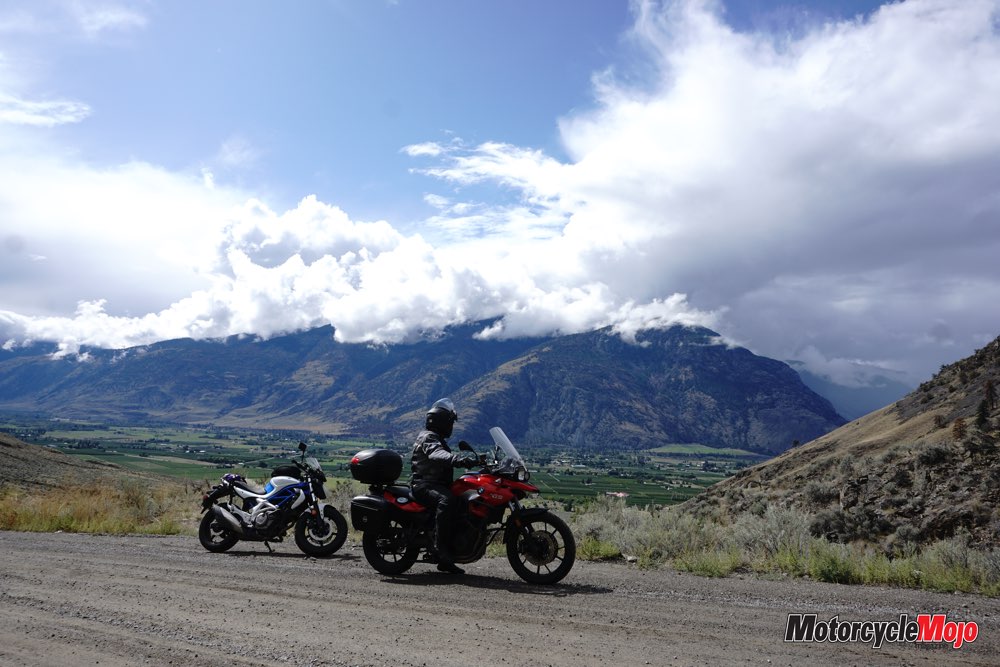
I met up with Thom Tischik, a friend who works for Tourism Penticton, the next morning. He has played a vital role in showcasing these roads to motorcyclists and had invited me to experience the epic on- and off-road routes in the area. He rented a BMW F700GS from Cycle BC, which is based in Vancouver and Victoria, and, I assumed, was happy to be out of the office on “tourism” business for a few days.
Vibrant Landscape
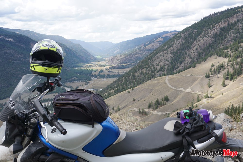
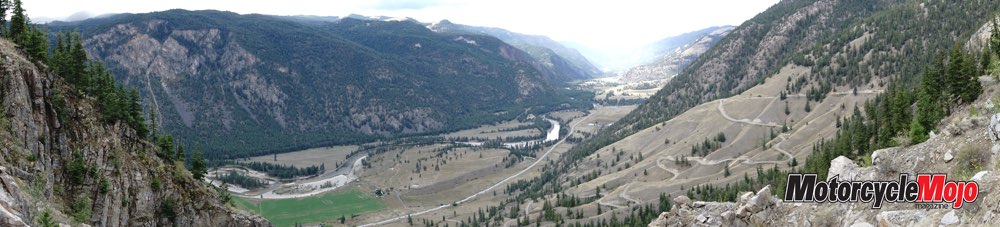
The charcoal sky lingered above us as we headed south from Penticton down Lakeside Road, caressing each curve along Skaha Lake’s shoreline. Although the sky was dull, the burnt yellow dirt of the rugged desert hills still looked grand in contrast to the blue water. The clouds soon broke up and the vibrant blue sky and pale etched rock formations all around us provided a feast for the eyes. As we rode, a sense of wanderlust crept over me. Reignited were my love of travel and a youthful joy of laying down kilometres for days on end. Something had settled within me over the past few years as I turned my focus to technical riding rather than distance. The nostalgic feeling grew as I rounded each corner. I remembered my first time riding through B.C. en route to Alaska almost nine years ago. Now, I was regaining the state of mind I once had as I rode: a curiosity and contentment I haven’t felt for some time.
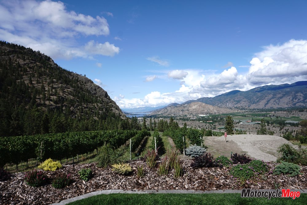
We carried on south toward Oliver and onto Black Sage Road. The sun broke free of the clouds as I tried to multitask between focusing on the winding road and taking in the view, which was littered with elaborate wineries high on the hillsides. We veered onto a well-travelled dirt road and made a chattery traverse on washboard gravel. Pavement appeared as we came to Fairview – once a town, but now just a monument. It was first settled in 1887 and soon became known as “the biggest city north of San Francisco”; the town’s boom busted in 1925 and now Fairview is only a sign with a couple of goat trails meandering around decrepit remnants of what was once a mining town.
We made our way north from there, and again I attempted to multitask between the challenge of safe riding while drinking in the view that surrounded us. Thom understood this and made a special stop at the See Ya Later Ranch, perched high atop Hawthorne Mountain and overlooking the valley and Skaha Lake to the north. It would be easy to sit there all day, studying the fine detail etched in every angle of the furrowed Okanagan Range. Alas, this wasn’t a geology trip; it was a motorcycle trip.
Searching for the Stars
We rode on scenic White Lake Road to the Dominion Radio Astrophysical Observatory (DRAO) located near the town of Kaleden. Before entering the surrounding area of the observatory we had to turn off our cellphones and GPSes, as any transmissions interfere with the radio telescopes. The world-renowned astronomical research facility was inaugurated in 1960 and uses the ranch land surrounded by hills in the White Lake Basin to protect the observatory from manmade radio interference. The DRAO was responsible for mapping a large portion of the Milky Way and is the largest radio astronomy observatory in Canada and only one of seven of its kind in the world. Alas, this was also not an astronomy trip; it was a motorcycle trip.
White Lake Road led us to Green Mountain Road, a secluded road twisting through the coniferous forest. The sun glistened through the tall spruce trees on each bend in the road, giving us a glimpse of the immense beauty of this unique ecosystem.
We returned back to Penticton and tasted some of the local wines and beer on offer. The ride had stirred up thoughts from my youth – thoughts of the seemingly infinite galaxy, along with the idea of how volcanoes, receding glaciers and a fault line running down to Washington State formed the landscape. Thoughts that I once ventured to understand.
Got Gravel?
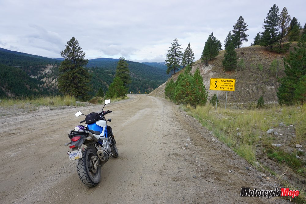
Thom, being the seasoned local that he is, offered options for every style of riding for the second day. Although I had my Suzuki Gladius 650 under me, I assured him that I was more than intrigued to explore the gravel roads in the area. We rode north to Summerland and then onto Princeton Summerland Road, where pristine tarmac soon transformed into light gravel. Then I spotted it: the one type of sign every motorcyclist yearns to see on their journey – a road sign warning of twists and turns for several kilometres. I was happy to be sporting my awkwardly sized Heidenau K76 tires, which handle horribly on absolutely everything except gravel. This wasn’t the fault of the tires, but purely the fault of another “Emily knows best” moment that failed miserably when I ordered rubber that was the completely wrong size for my bike.
The rural road curved as it caressed the weathered rocky hills heading toward Princeton and soon turned into ranch land that invited a mist to linger as the sun climbed above us. The vast diversity in the landscape of the Okanagan Valley – from harsh desert conditions to dense vegetation – and it never ceases to keep me on my toes. We rolled into Princeton and got a quick coffee and some feeling back in my fingers from the brisk September air. Then we found our way onto Coalmont Road, an incredibly curvy paved road seemingly leading to the middle of nowhere – no cars; just curves – a rider’s dream. We soon arrived in Coalmont, although if you blinked you’d most likely end up in the bushes. The town’s Welcome sign states “Coalmont welcomes you and will be delighted to serve you provided you are lucky enough to find us open” along with a warning to all travelling salesmen that safe passage through town is not guaranteed.
We could’ve continued on that road to meet up with Highway 5A, another road worth riding, but the sun was sinking and Thom had taunted me with the promise of an epic gravel adventure for the afternoon, so we turned back down the sweeping road to Princeton.
More Ghost Towns
In Princeton, we turned onto Old Hedley Road. Now, if anyone does decide to ride this area (which I beg you to), remember this road. It’s far better than the taking Highway 3 to Hedley. Old Hedley Road follows the opposite side of the Similkameen River and offers a fresh, unobstructed view of the scenery as you ride into town. Hedley is a former gold-mining town that didn’t quite bust after its boom, but diminished in size. With more than 1,000 people living there in its heyday, Hedley now is one of the many small towns that line the Crowsnest Highway.
From town, you can look up Nickel Plate Mountain and see the Hedley Mascot Mine protruding out of the side of the mountain at over 1,500 metres high, looking as if it could slide onto the town at any moment. In the ’90s, the government was going to burn the camp because of the safety risk, but then decided that the mine would be revitalized for historical purposes as it’s considered as one of the most unusual mines in the world.
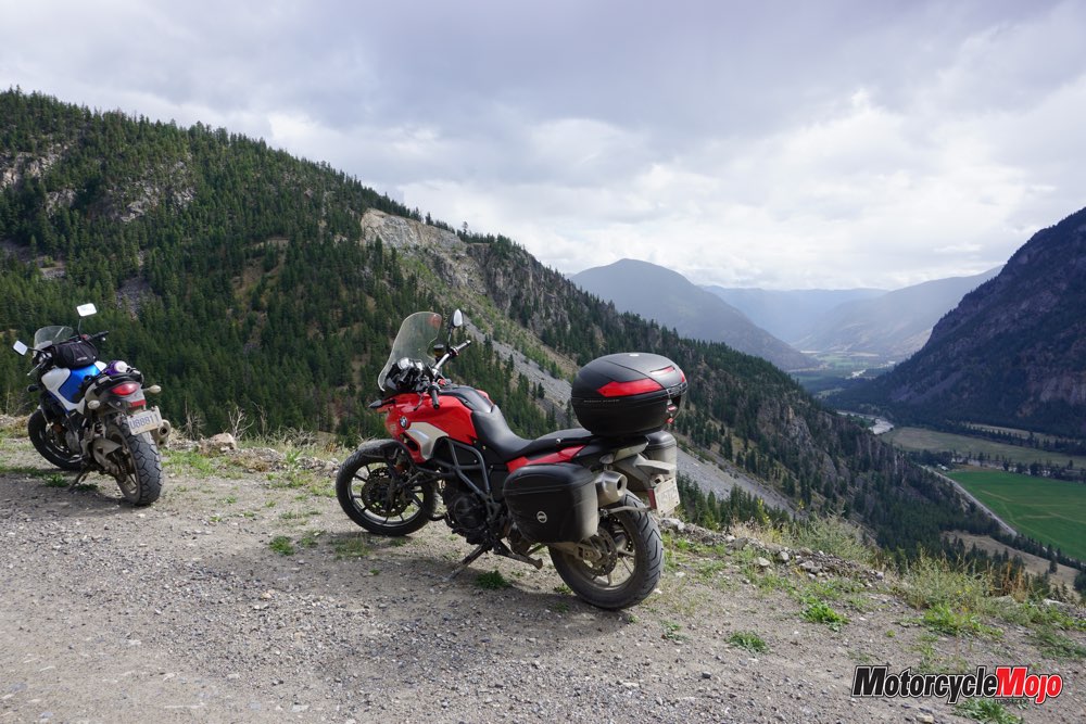
Again, the sun was working against us, offering little time to deviate from our plan. We took Hedley Nickel Plate Road and found ourselves climbing switchback after switchback and gaining elevation quickly. As we rode upward, I found myself being a stereotypical Canadian, constantly apologizing to my bike as I felt the fork compress underneath me with each rock or pothole and the bike’s rear end chattered along as it tried to find some traction. After taking multiple stops on the road, thinking we had found the best viewpoint, we finally settled on the summit, which overlooks the kinked gravel road we had just ridden up. Off in the distance was a backdrop of superimposed mountains. We continued on the road, leading us into the woods and eventually past Apex Mountain Resort and back into Penticton.
As I sat on the motel balcony of Tiki Shores the following morning drinking my coffee, I thought about how fortunate I was. Normally my trips are lonely, littered with issues and comprised of me being lost and finding my way for the majority of a trip. This time, with Thom as my riding companion and tour guide, I discovered that things going to plan really can be enjoyable. The wealth of great roads that are laid out in the area, which we had only just begun to experience, only underscored this feeling.
The Long Way Home
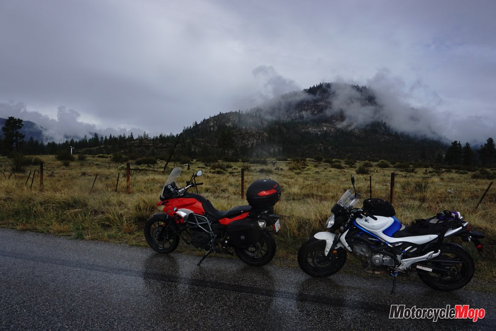
It was time to return home. I decided to take another of Thom’s suggested routes – one that we had run out of time to ride. This was the favourable riding option, as opposed to the painful ride through the congested streets of Kelowna, to get home. I would head down to Bridesville via McKinney Road, then hit Highway 3 and then north on 33 to return to Revelstoke. I left wondering when I could return to the Penticton area for another ride. A switch had flipped, and I was in love with just being on my bike again.
I rode through Oliver and onto McKinney Road. As I followed it back into the woods, feeling secluded, something in the trees caught my eye. I slowed my pace and looked to my right to see wild horses sauntering along beside me. Picture an epically majestic scene from an old-time movie about capturing wild horses – that’s exactly how that experience felt. I was at one with Nature. There is nothing like wild horses paired with the horsepower beneath me to truly solidify the wanderlust and enjoyment of this trip. Of course, as soon as I stopped to enjoy the scene the horses ran away and didn’t come back.
The road turned to gravel as I went deeper into the wilderness, again encountering wildlife – albeit this time it was slightly less majestic, as I found myself stopping to let free-range cattle cross the road. I continued along, seeing little traffic and lots of Nature, taking eight hours on an enjoyable roundabout route rather than the faster three and a half hours on the highway.
Often we become fixated on a destination; travelling close to a base location keeps your mind open to more exploration of the area and the love of discovering the almost unknown. When thinking of a well-travelled motorcyclist, it’s easy to think of exotic scenes and immersion in far-away cultures. However, sometimes staying close to home can provide a new outlook on the uniqueness of your own backyard. The Penticton area instilled the worth of this value in me, and I remembered why I was so attracted to living in B.C. in the first place. Throughout my trip, I kept trying to compare Penticton with other areas in which I had ridden, but the Okanagan Valley offers a unique mix of Paleozoic formations interspersed with farmland and urban sprawl, thus making comparisons almost impossible.
The southern Okanagan Valley truly is an enigmatic gem within British Columbia.


Thanks for Reading
If you don’t already subscribe to Motorcycle Mojo we ask that you seriously think about it. We are Canada’s last mainstream motorcycle magazine that continuously provides a print and digital issue on a regular basis.
We offer exclusive content created by riders, for riders.
Our editorial staff consists of experienced industry veterans that produce trusted and respected coverage for readers from every walk of life.
Motorcycle Mojo Magazine is an award winning publication that provides premium content guaranteed to be of interest to every motorcycle enthusiast. Whether you prefer cruisers or adventure-touring, vintage or the latest models; riding round the world or just to work, Motorcycle Mojo covers every aspect of the motorcycle experience. Each issue of Motorcycle Mojo contains tests of new models, feature travel stories, compelling human interest articles, technical exposés, product reviews, as well as unique perspectives by regular columnists on safety or just everyday situations that may be stressful at the time but turn into fabulous campfire stories.
Thanks for considering a subscription. The Mojo team truly appreciates it.
